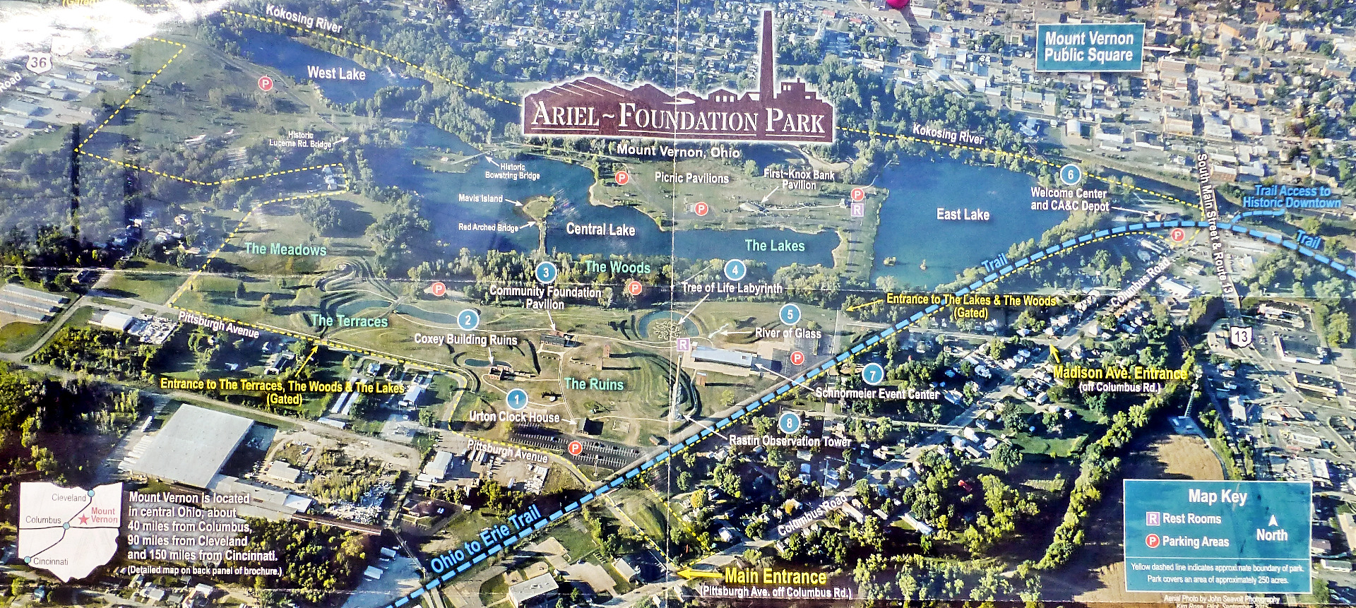
Ariel-Foundation Park is a 250 acre park owned by the City of Mount Vernon in Ohio. It is operated by the Foundation Park Conservancy. The park is located on a former industrial site that housed the Pittsburgh Plate Glass Company (now PPG).
History and Overview
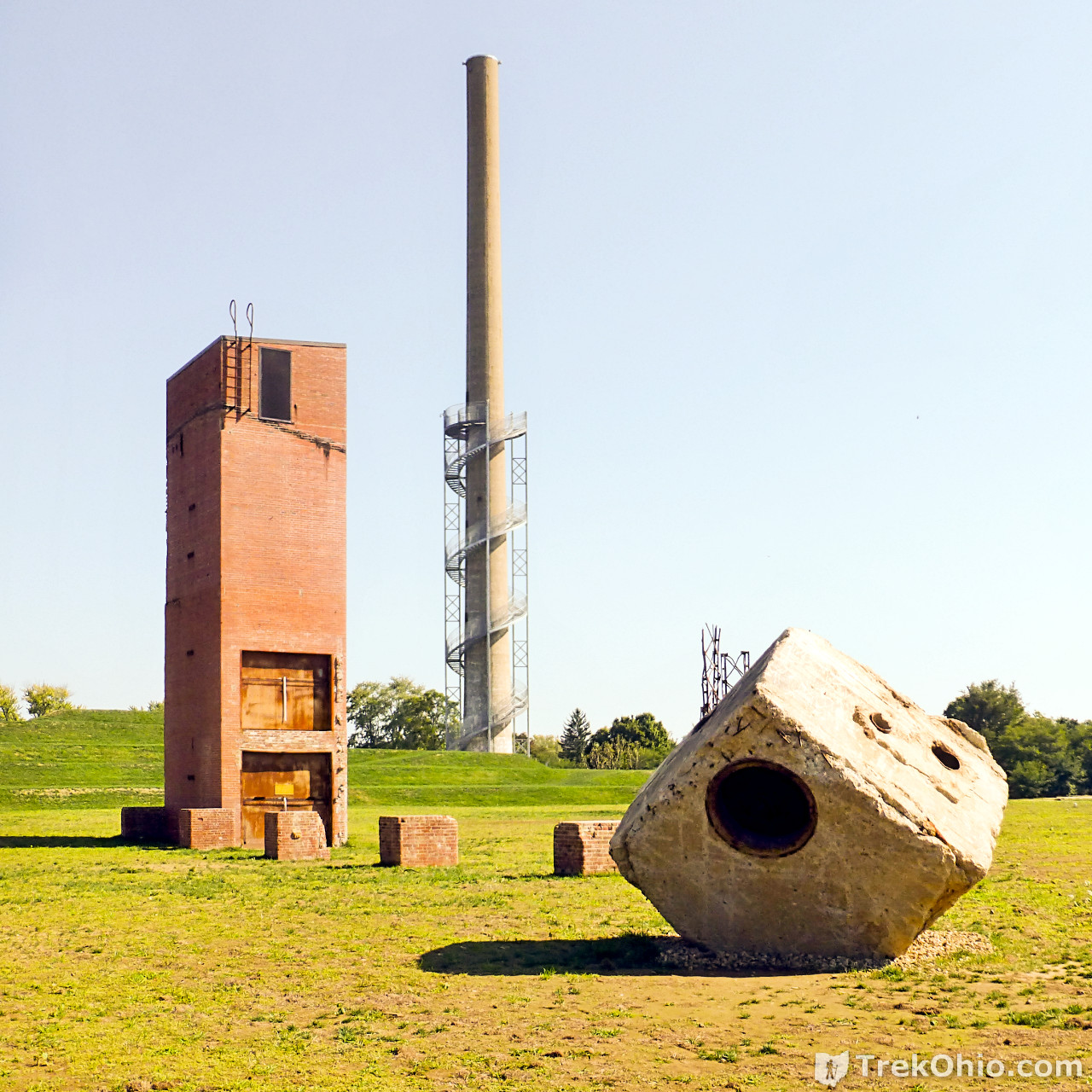
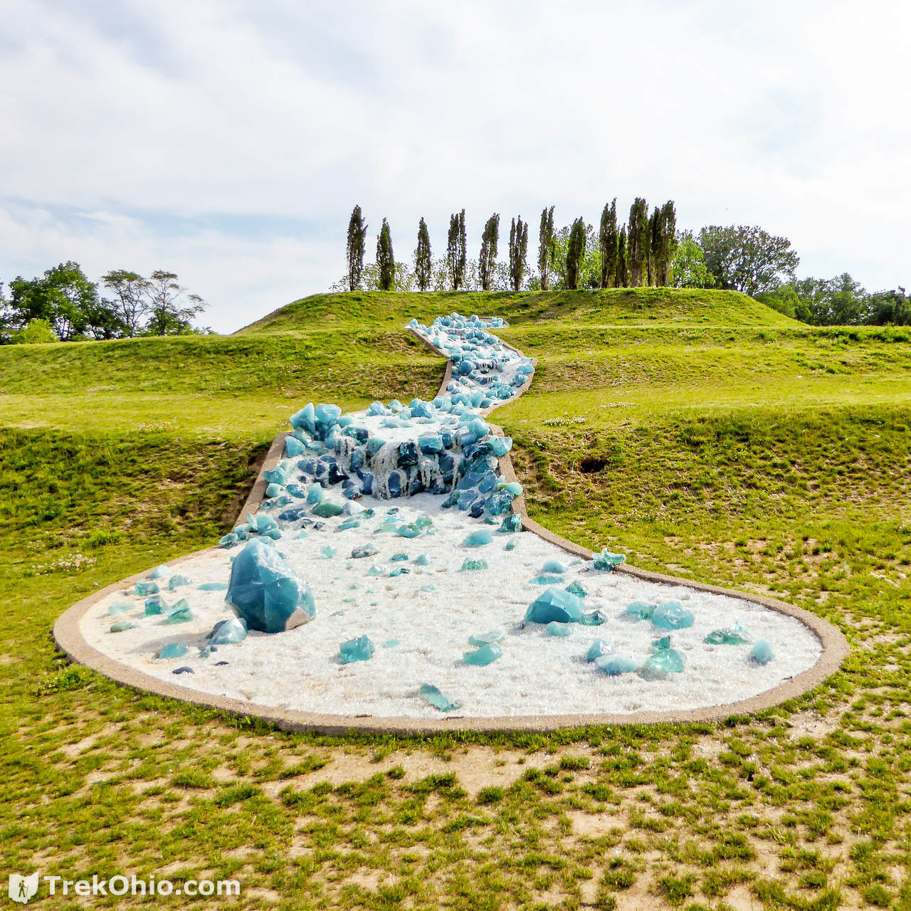
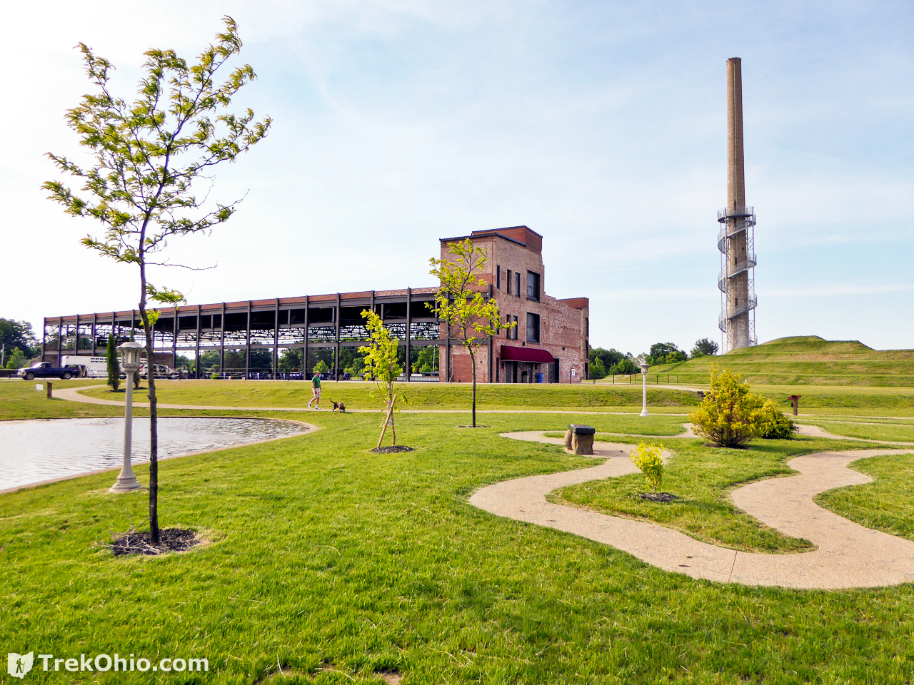
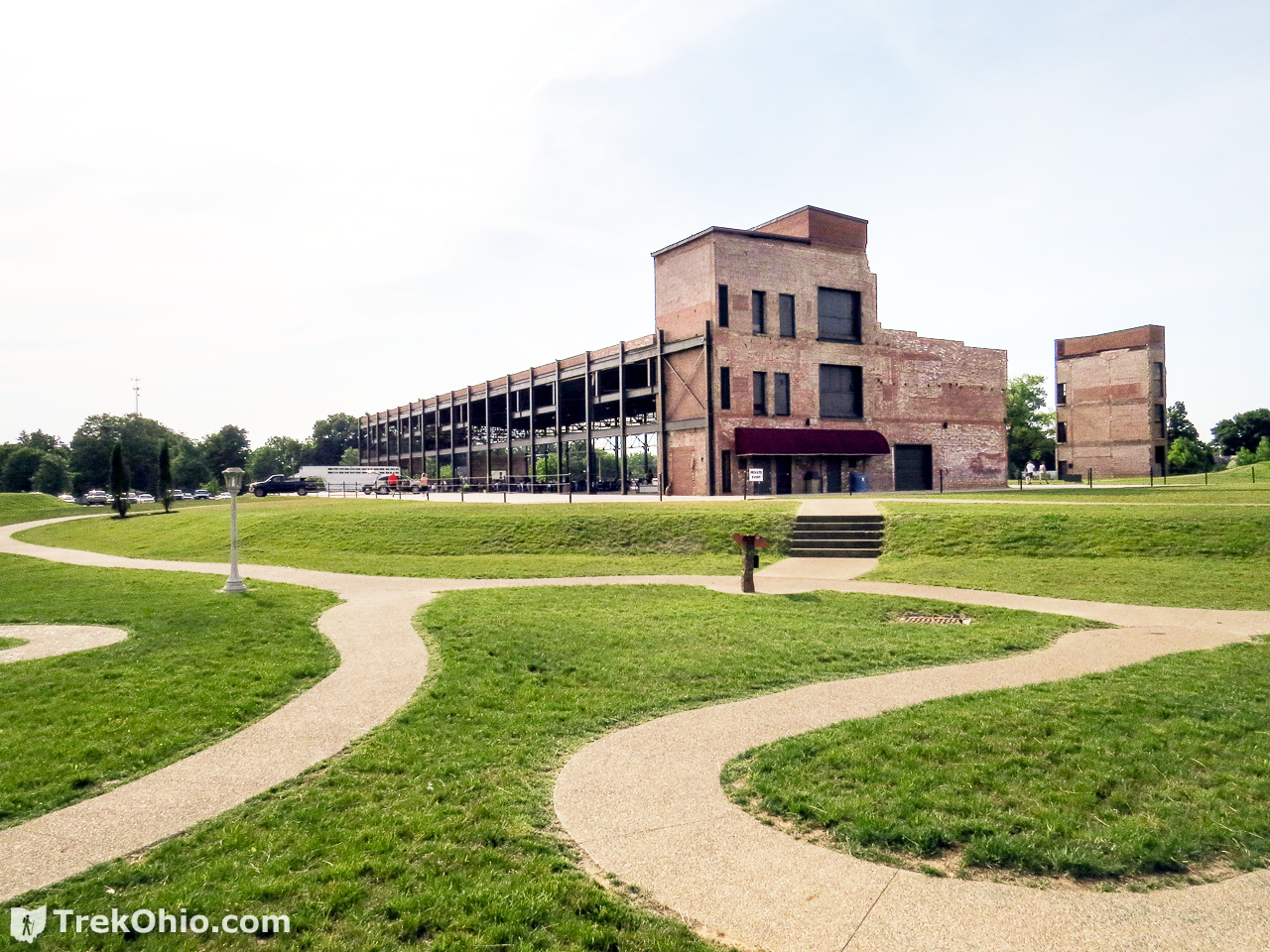
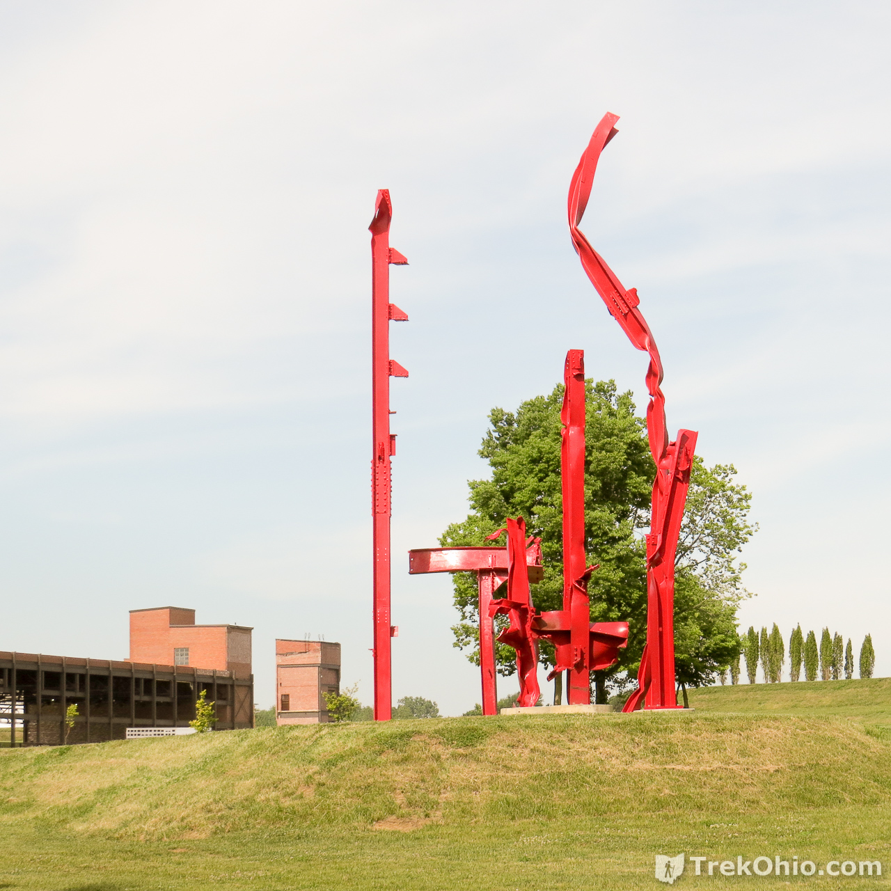
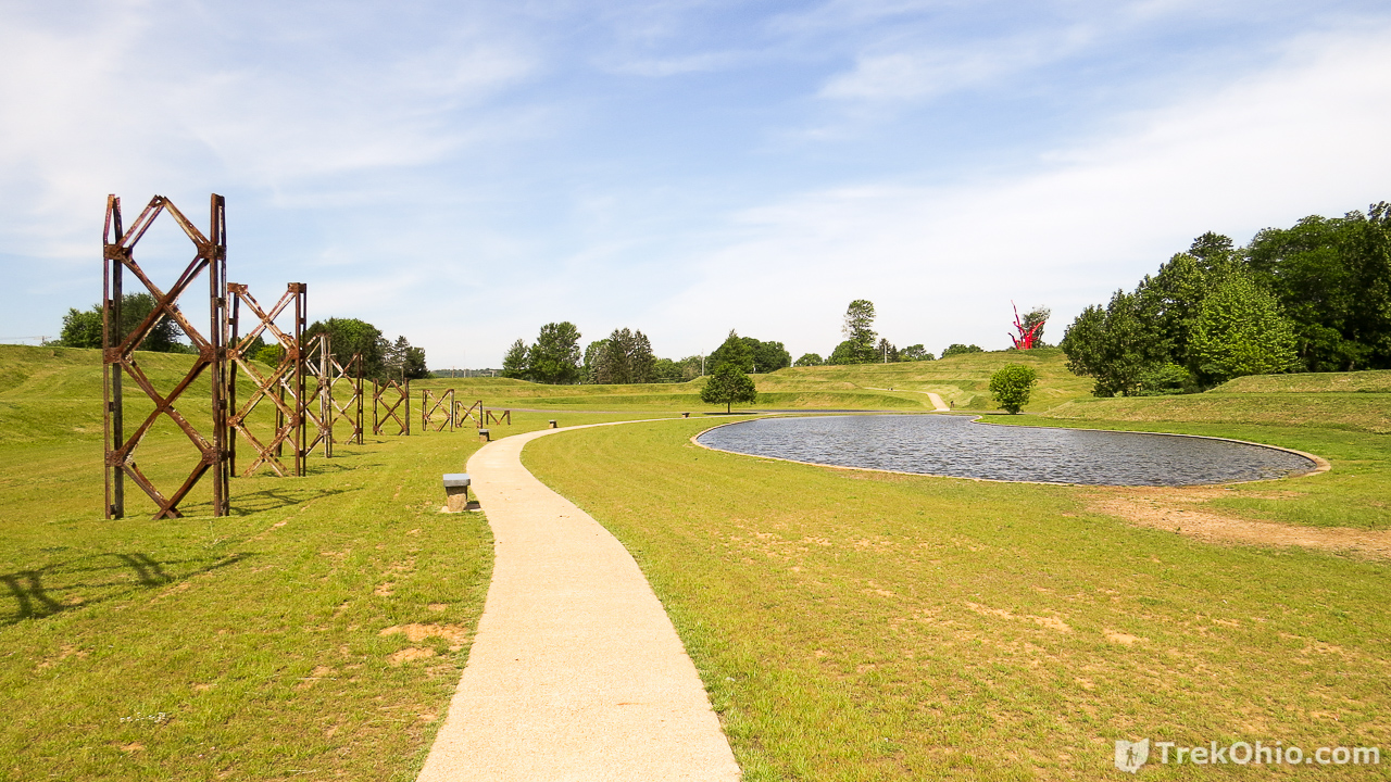
The Pittsburgh Plate Glass Company opened in 1907 and manufactured plate glass for automotive windshields. The plant was a sprawling complex of brick and steel girder buildings totaling 1,000,000 square ft. A number of gravel pits were also found on the plant’s property. In deciding to convert this former industrial site into a park for the enjoyment of the public, the Ariel-Foundation wanted to pay tribute to its industrial history and to the people of Mt. Vernon who worked there. It did so by artistically preserving elements from the site’s industrial past. The end result is industrial chic on a grand scale.
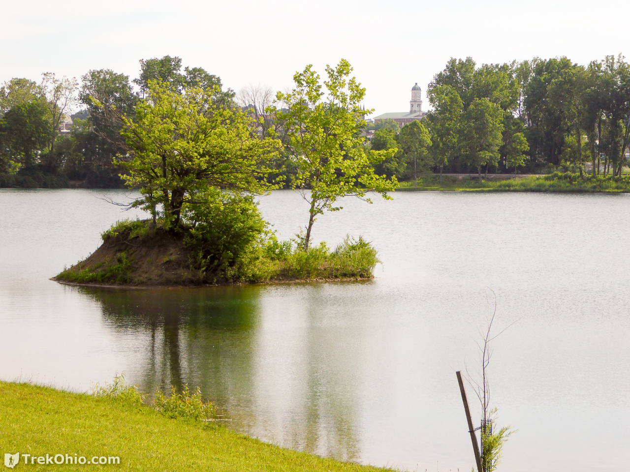
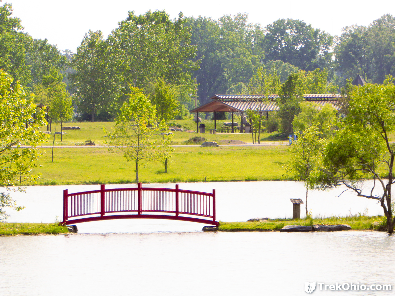
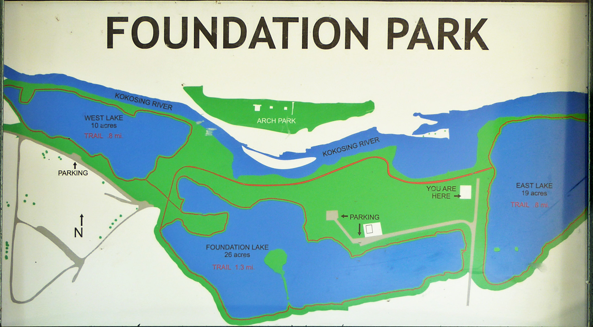
The plant was closed by PPG in 1976, and the site went through a series of owners. It was used for a while as a storage warehouse. Ultimately the buildings were gutted and the city of Mount Vernon took possession of the site in 2012. In 2013 ownership was transferred to the Ariel-Foundation which re-purposed the site as a unique park. The former gravel pits are now scenic lakes that are stocked with rainbow trout, yellow perch and bluegill. Canoes and kayaks are welcome on these lakes. The lakes vary in depth with one being 10 to 20 feet deep while another is about 65 to 85 feet deep on one side.
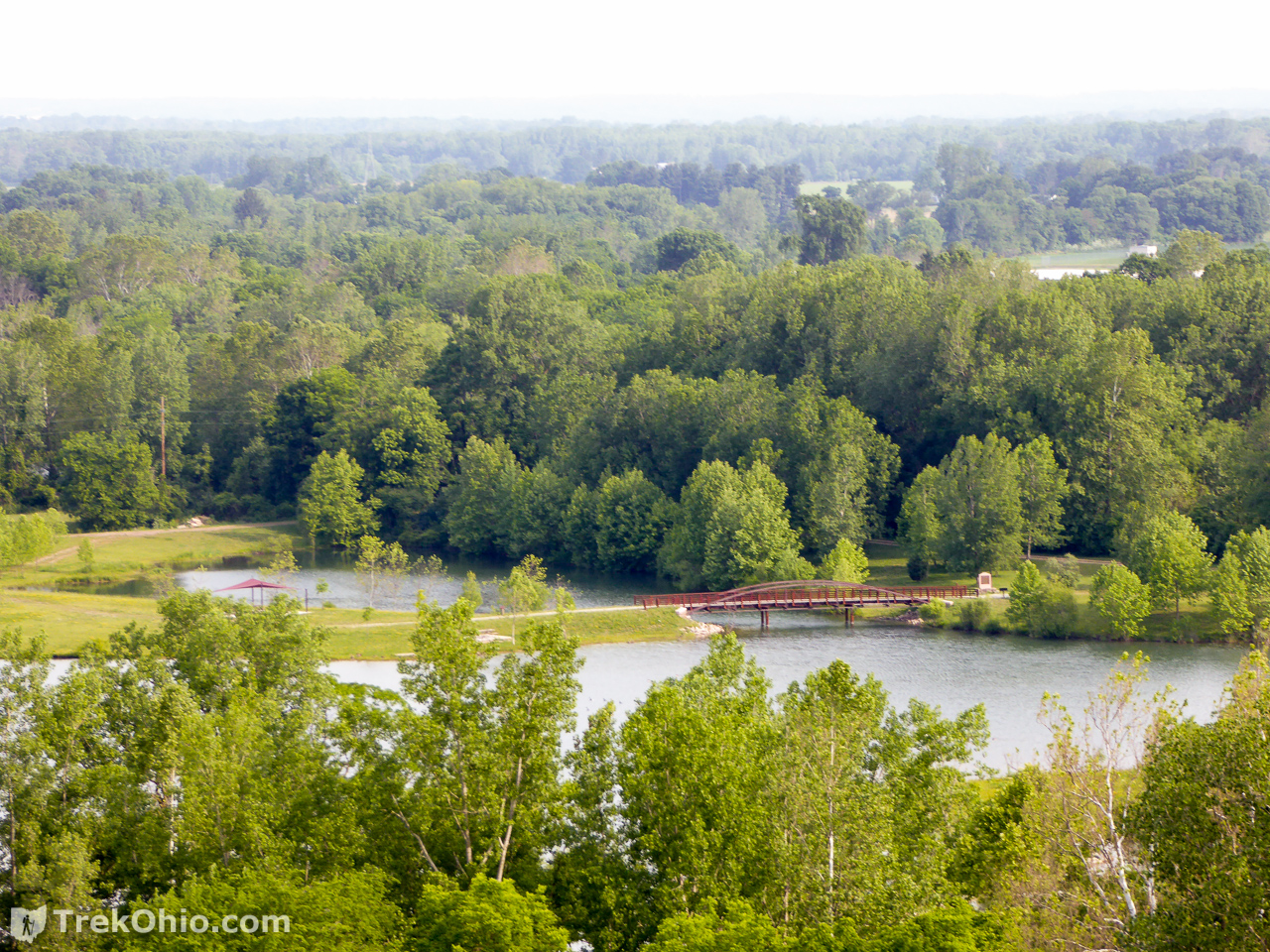
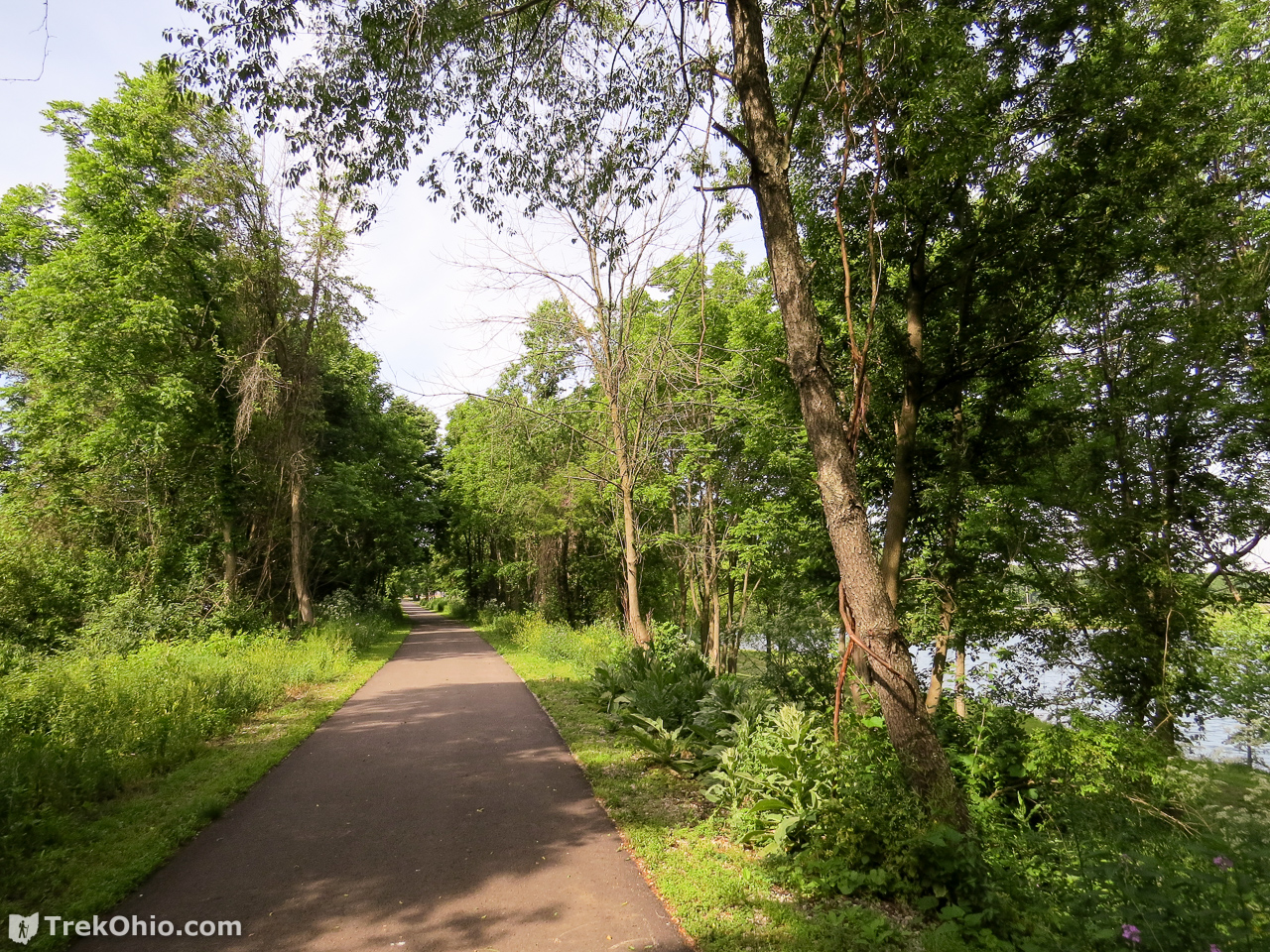
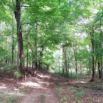
The Kokosing River passes through the park near its northern border, while the Heart of Ohio bicycle trail crosses through the park near its southeastern border. There are also plans for the Kokosing Gap Trail to eventually extend to the park. The park is crisscrossed with walking trails, many of which are paved. Picnic tables, picnic pavilions, and benches are scattered through the park. Dogs are welcome on the park grounds as long as their owners keep them on a leash and pick up after them. The site also features an outdoor concert area and public restrooms with a number of buildings available to rent for private events. An archery range is planned for the near future.
The park is owned and was funded by the Ariel Foundation. The Ariel Foundation is a Mount Vernon based charitable organization founded by Karen Wright, the CEO of Ariel Corporation. Ariel Corporation is based in Mount Vernon and is a manufacturer of industrial-scale natural gas compressors with 1,200 employees.
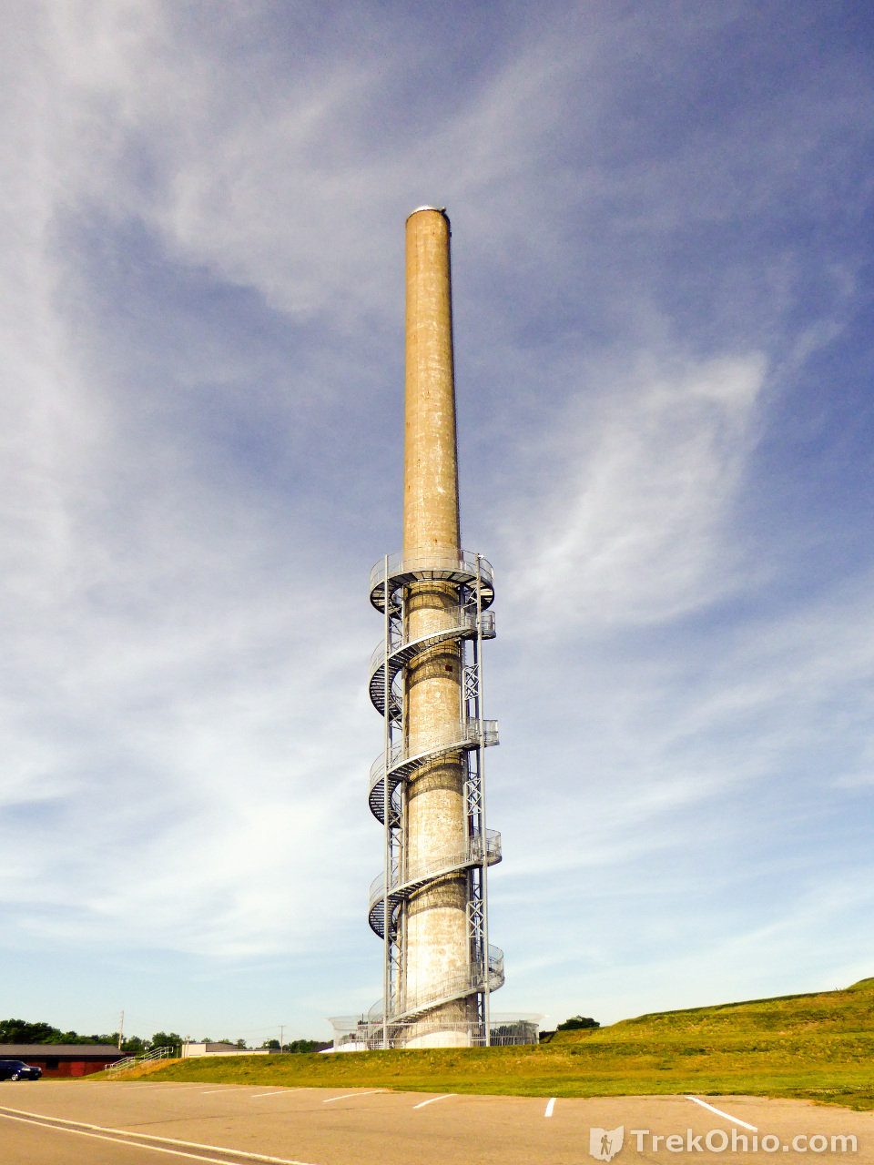
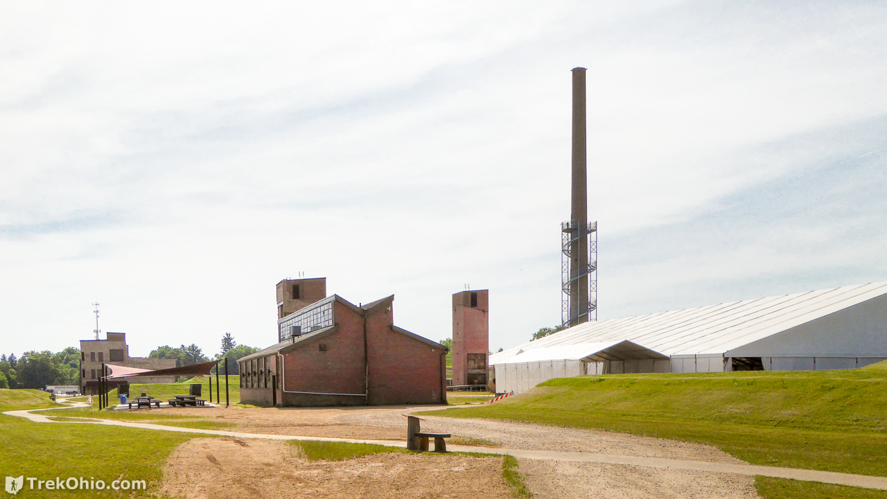
Rastin Observation Tower
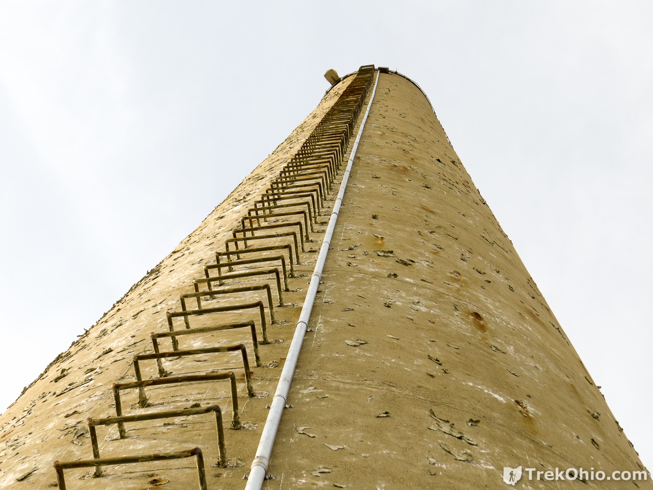
The centerpiece of the site is the 280 foot smokestack which has been re-purposed as the Rastin Observation Tower pictured in this article’s topmost photo and below. A spiral stairway around the outside of the smokestack climbs 140 feet to an observation deck offering a stunning view of the park and Mt Vernon. The stairs are wide and protected by guardrails and a protective barrier making them suitable for the whole family. The tower is open April 1st through November 15th and is closed during the winter. I note that most of the trees in the area are deciduous, so it would seem to be a promising site for viewing fall foliage prior to the tower’s closing in mid-November.
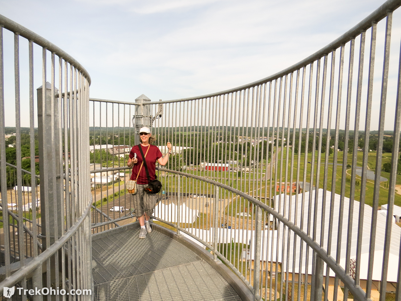
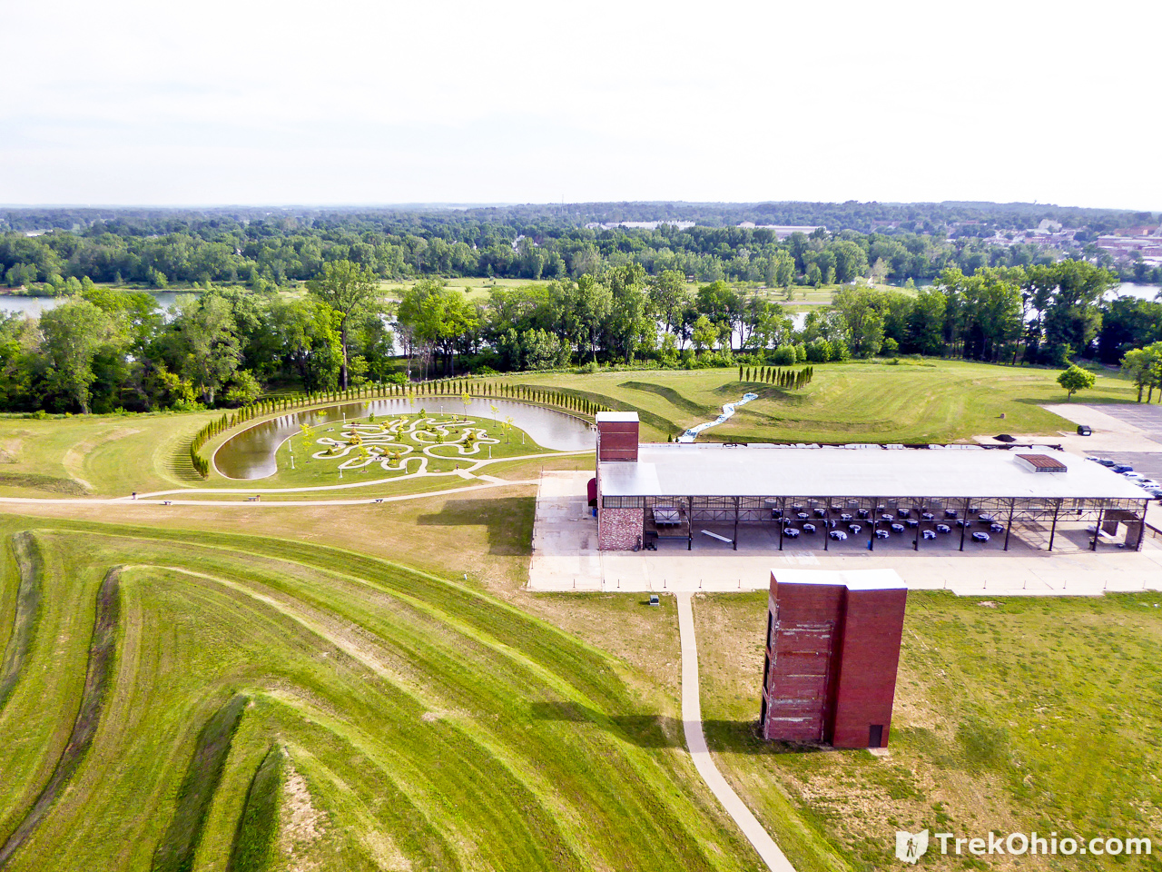
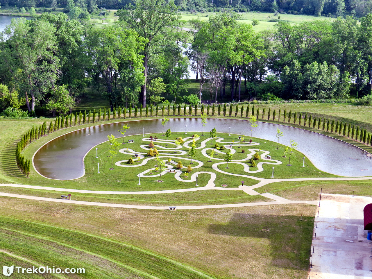
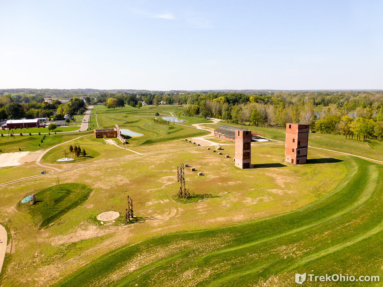
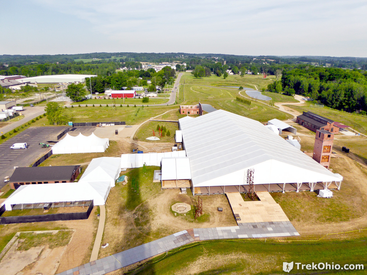
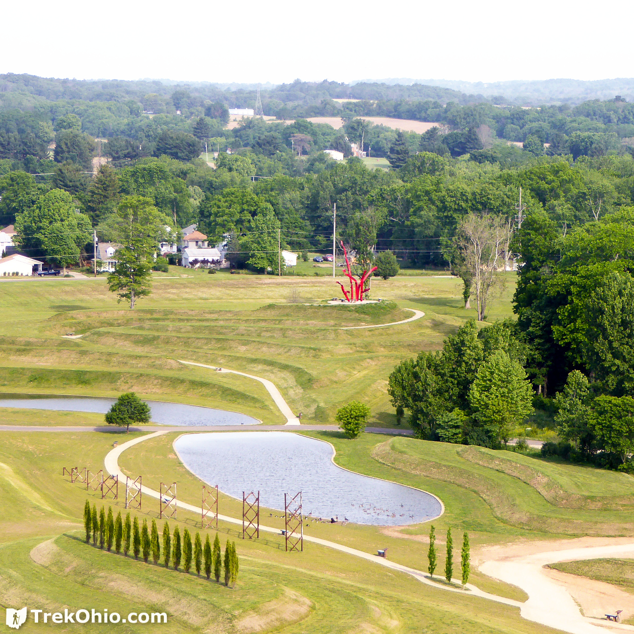
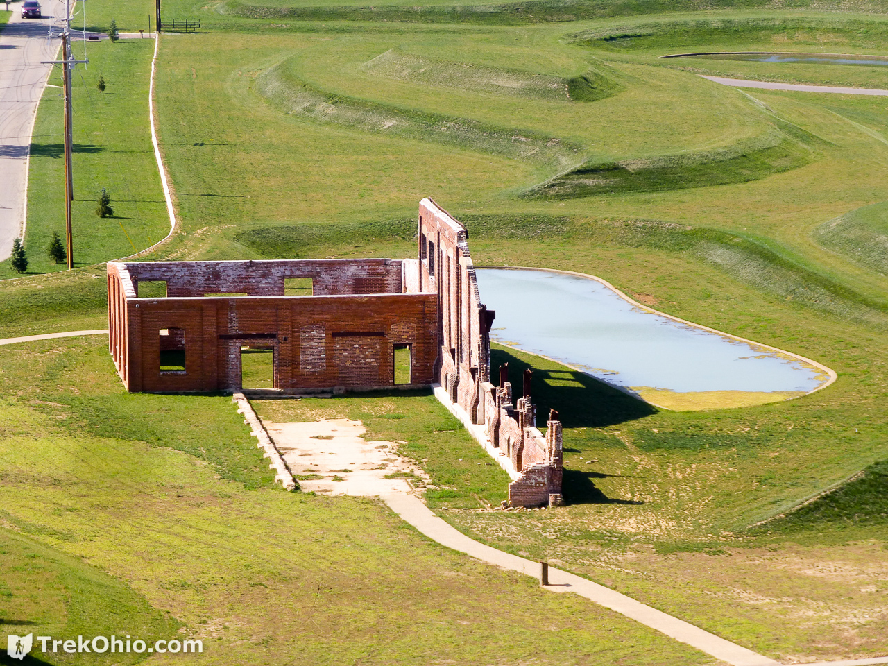
Just to give you some idea of the view from the tower, below are a number of photos of the park taken from the observation deck of the tower. Some were taken with telephoto to provide a more detailed view of a feature.
The photo below is of the same general areas as the one above, except gigantic tents had been set up to celebrate the Ariel Corporation’s 50th anniversary in June 2016.

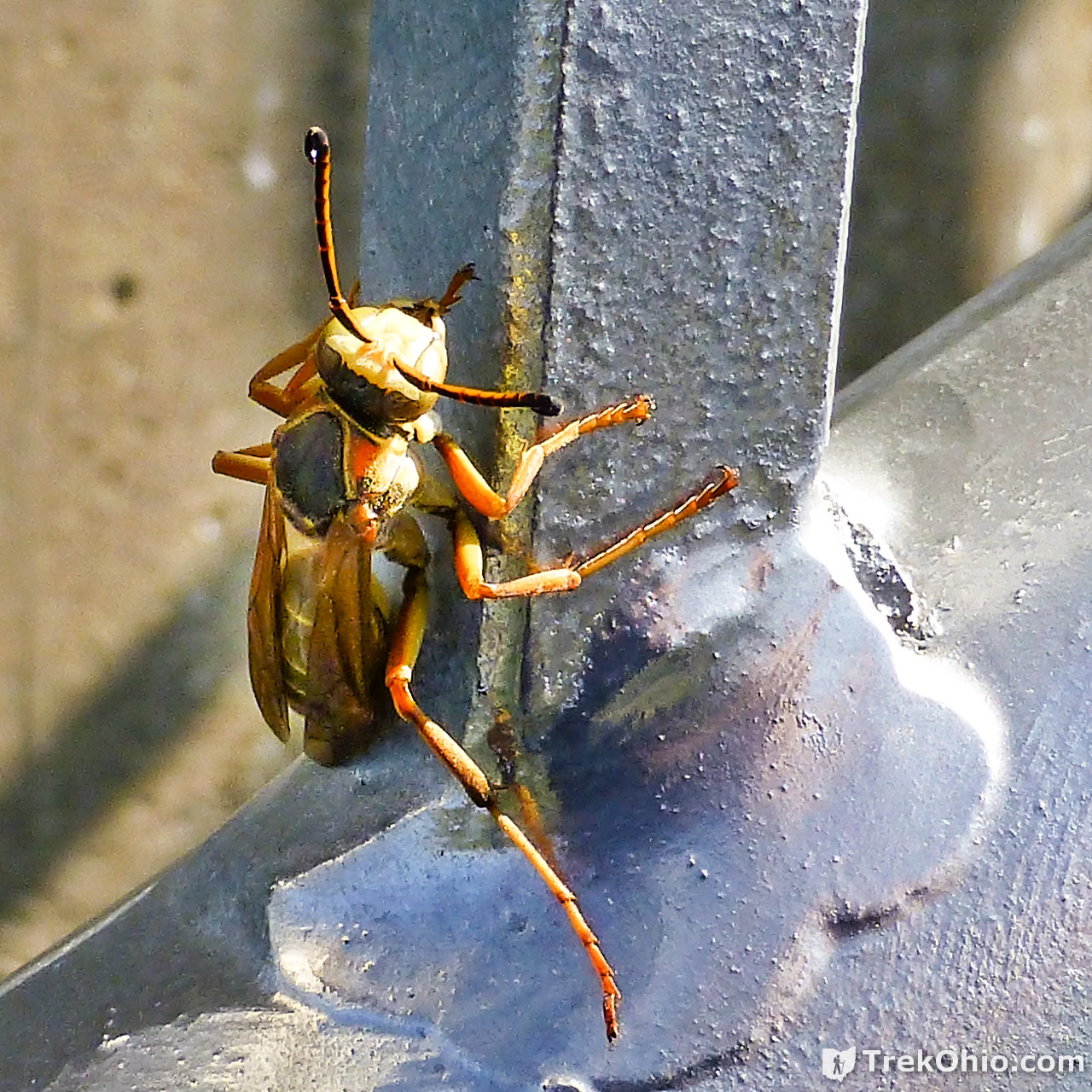
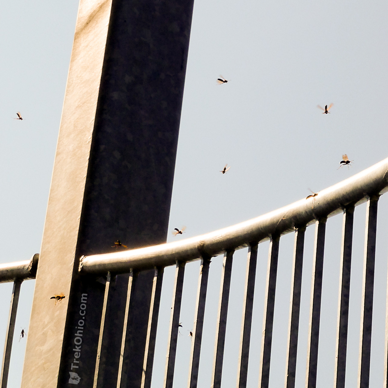
I mention in passing that as I climbed the stairs of the observation tower in early October, I encountered an unusual number of wasps that I don’t recall seeing during our June visit. At first I thought that I must be near a nest, but on every flight of stairs when I reached the northwest side of the tower I would encounter more wasps. I have been contacted by a park official who has told me that there is no wasp nest, but that the wasps show up near the tower annually near the beginning of October, and that they disappear after the first frost. In general I have learned that if I don’t bother stinging insects, they don’t bother me. But if I had an allergy to wasp stings, this may have given me pause.
And the photo below gives you some idea of the number of wasps.
Ground Level near the Tower
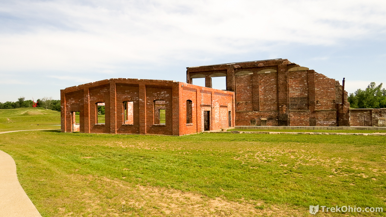
Among the industrial structures that have been preserved and re-puposed is the Schnormeier Event Center. It is a 17,000 square foot building that has had its walls removed. Nonetheless, it has electric power, a stage and rest rooms, and it is available for people to rent to hold events there. During one of our visits to the park, it was being prepared to host an event for an organization known as Crossfit 1808 which had rented the space for the day.

Eastern Region of Park
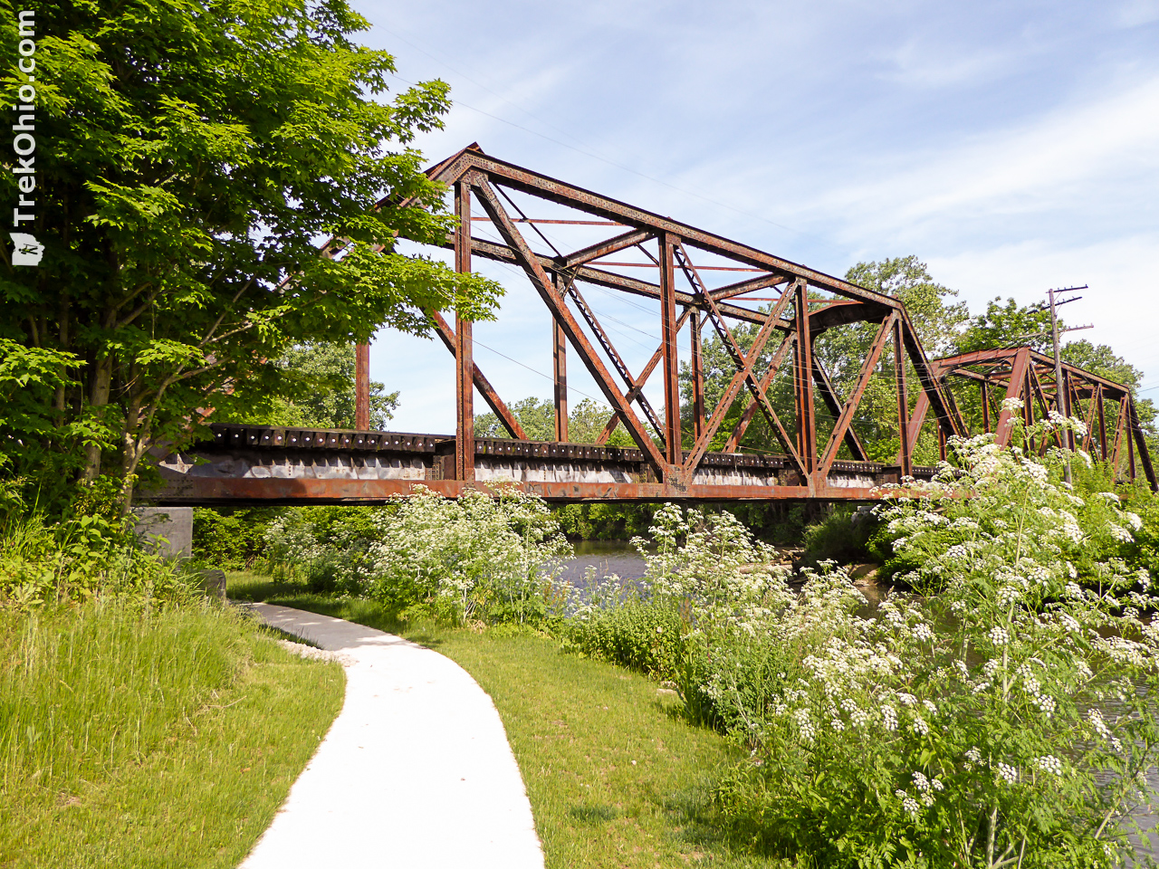
After looking over the central region of the park near the tower, we headed out toward East Lake. We left the paved path and followed a dirt path around the eastern edge of the lake. We passed a picnic table or two along the lakeside. Going east from the northern tip of East Lake, we once again came to a paved path that lead under a railroad trestle.
We continued following this path till we reached the park’s Welcome Center, which is a re-purposed railroad depot.
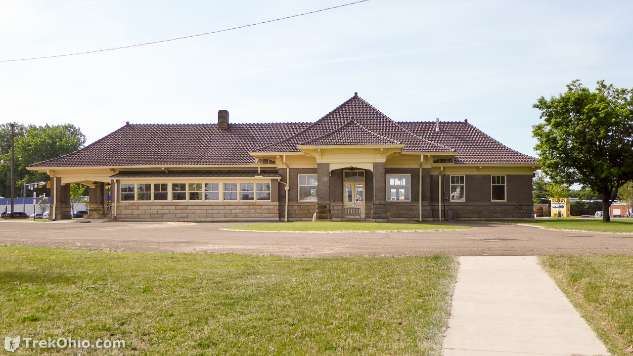
The Heart of Ohio bicycle trail passes in front of the Welcome Center. We turned right (west) and followed the bicycle path until we were back at the Rastin Observation Tower once again.
Western Region of Park
After we reached the observation tower we cut through the center of the park once again and headed west through the Ruins and the Terraces on a paved path.
We eventually came to a dirt road which we followed along the western border of the Central Lake. This provided us a nice view of the Red Arched Bridge.
We saw several people fishing from the shoreline, but we also saw a number of turtles basking and swimming around. I converted the photo below to Black and White to better show the creatures under the water.

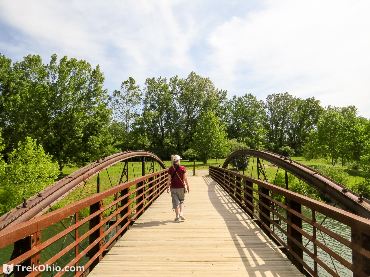
We followed the path near the northwestern part of the Central Lake and crossed the Historic Mill Road Bowstring Bridge.
We then followed the path along the northern border of the Central Lake until we reached the strip of land that divides the East and Central Lake. At this point we headed back toward the parking area near the tower.
Additional information
- TrekOhio: Knox County Parks & Preserves — This is the county where Ariel-Foundation Park is located; check out this page for links to the official website and for information on nearby parks and preserves.
- Ariel-Foundation Park — Official website
- Ariel Foundation — According to this website, the foundation concentrates its efforts on the arts, education, parks and the pursuit of happiness. It supports people and projects that are focused on improving the quality of life for the people of the Mount Vernon, Ohio area
- Ariel Corporation — This fifty-year-old, Mt. Vernon corporation is currently the largest manufacturer of reciprocating gas compressors in the world.
- ChasingSmokestacks.com: Pittsburgh Plate Glass Plant in Mount Vernon
- Facebook: The Knox County Fish and Game Association Inc. — This group works with Knox County to hold events at various parks throughout the year, including the annual Youth Fishing Derby held at the Ariel-Foundation Park.
- YouTube: Video of Ariel-Foundation Park from a Drone
- YouTube: How sheet glass is manufactured
Location
- Address: 100 Pittsburgh Ave., Mt Vernon, Ohio 43050
- GPS Coordinates: 40.382564, -82.497169
- Google Maps: View on map or get directions
More on Knox County
 Ramser Arboretum
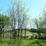 Knox Woods State Nature Preserve and Wolf Run Regional Park
 Honey Run Highlands Park
 Thayer Ridge Park