Hinckley Reservation is one of sixteen parks that make up the Cleveland Metropark system. The 2,803-acre park is located in Hinckley Township, primarily in Medina County. The park contains nearly twenty miles of trail for those on foot and six miles of bridle trail. There is a 90-acre lake (Hinckley Lake) within the park and two smaller fishing ponds; there is also an 80 by 100 foot stainless steel pool near the lake. Besides hiking, the area offers opportunities to fish, boat and swim. In the winter, visitors can ice skate, or they can go sledding on the sledding hill. Hinckley Reservation is also home to the annual festival known as Buzzard’s Day which celebrates the return of the turkey vulture to the area around mid-March.
This is a huge park, and we only explored a tiny portion of it, focusing on Whipp’s Ledges. However we also stopped by the Spillway Beach and one of the park’s overlooks of the lake. In the future we hope to check out some of the other trails.
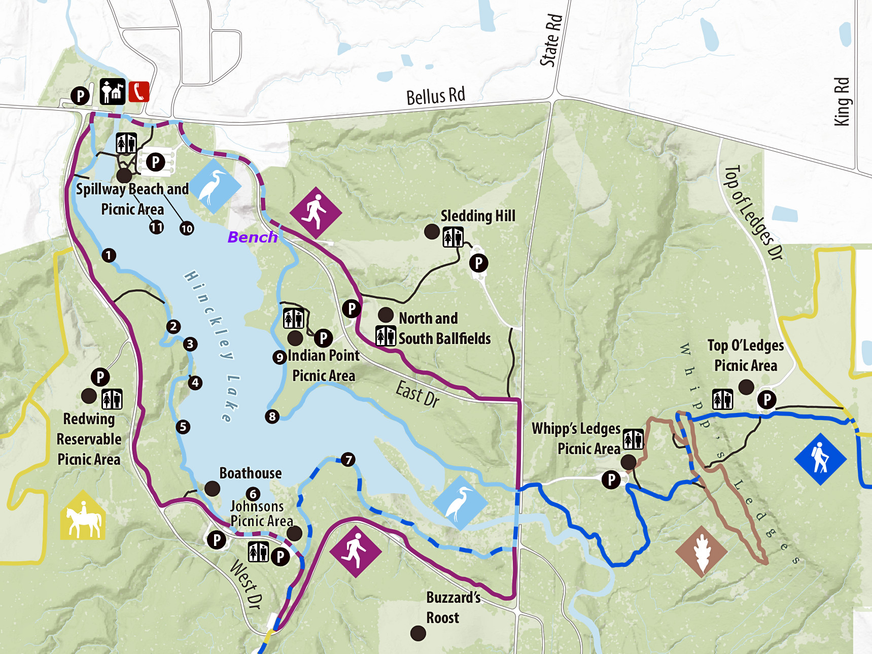
Getting Oriented
Use the map below to identify the location of any of the places discussed in this article. You can click on the map (or any photo) to view a larger version.
We began at Spillway Beach off of Bellus Road, located in the upper left of the map. We then turned right onto East Drive heading towards Whipp’s Ledges, but on the way we passed an attractive observation point overlooking the lake. We stopped to take in the lake view and bumped into some hikers who told us this area was also an access point for the Hinckley Lake Loop Trail. This overlook was originally unmarked on the map, but I added the word “Bench” in blue italics to show it’s location (it’s between the heron icon and the running-man icon in the upper left). Shortly afterwards we continued our drive to our hiking destination, the Whipp’s Ledges Loop Trail. This trail is shown in brown to the lower right on the map; its icon is an oak leaf. After hiking this trail, we returned to the parking lot using the Buckeye Trail, so we didn’t have to backtrack on a trail that we’d already seen. The Buckeye Trail is marked in blue on the map.
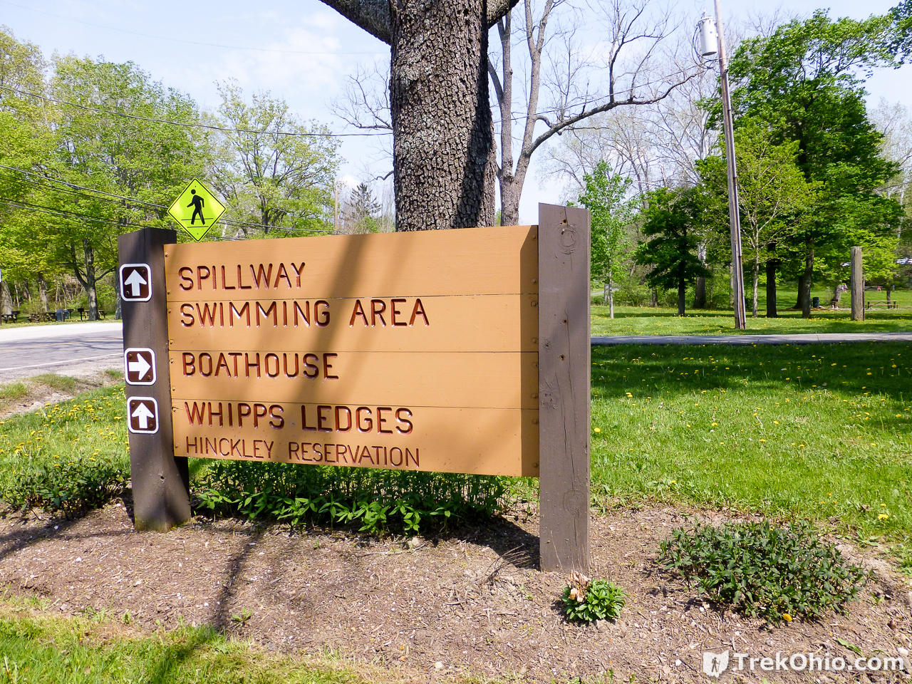
Spillway Beach
We basically just pulled over here to see what it was like and to view the park map at the kiosk here.

A sign showed us that we were already in the vicinity of the ledges.
Observation Point near Hinckley Lake Loop Trail
Shortly after turning onto East Drive, we passed a parking lot near benches overlooking the lake. It looked pretty, so we stopped.
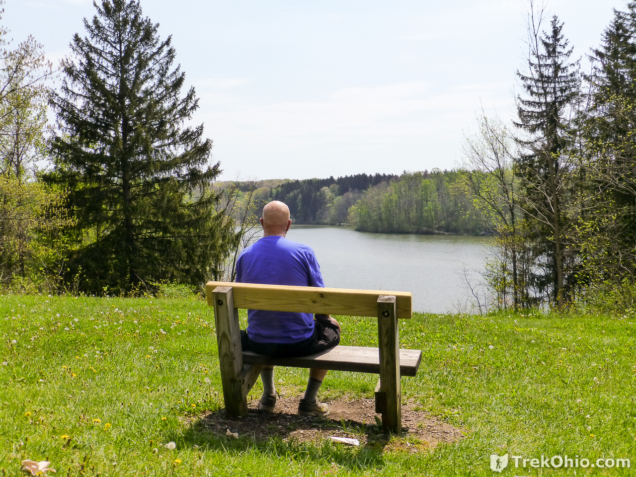
While we were there we talked to some hikers who were following the Hinckley Lake Loop Trail around the lake. There is a trailhead for this hike nearby.
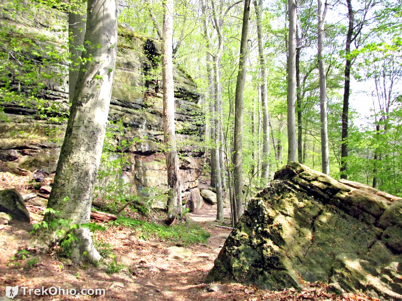
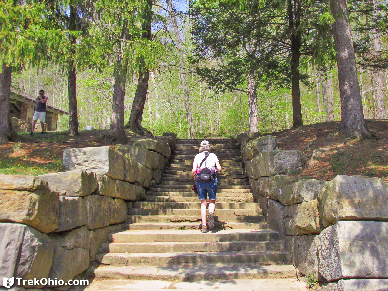
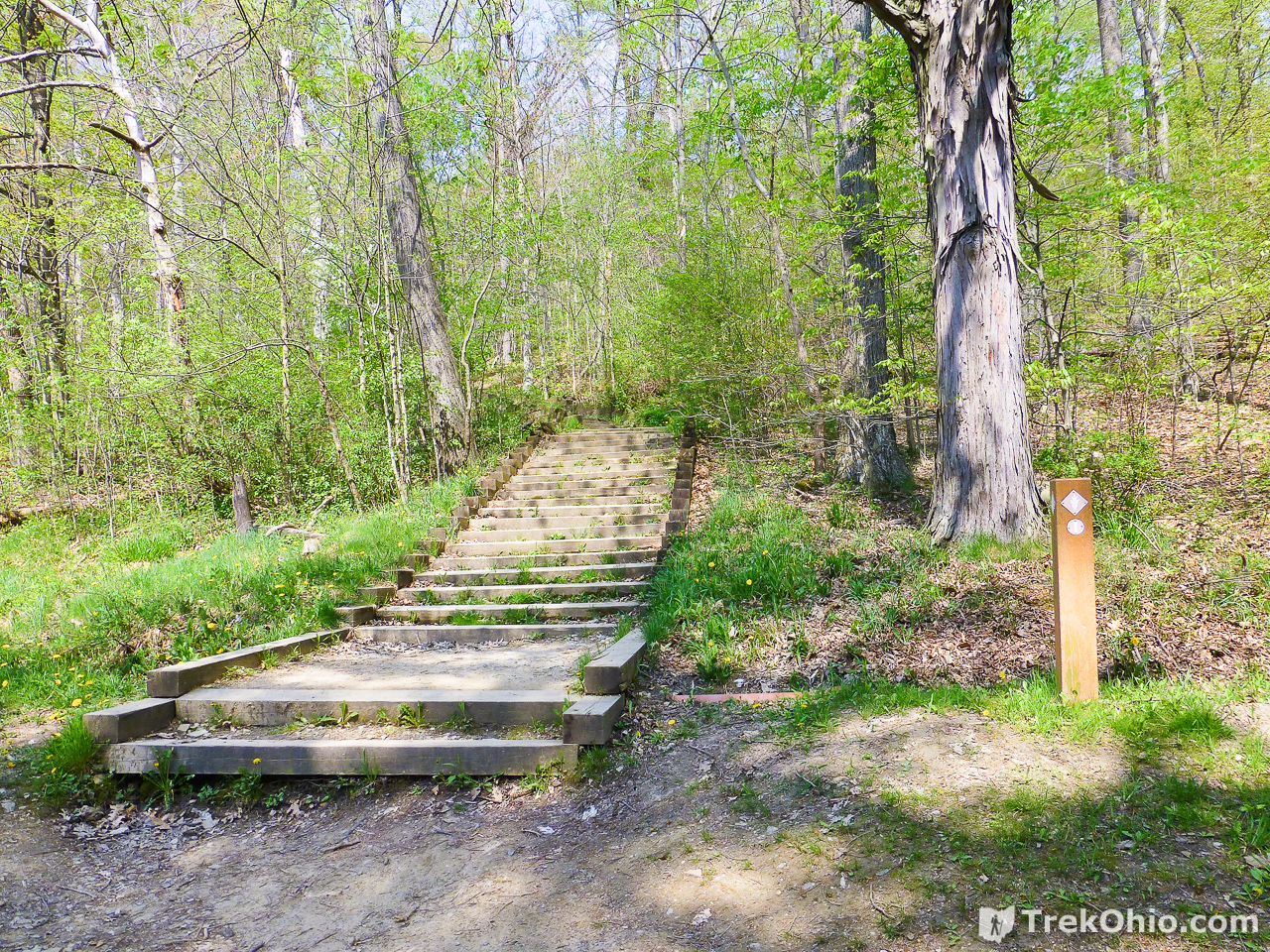
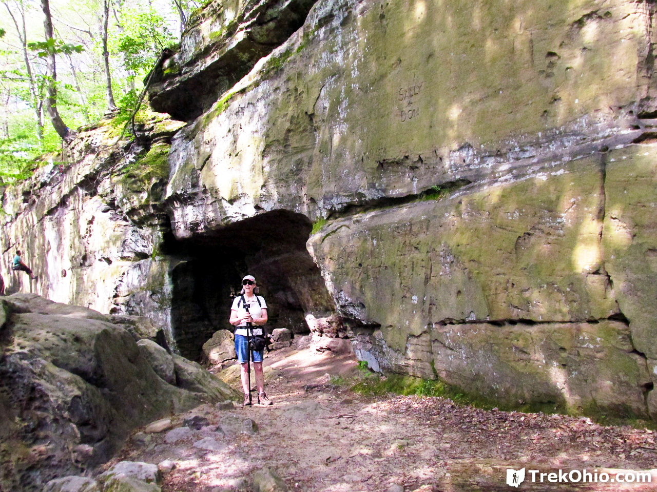
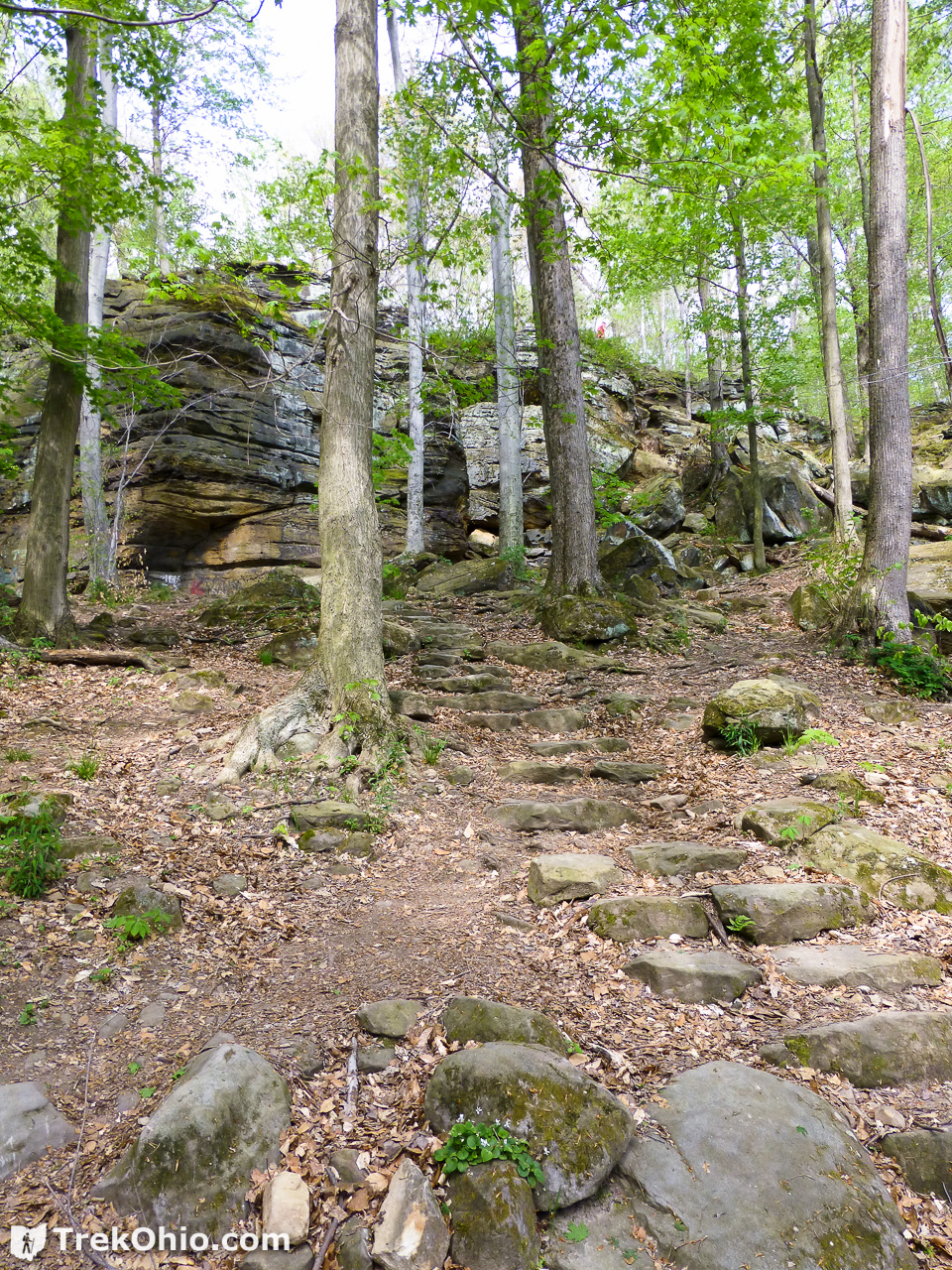
Whipp’s Ledges Loop Trail
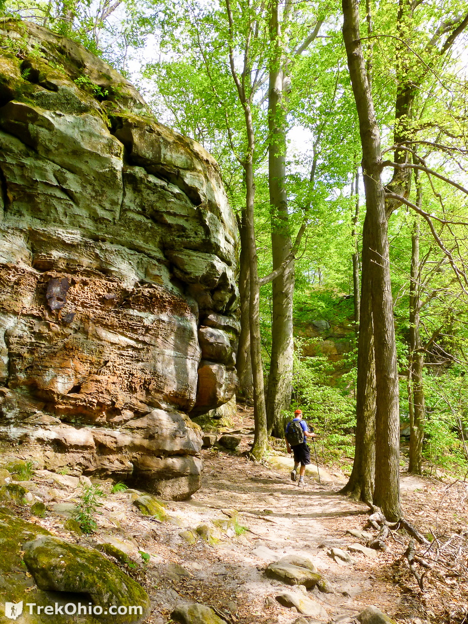
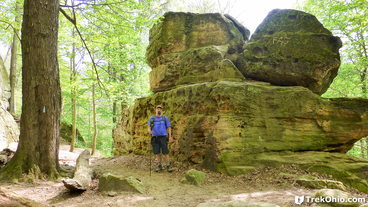
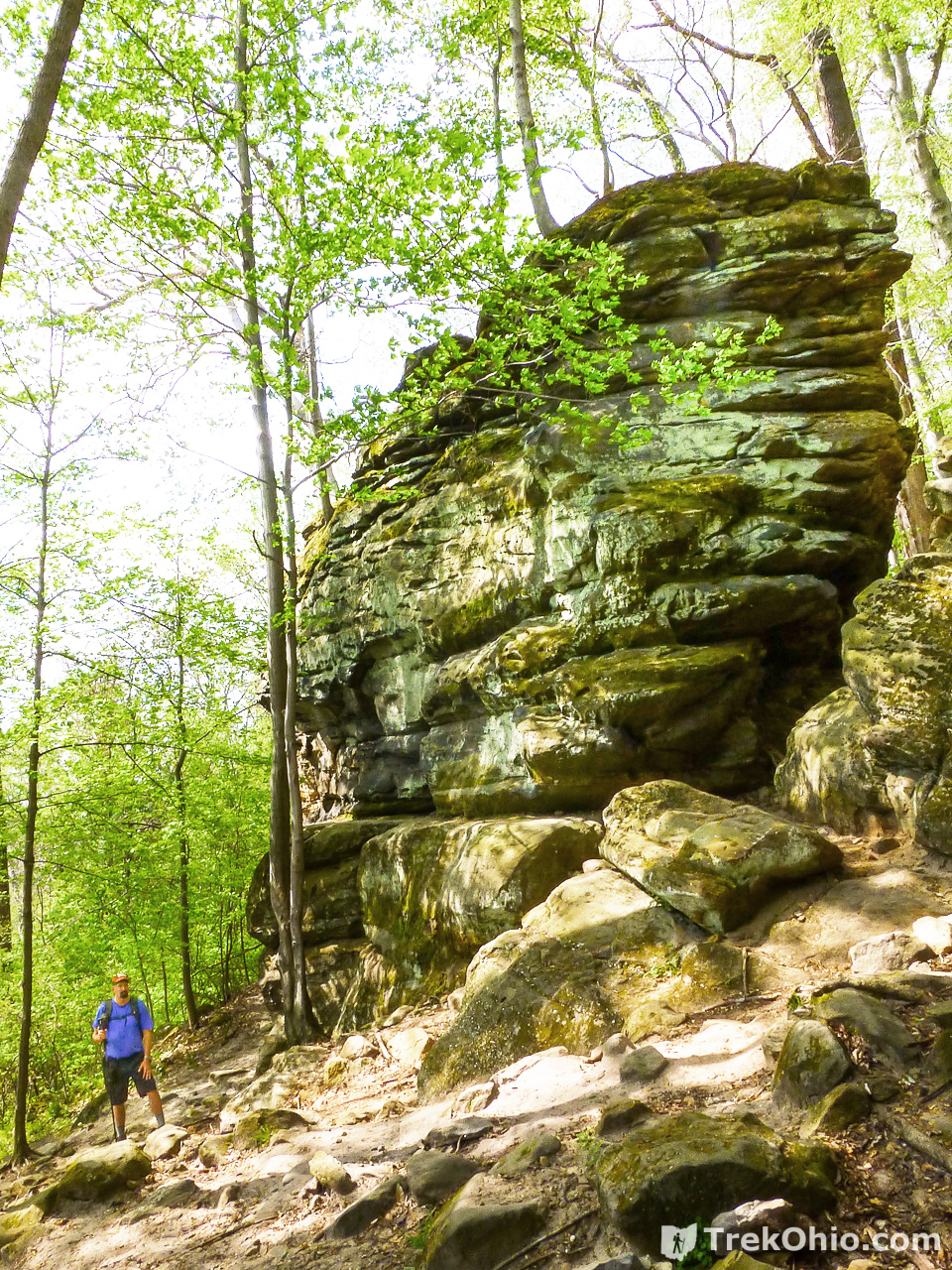
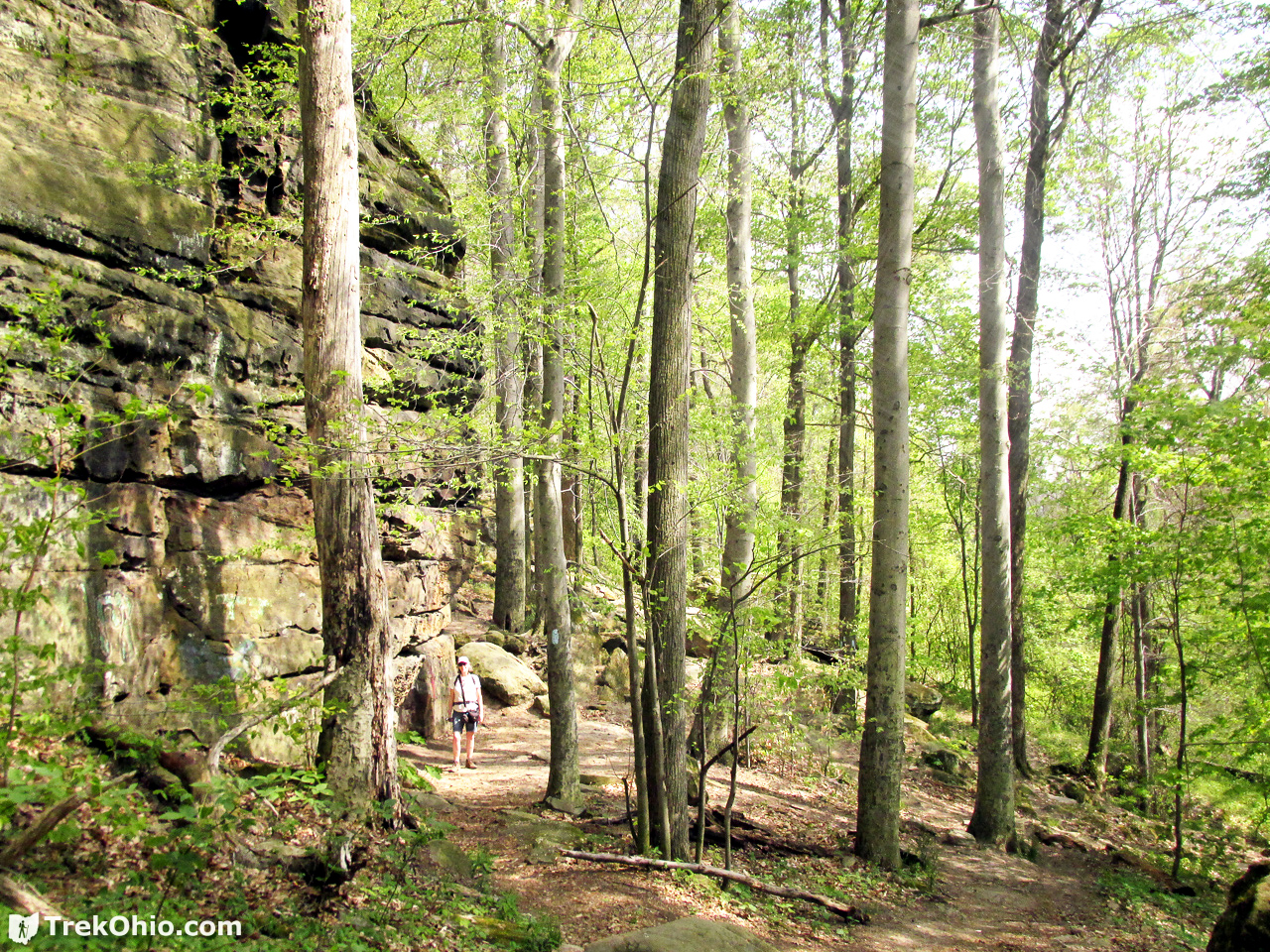
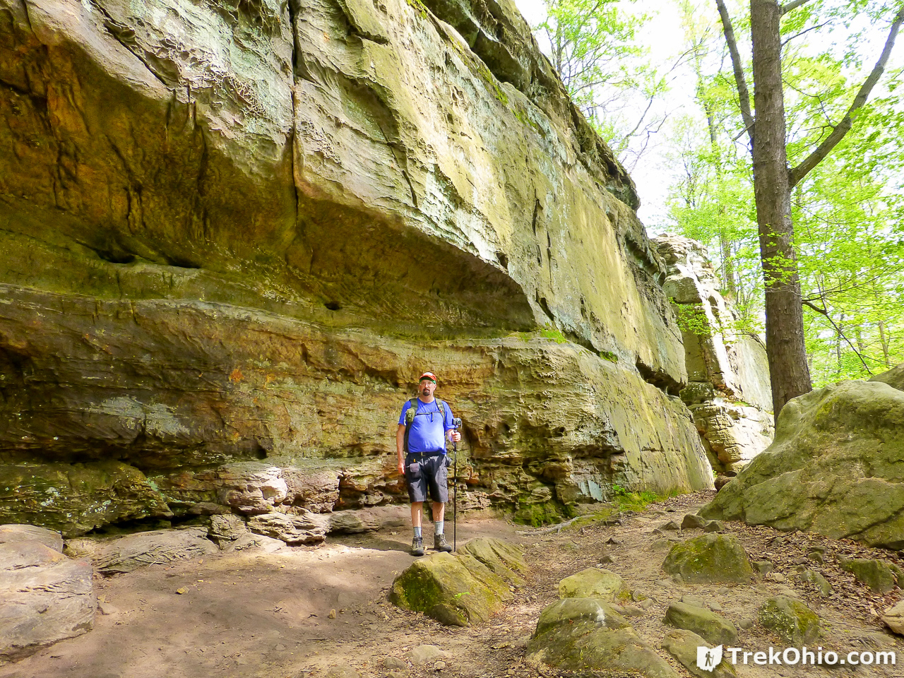
For us the Whipp’s Ledges Loop Trail was the main attraction. This is a short, 1.25-mile trail that passes through some spectacular scenery. The cliffs here are made of Sharon conglomerate sandstone. Sometimes the trails passed by the cliffs and at other times there were opportunities to walk down fissures between cliffs.
We began our hike near the Whipp’s Ledges Picnic Area off of State Road. After hiking around the ledges we were able to return to the parking lot using the Buckeye Trail (the blue trail on the map with the hiker icon).

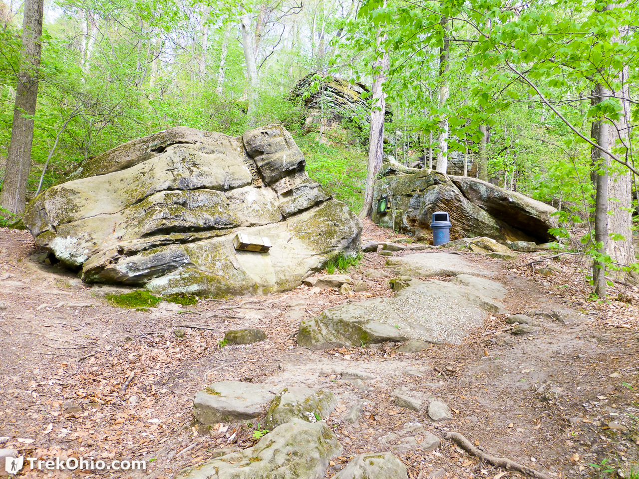
Below I’m going to show you some of the sights that we took in as we wandered around the ledges. One of the easiest ways to show the size of a cliff or a rock formation is for a person to stand beside it for comparison purposes. That’s why we are in so many of the photos that follow.


Rock climbing
While we were exploring Whipp’s Ledges, we did come across people who were rock climbing.
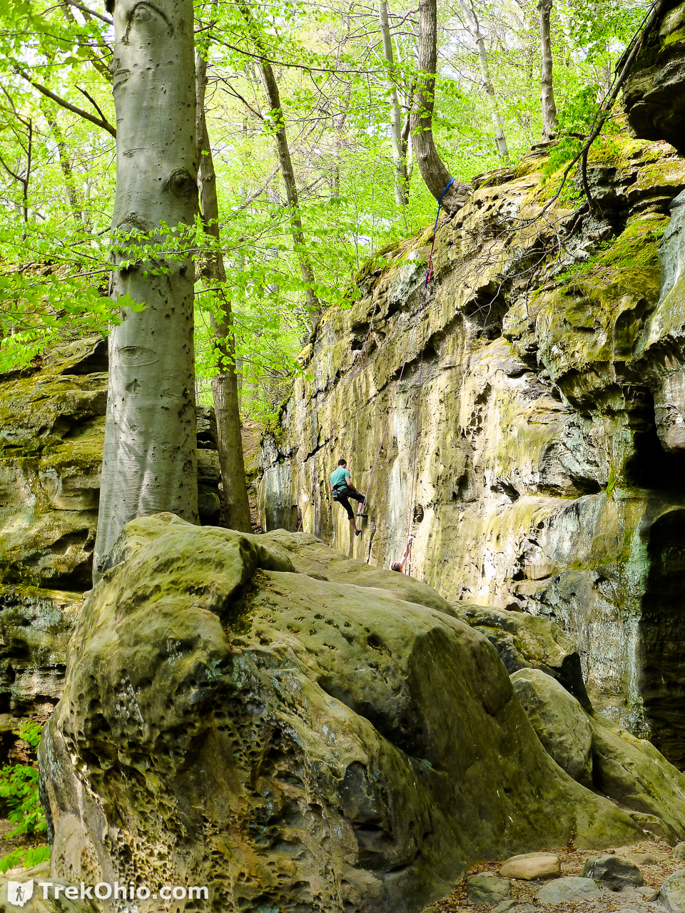
As we drew closer we could see that he was part of a group.

According to RockClimbing.com to go rock climbing at Hinckley Reservation:
You must obtain a permit to climb with a rope system… Contact Mike Barnhart (216) 351-6300, Ext. 264, with the Cleveland Metro Parks system. You can visit the Cleveland Zoo and get things handled their (sic) as well, but don’t expect same day service. You must have proof of 300,000 USD personal liability insurance (home owners or renters)…
Additional information
- TrekOhio: Medina County Parks & Nature Preserves — This is the county where Hinckley Reservation is located; check out this page for links to the official website and for information on nearby parks and preserves.
- Hinckley Reservation (PDF) — This is chapter four of a larger work, Envisioning the Emerald Necklace: From Forest to Lake. You can find other chapters from this same publication by performing this Google search.
- Ohio Ornithological Society: Birding at Hinckley Reservation
- Buzzards Day
- Rock Climbing Routes in Whipps Ledges, Northeast Ohio | Rockclimbing.com
- Medina Gazette: Hinckley Reservation may see drones flying overhead to monitor park health
- In November 2016 a brush fire near Whipp’s Ledges burned 20 to 30 acres of Hinckley Reservation. It took about fifty firefighters to put it out. This was reported at fox8.com, Cleveland 19 News, and Newsradio WTAM 1100 among others.
Location
- Parking for the Spillway Beach
-
- Address (approximate): 1039 Bellus Rd., Hinckley, Ohio 44233
- Directions: Parking is on the north side of Bellus Road. Once you’ve parked, go to the east end of the parking lot, then walk across Bellus Road to the south side to the entrance for the Spillway Beach.
- GPS Coordinates: 41.228167, -81.721583
- Google Maps: View on map or get directions
- Bench overlooking Hinckley Lake
-
- Address (approximate): 1858 East Dr., Hinckley, Ohio 44233
- GPS Coordinates: 41.225091, -81.714839
- Google Maps: View on map or get directions
- Entrance to the parking lot for Whipp’s Ledges
-
- Address (approximate): 2001 State Rd., Hinckley, Ohio 44233
- GPS Coordinates: 41.218707, -81.706439
- Google Maps: View on map or get directions
More on Northeastern Ohio
 Liberty Park: Ledges Trail
 Harpersfield Covered Bridge MetroPark
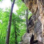 Cuyahoga Valley National Park: Ledges Trail
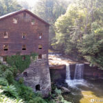 Mill Creek Park: Lanterman’s Mill and Mill Creek Gorge