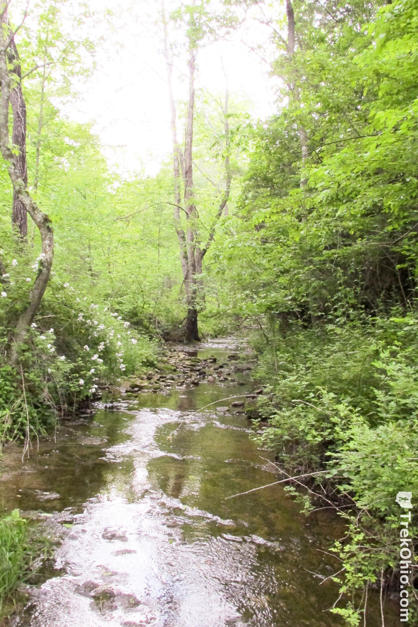
Chalet Nivale Preseve is a 106-acre preserve in Adams County that is owned and managed by the non-profit organization, the Arc of Appalachia. The preserve contains two feeder streams that are part of the Scioto Brush Creek Watershed; these feeder streams are among the highest water quality streams in the state of Ohio. By protecting the woodlands around these feeder streams, their exceptional water quality goes on to enhance the water quality of Scioto Brush Creek.
Recreational hikers have three trails to choose from at the preserve. Two of these trails are located near the feeder streams, while the third passes through a meadow. I haven’t seen any report on total mileage, but we are estimating about three miles for the entire trail system. A large variety of spring wildflowers can be observed near the woodland trails. The trail system crosses the streams at various points, so some wading is required (note that the streams are relatively shallow).
Getting Oriented
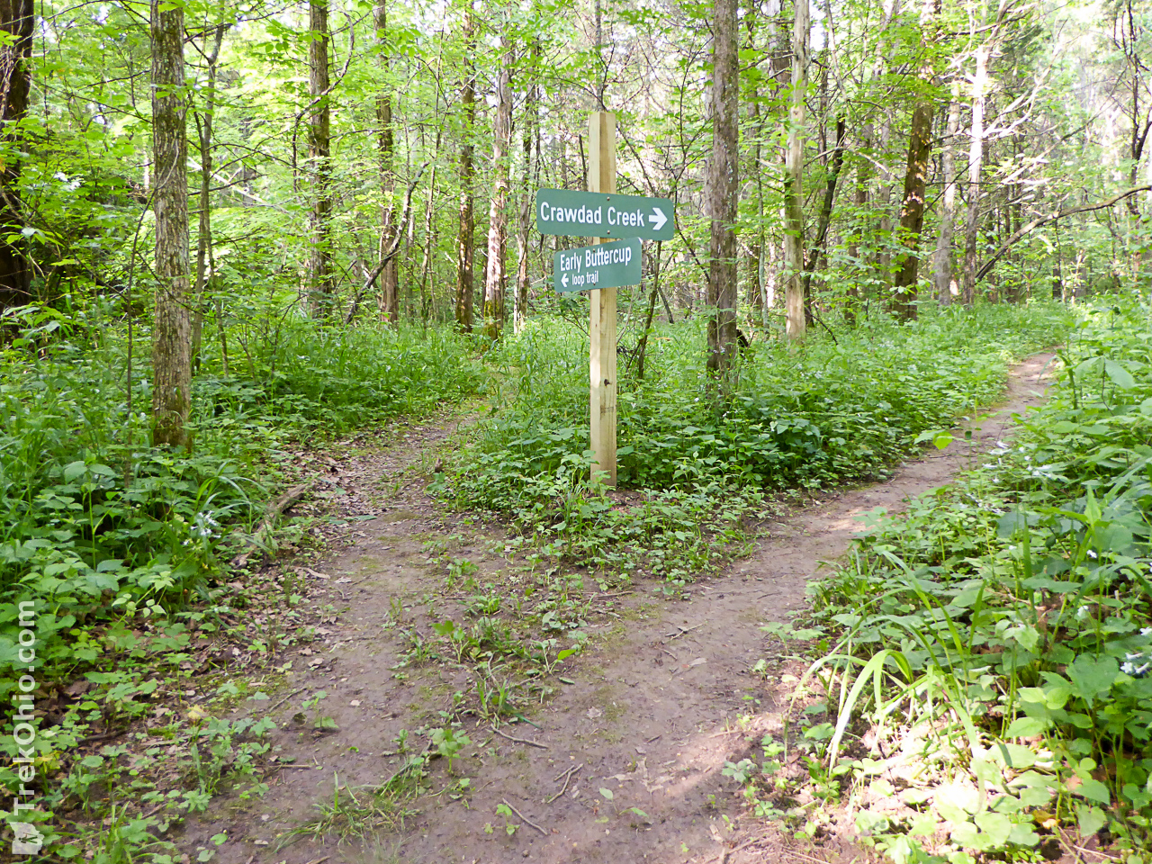
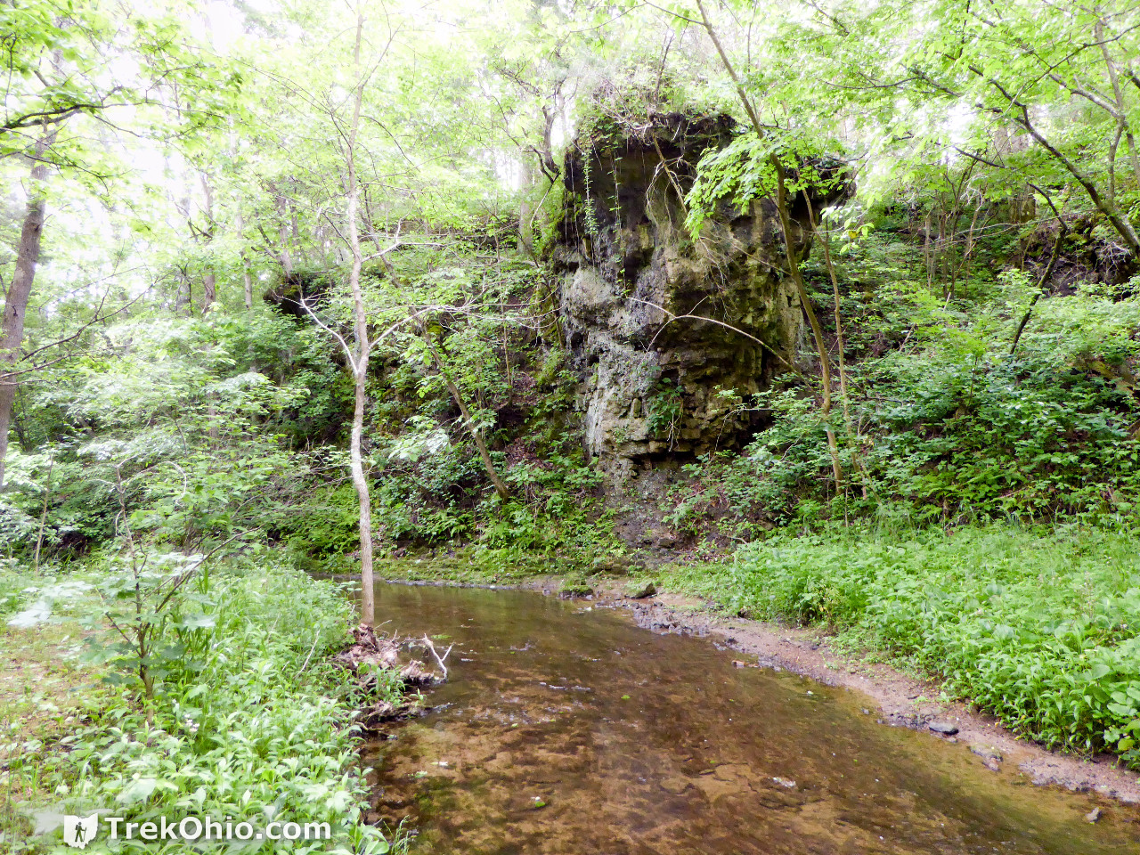
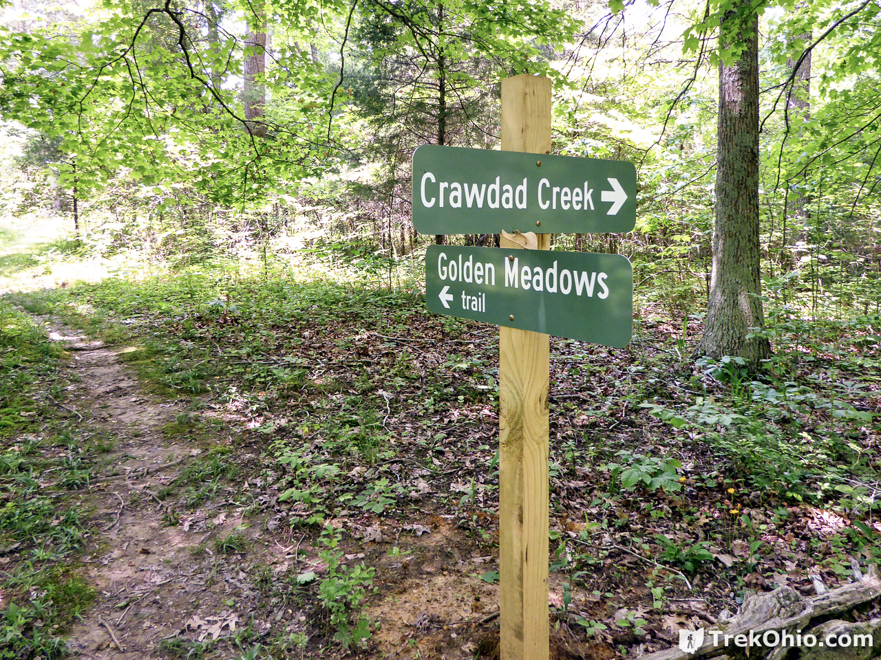
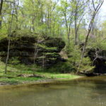
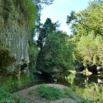
The two woodlands trails are the Early Buttercup Trail and the Crawdad Creek Trail; each of these trails contains a large loop. If you like cliffs, slump blocks and rocky outcroppings, then the Early Buttercup Trail has a lot to offer you. There were some dolomite cliffs near a portion of the stream off of the Crawdad Creek Trail, but that wasn’t typical for this trail. We were there near the end of May last year, and despite the fact that this was a bit late in the year to enjoy spring wildflowers, we still saw quite a few.
We made a GPS trace of our hike which is pictured below. The bottom trace (in blue) is the Early Buttercup Trail. We seem to be missing a piece of the loop in the lower left, but with that said our readings said we hiked for 1.1 miles. The top trace (in yellow) is mostly the Crawdad Creek Trail, but it also contains a small portion of the Golden Meadows Trail. The top trace amounted to 1.76 miles with maybe .7 of that being our round-trip on the little bit of the Golden Meadows Trail. I traced an estimate of the Golden Meadows Trail onto Google Maps, and that ended up being about another mile.
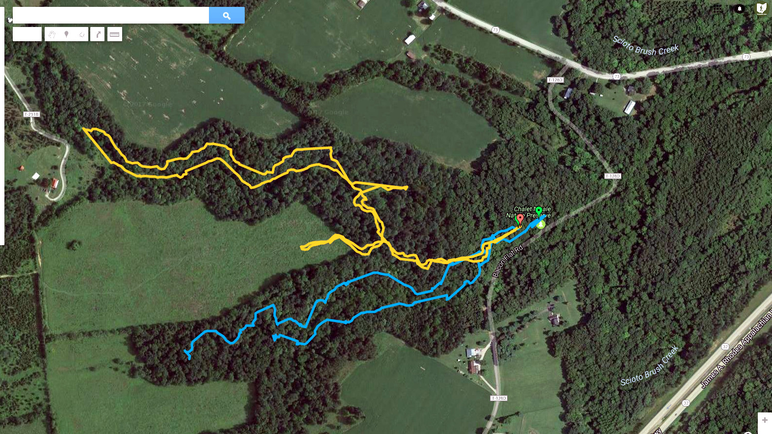
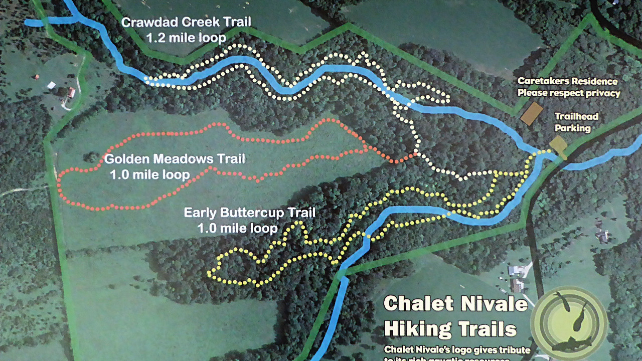
And you can compare the above trace to a photo of the trail map that was displayed on the preserve’s kiosk that shows the entire trail system.
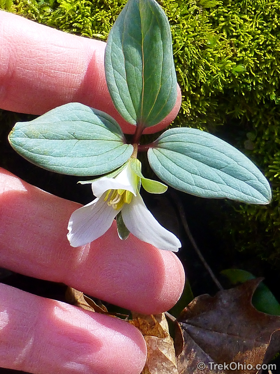
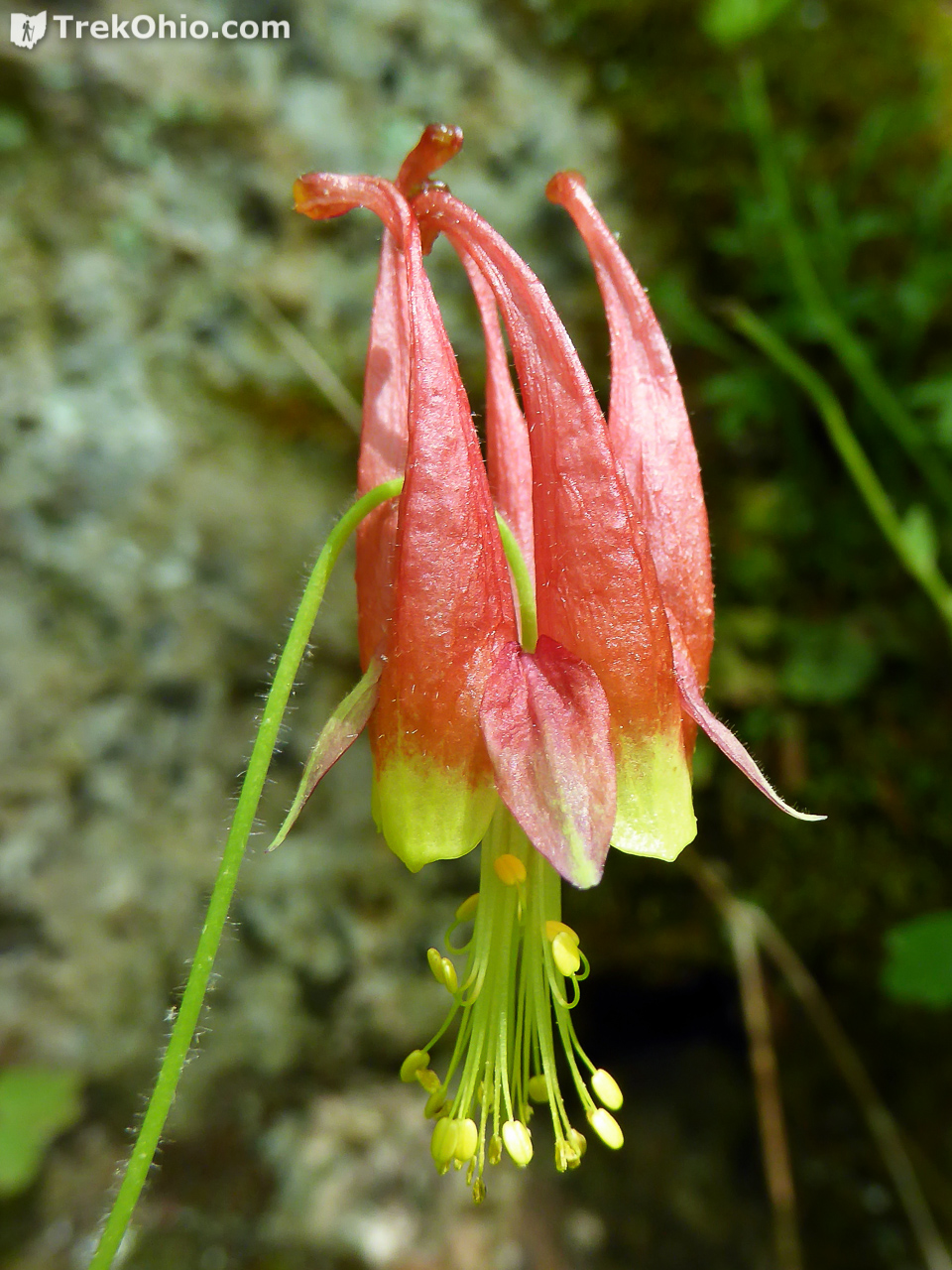
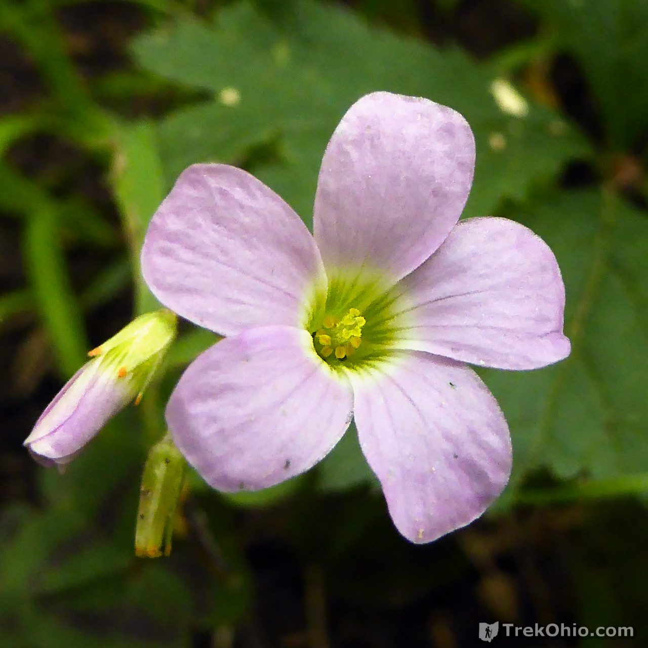
The preserve is named Chalet Nivale based on two of the preserve’s features. The French word, Chalet, refers to the house where the preserve’s caretaker resides. And Nivale refers to the flower, Trillium Nivale, also known as Snow Trillium. Snow Trillium typically blooms in March which was way before we arrived on the scene, but I’ll include a photo of it that I took elsewhere just so you can see the preserve’s namesake.
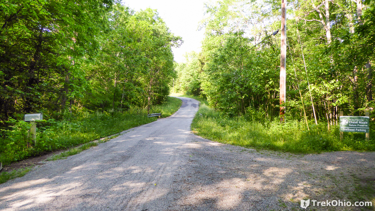
The preserve is accessed from Bacon Flat Road, a few miles east of Peebles, Ohio.
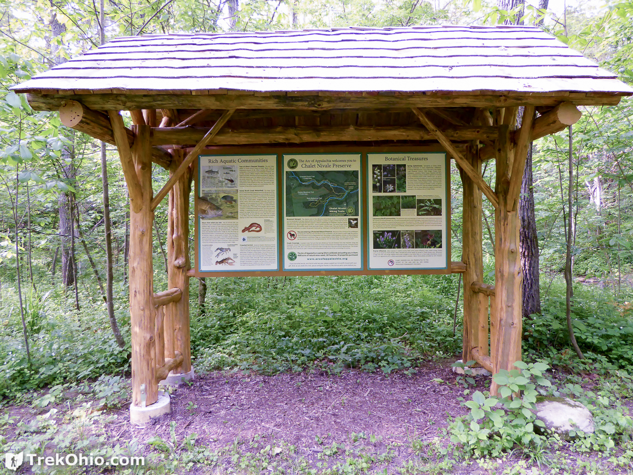
The kiosk was very informative. If you have an interest in plant life, it is worth reading the information posted at the kiosk to learn which not-so-common plants can be viewed here. Since the preserve is so focused on the watershed, there was also a lot of information on fish and aquatic invertebrates. The trailhead is just to the right of the kiosk.
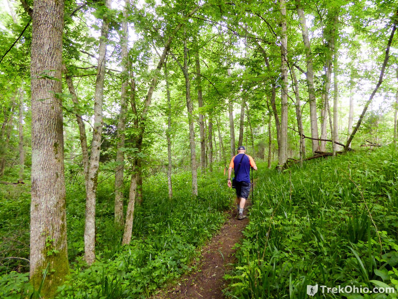
Early Buttercup Trail
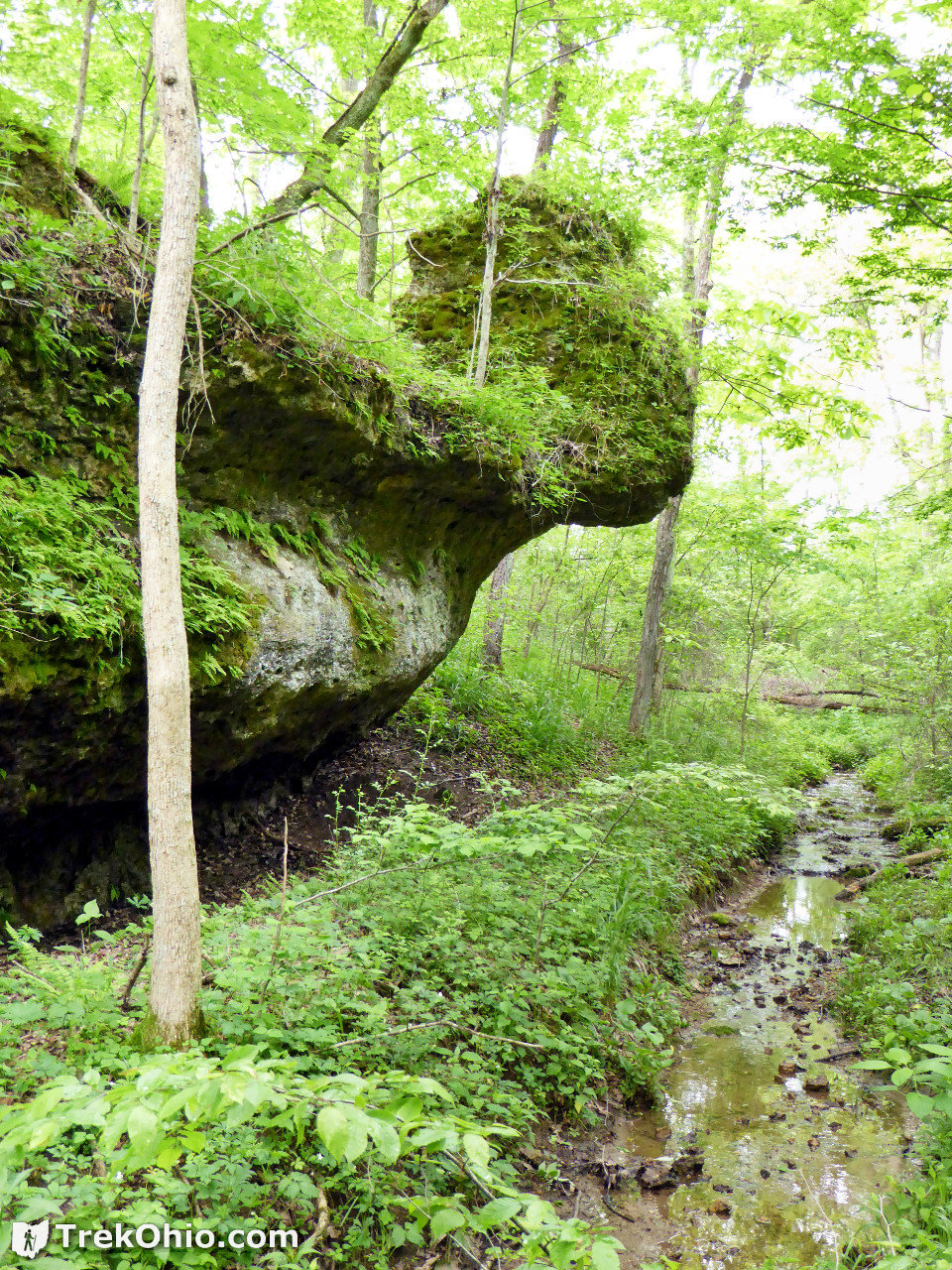
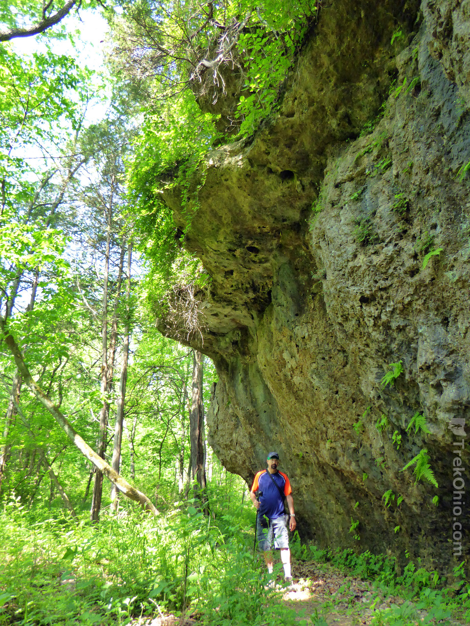
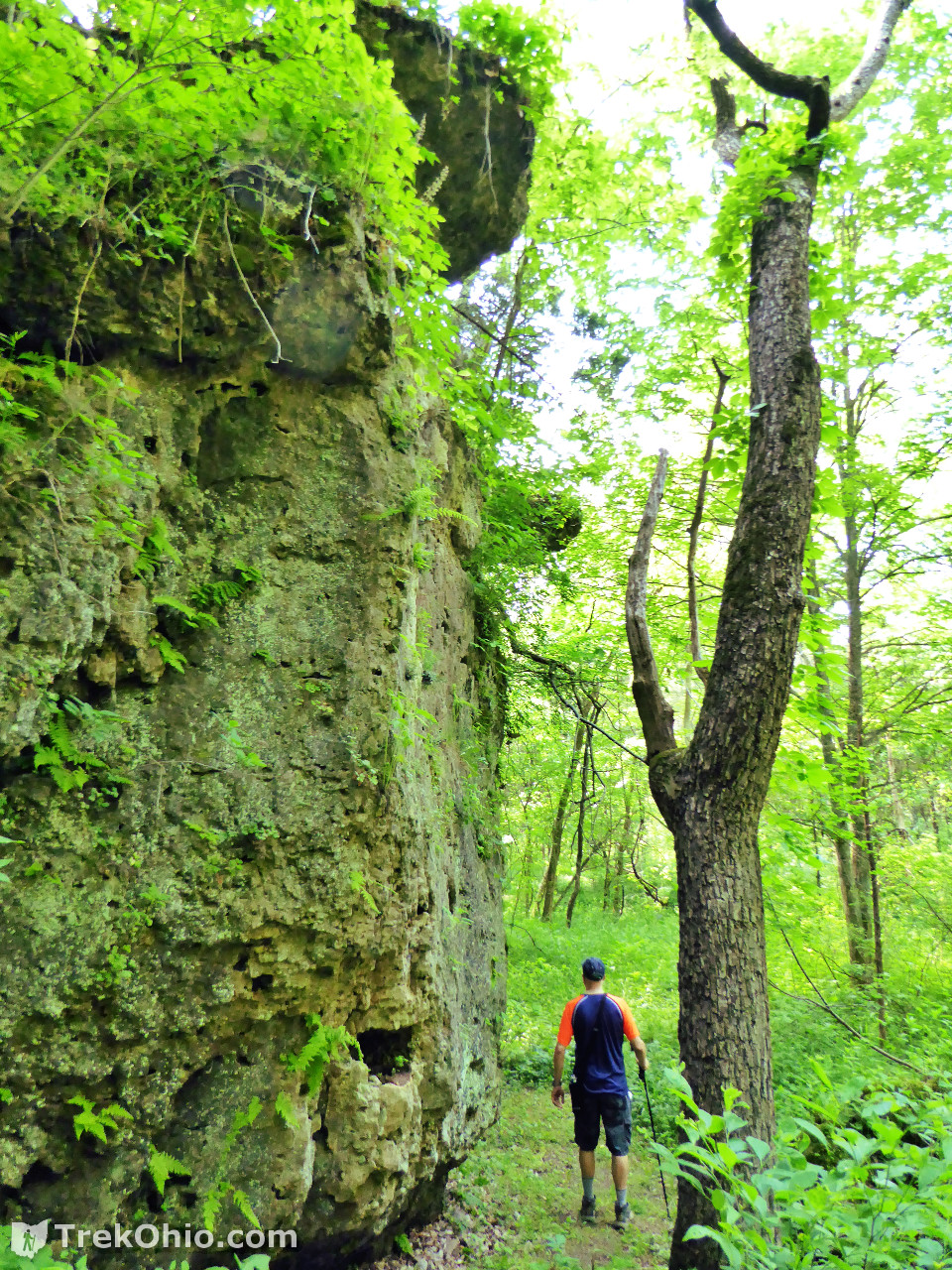
This was my favorite trail because I really enjoy seeing a bit of bedrock here and there.
It turns out that stream quality is measured on a scale of 1 to 60 (highest quality). One of the feeder streams in the preserve has rated a perfect 60, while the other has a still-impressive score of 54.
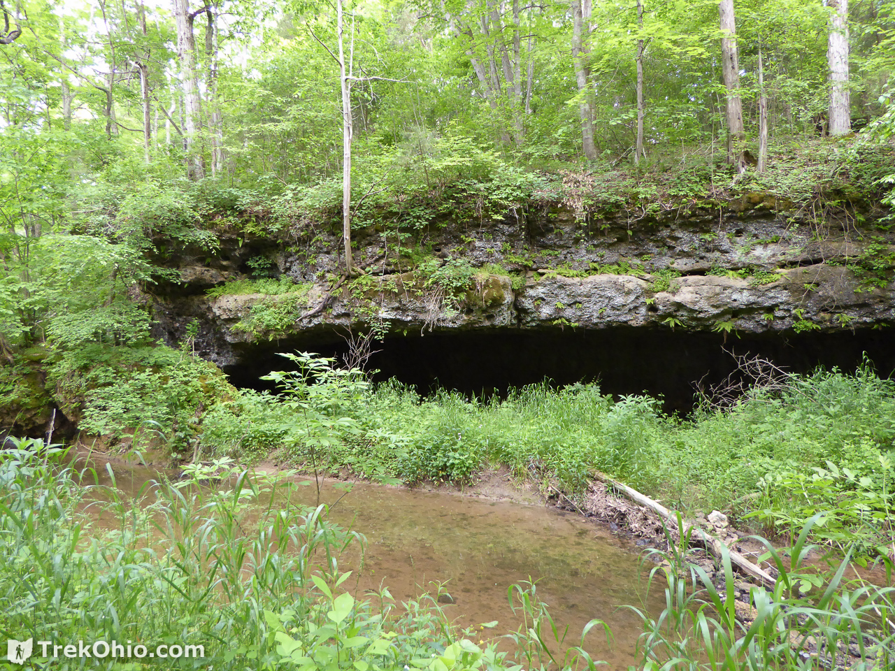
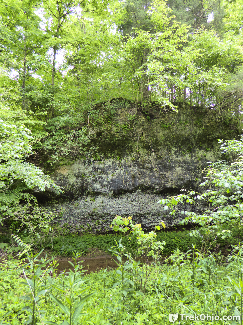
Some portions of the streams were bordered by exposed bedrock.
The trail passes a number of slump blocks of various size.

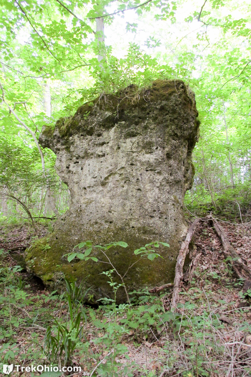
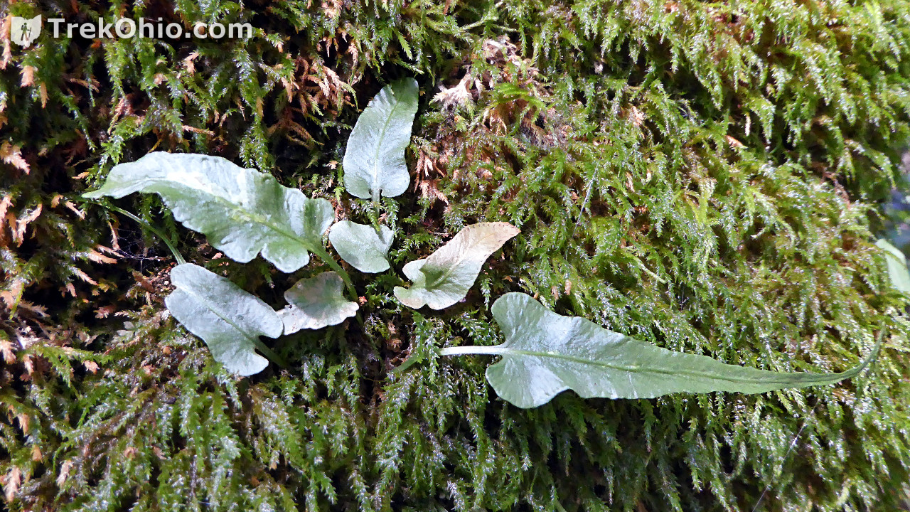
The bedrock for this part of Ohio is limestone or dolomite, and that’s what you are seeing whenever you spot a slump block or cliff. This type of bedrock causes the soil to tilt alkaline which favors certain plants. Alkaline-adapted plants include walking fern which is shown growing on the rock below. The green leaves emerging from the moss below are actually the fronds of walking fern.
At other points the trail passed by cliffs.
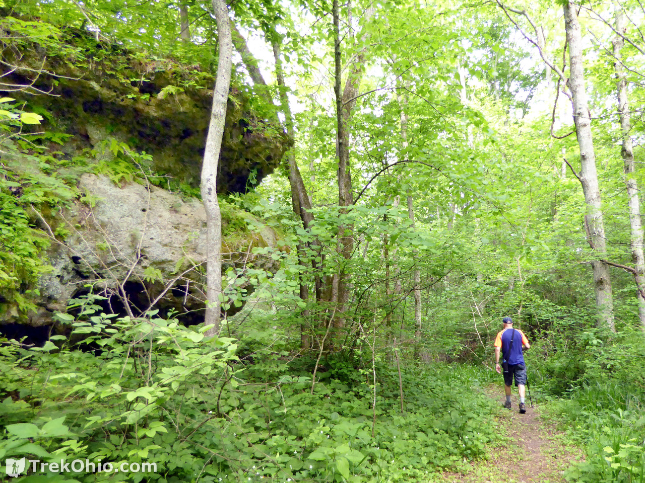

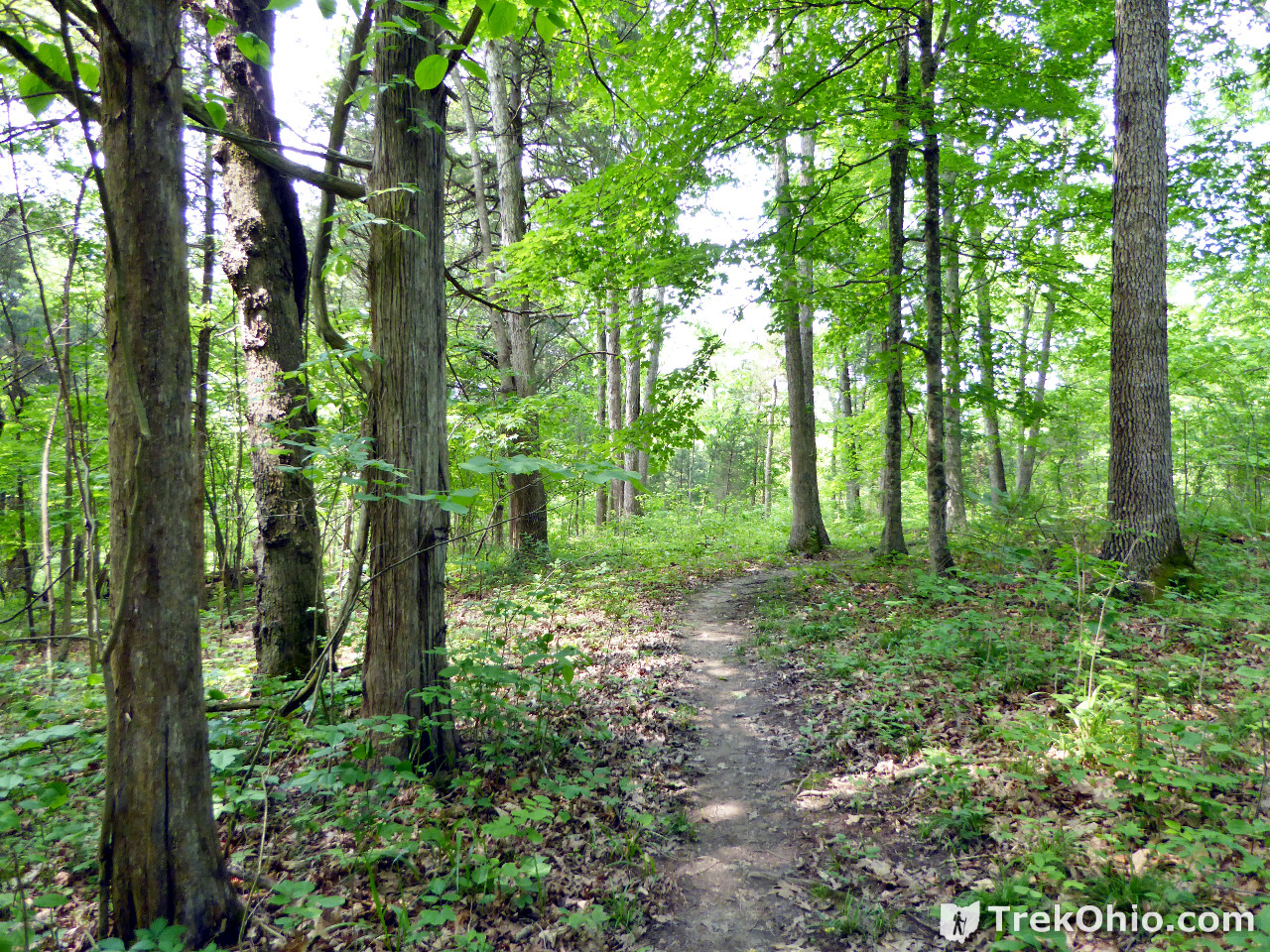
However, I don’t want to mislead you into thinking that this entire trail had views of slump blocks or cliffs. Large portions of the trail were woodlands without rocky features.
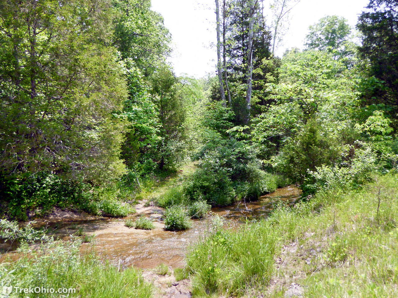
Crawdad Creek Trail
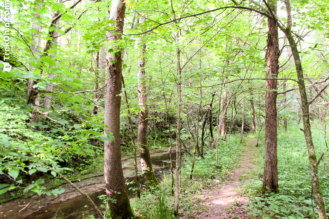
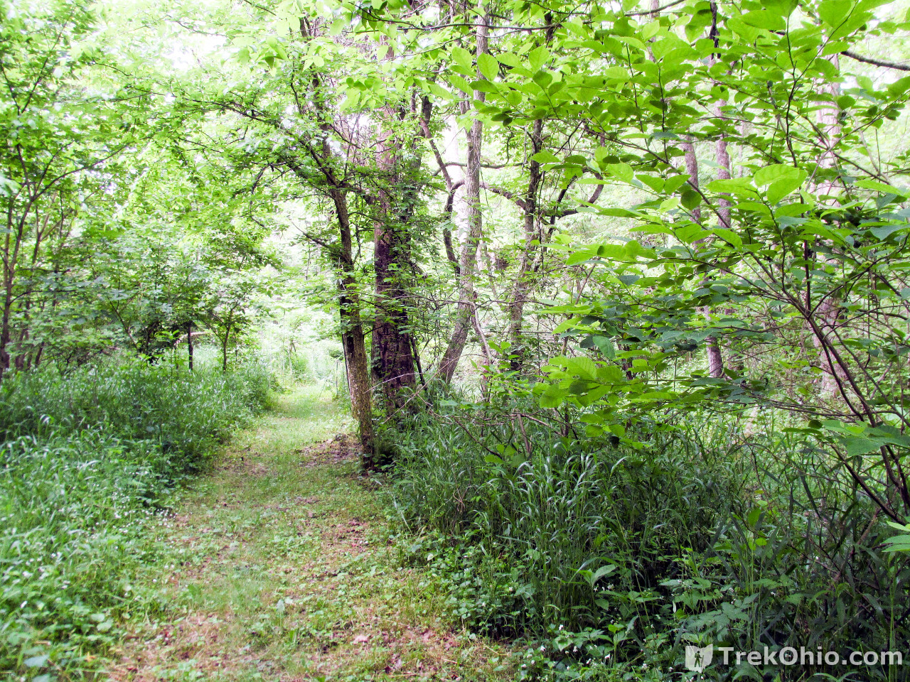
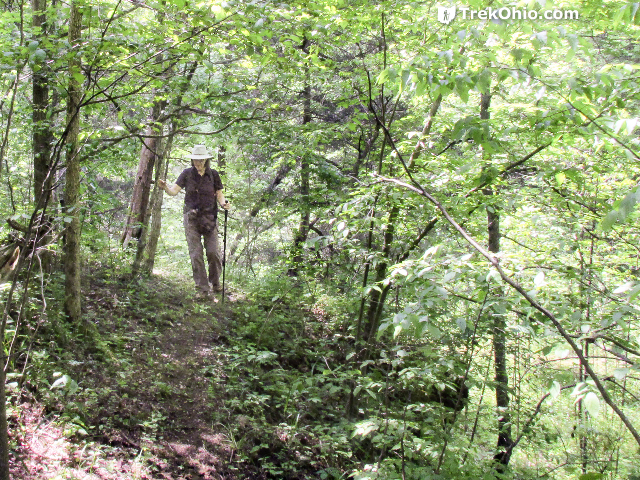
In all of the literature that I saw about Chalet Nevale, I never encountered a name for either of the two streams in the preserve. But given the name of this trail, I am deducing that this feeder stream is Crawdad Creek. ![]() Although Crawdad Creek Trail passes through woodland, it also passes through some open areas. One of the most striking features while visiting at the end of May were the blossoming ninebark shrubs which were covered in butterflies.
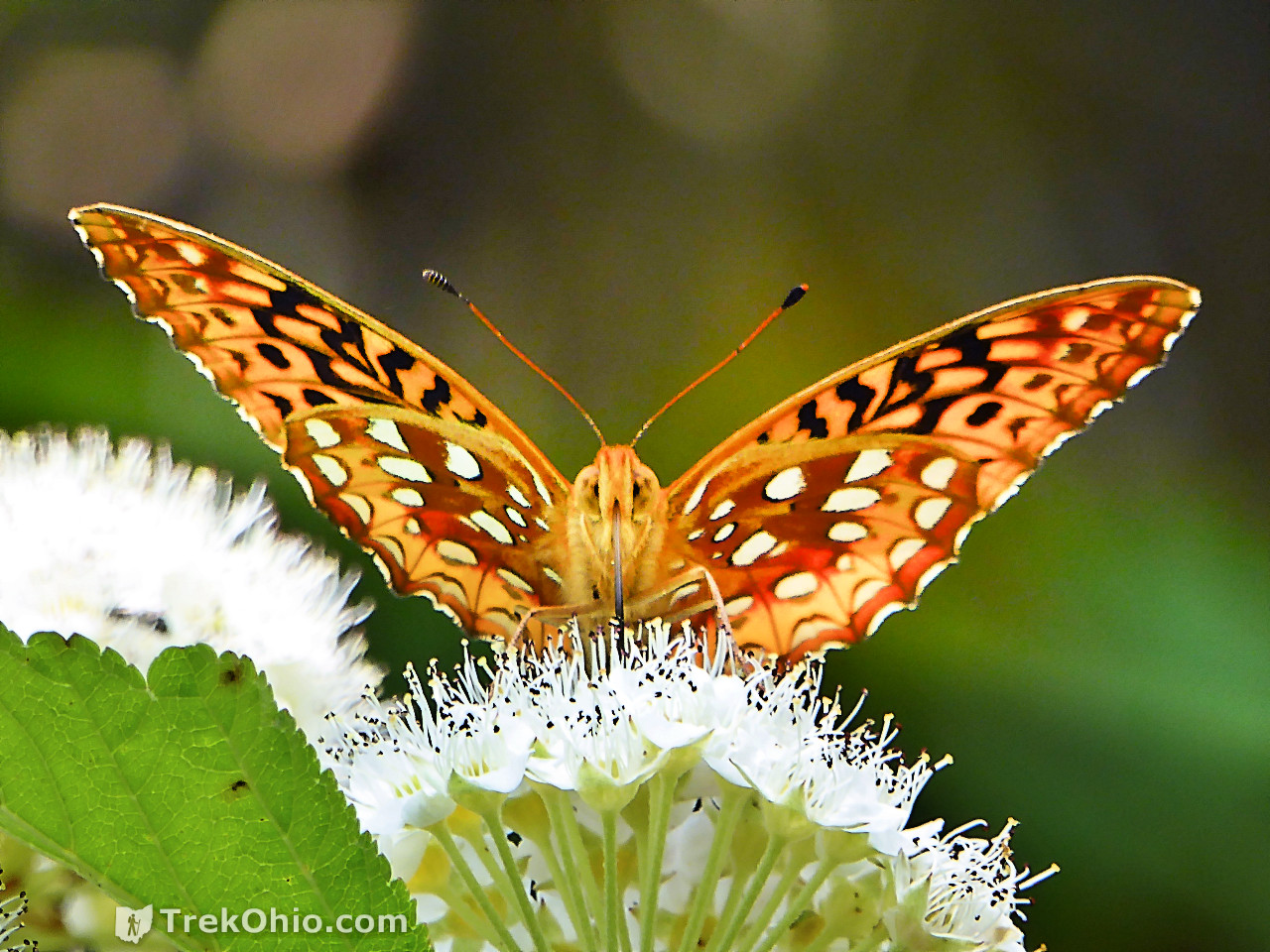
Although Crawdad Creek Trail passes through woodland, it also passes through some open areas. One of the most striking features while visiting at the end of May were the blossoming ninebark shrubs which were covered in butterflies.
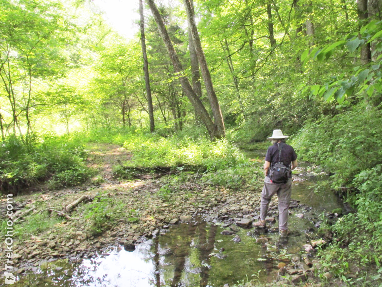
When you encounter holes near water, they were probably made by burrowing crawdads (also known as crayfish). Of the four species of crawdads that live in the preserve, the species known as the Little Brown Mudbug is rarely seen outside of its burrow.

While we were there in late May, a shrub known as ninebark (Physocarpus opulifolius) was blossoming at many points along the Early Buttercup Trail. And every blossoming shrub had its share of great spangled fritillary butterflies.

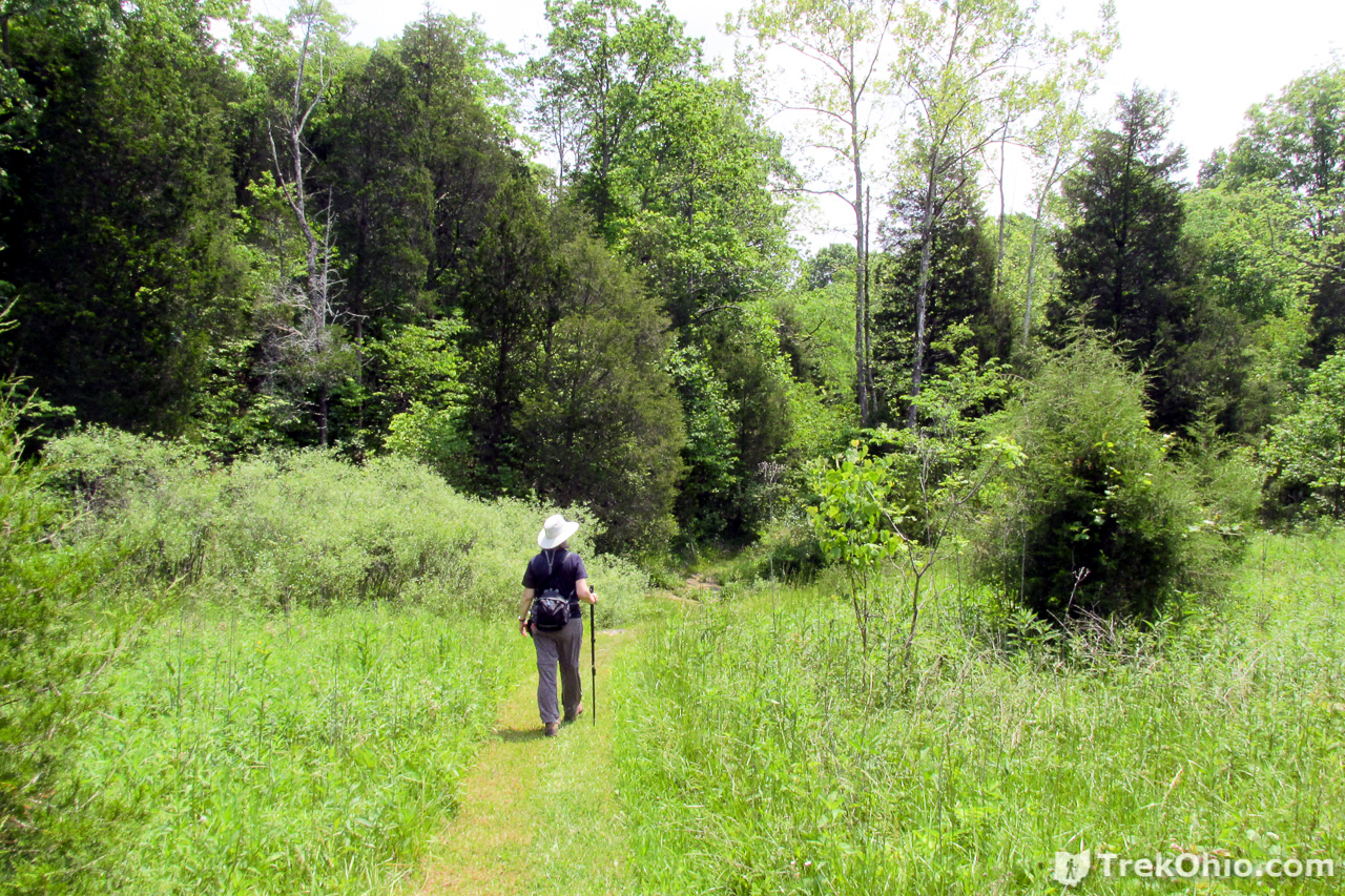
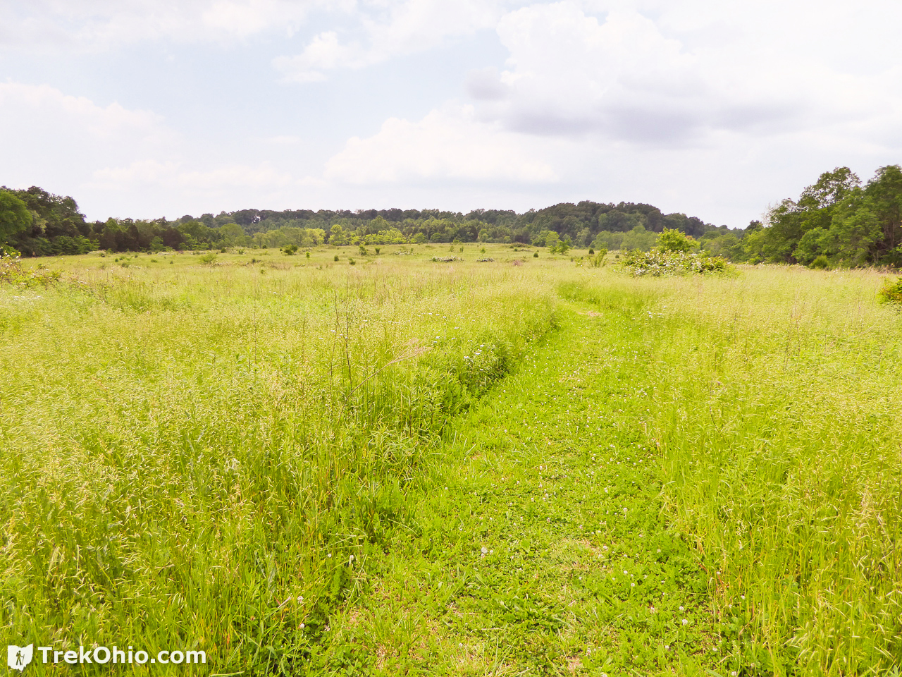
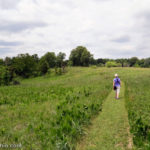
Golden Meadows Trail
We just hiked along this trail long enough get a view of the meadows. A lot of grassy areas in Adams County still retain some prairie species, so it would be interesting to return in July to see what is blooming.
Flowers and Plants
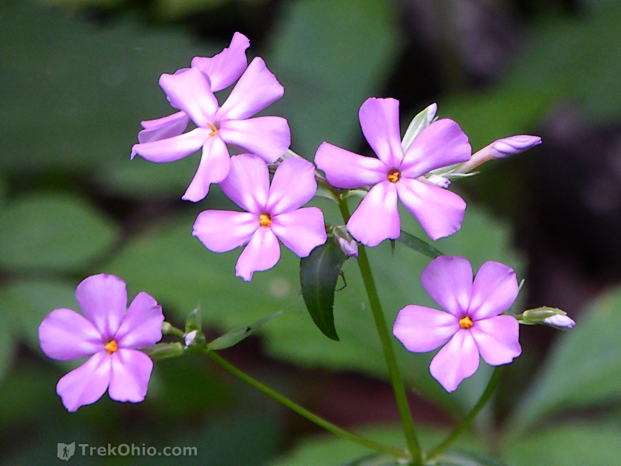
As I mentioned earlier, late May is past the peak blooming period for spring wildflowers, but we still saw quite a few flowers anyway. I will note that since this is a preserve, it is very important to not disturb any of the plants. In fact there was a note on the preserve’s kiosk saying that anyone caught digging up a plant would lose hiking access to any of the preserves that are managed by the Arc of Appalachia.
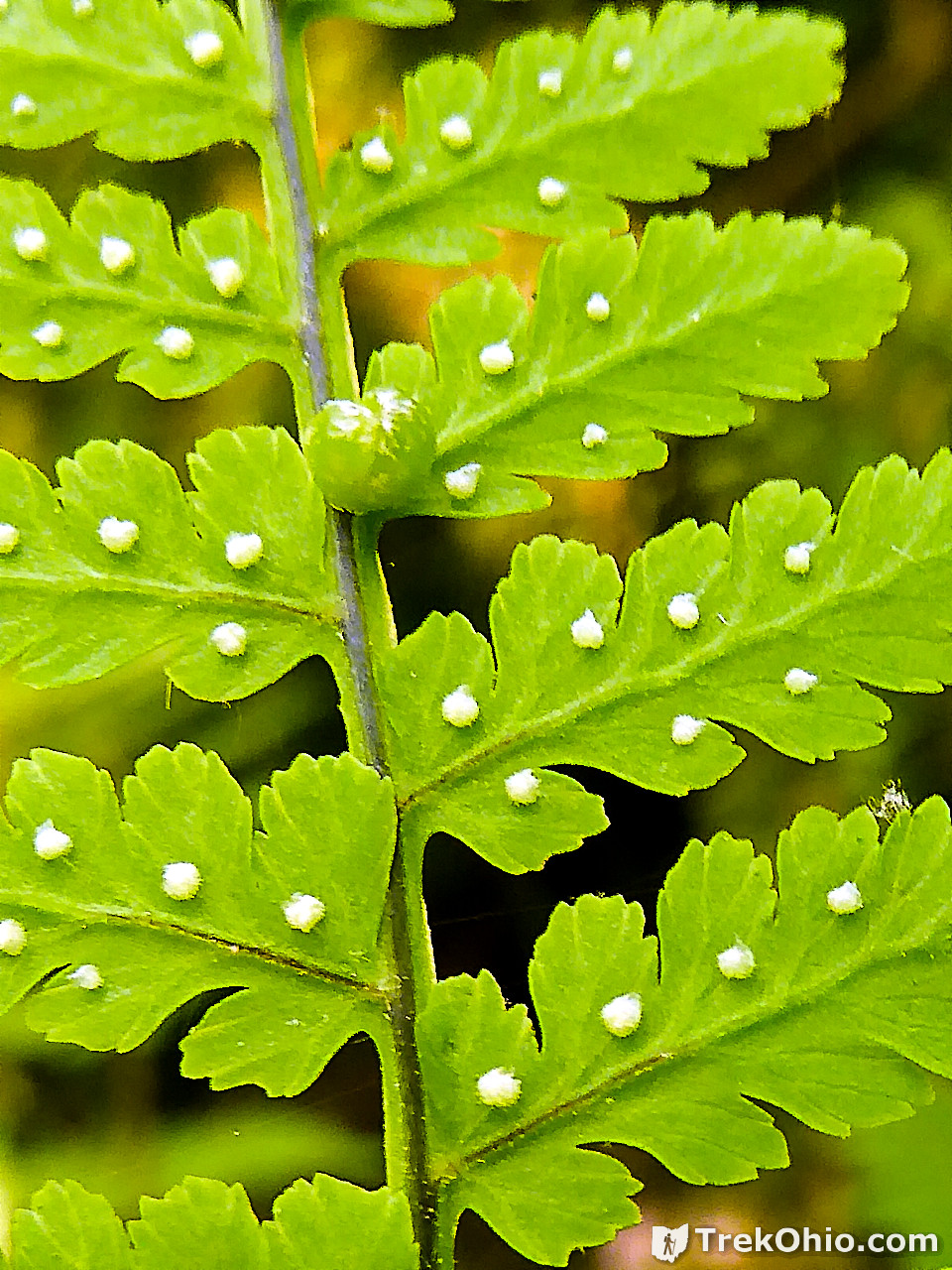
The Bulbet fern reproduces itself both sexually via propagating its spores (contained in the white, round structures pictured above), and by creating a mini-me (the green bulblet) that is an exact clone of the parent plant.

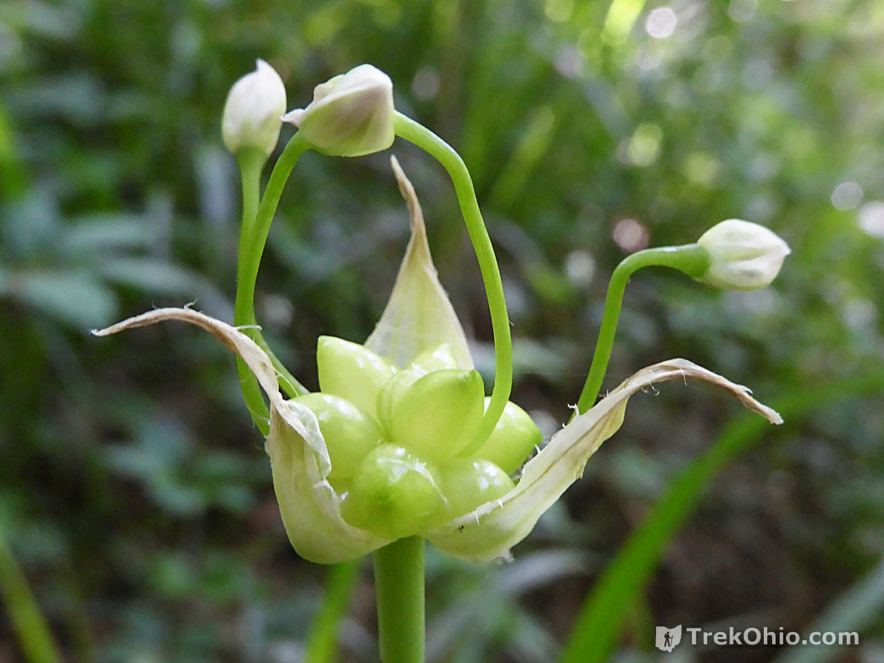
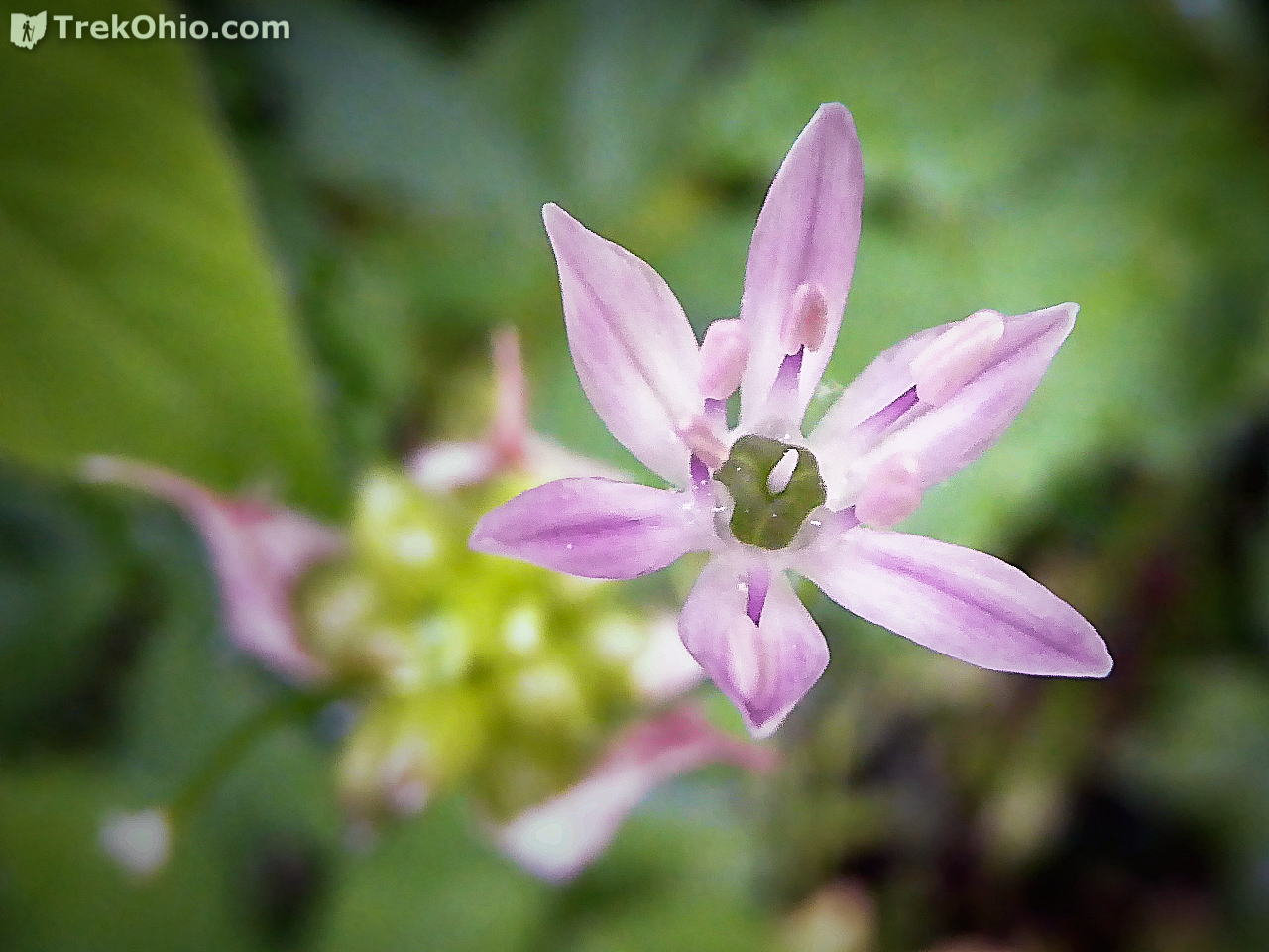
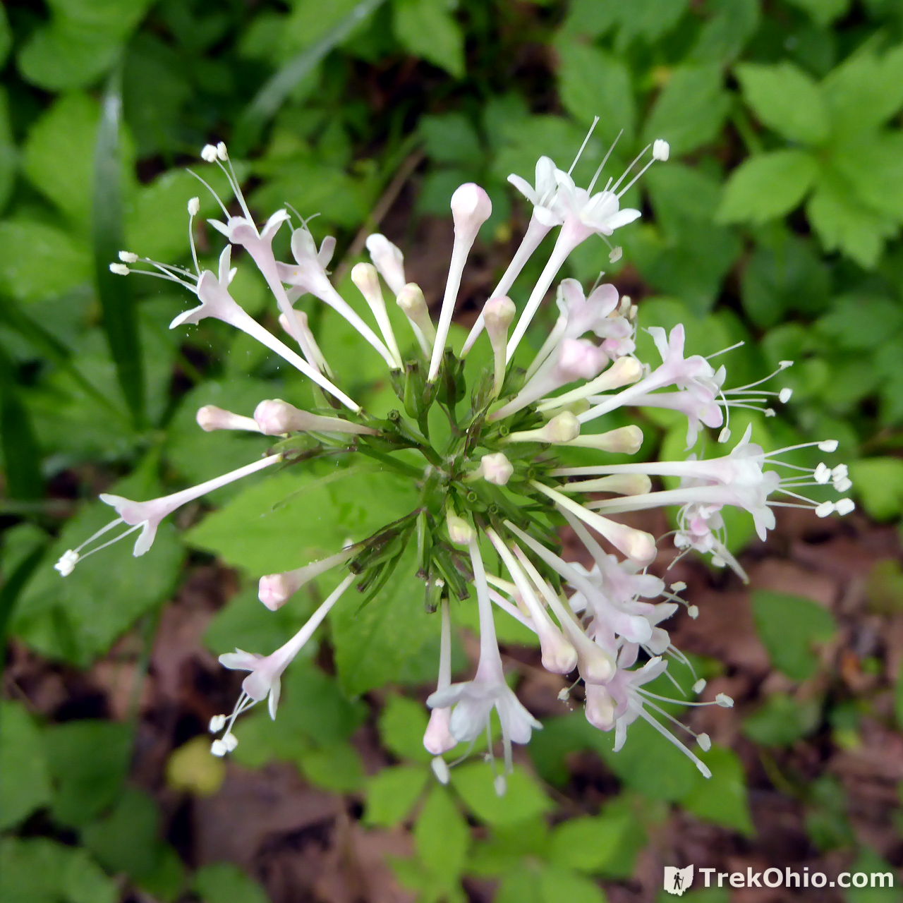
Above the wild garlic buds have emerged out of their papery container, and below you can see what it looks like when one of the buds blossom.

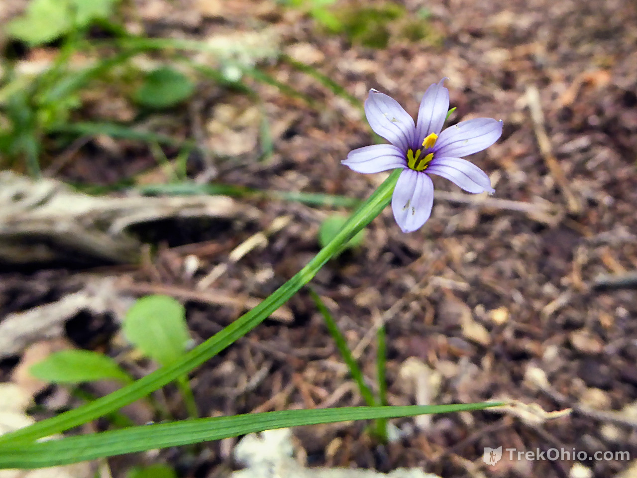
I usually just photograph the blossom of blue-eyed grass, but below I step back a ways so you can see that the flower really does look like it is emerging from the end of a blade of grass.

Additional information
- TrekOhio: Adams County Parks & Nature Preserves— This is the county where Chalet Nivale Preserve is located; check out this page for links to the official website and for information on nearby parks and preserves.
- Facebook Page: Chalet Nivale
- Wikipedia: Physocarpus — This was the blossoming Ninebark shrub that we frequently saw while hiking the Crawdad Creek Trail.
- Wikipedia: Staphylea trifolia — Bladdernut, a North American shrub whose seed pods were on display during our hike.
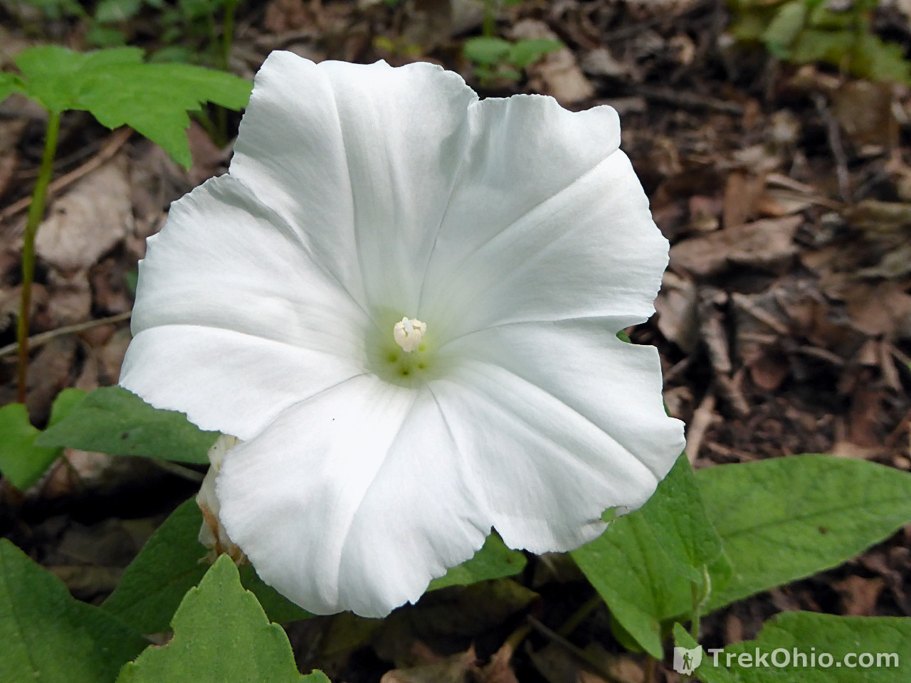
- Wikipedia: Calystegia sepium — Hedge bindweed
Location
- Address (Google Map’s guesstimate): Somewhere between 1300 and 1406 Bacon Flat Road, Peebles, Ohio 45660
- Directions: From OH-73, go south on Bacon Flat Road (also known as T-126D) for a little over a quarter mile. The entrance will be on your right.
- GPS Coordinates: 38.973372, -83.349011
- Google Maps: View on map or get directions
More Preserves Associated with the Arc of Appalachia

Was there last week. Awesome Place! Had a tour guide, a little Jack Russell that came over from the Red House, by the meadow.
Brett, glad you had a good time! I’m a little bit envious since I’d love to visit Chalet Nivale around this time of year. Your little tour guide sounded fun. 🙂