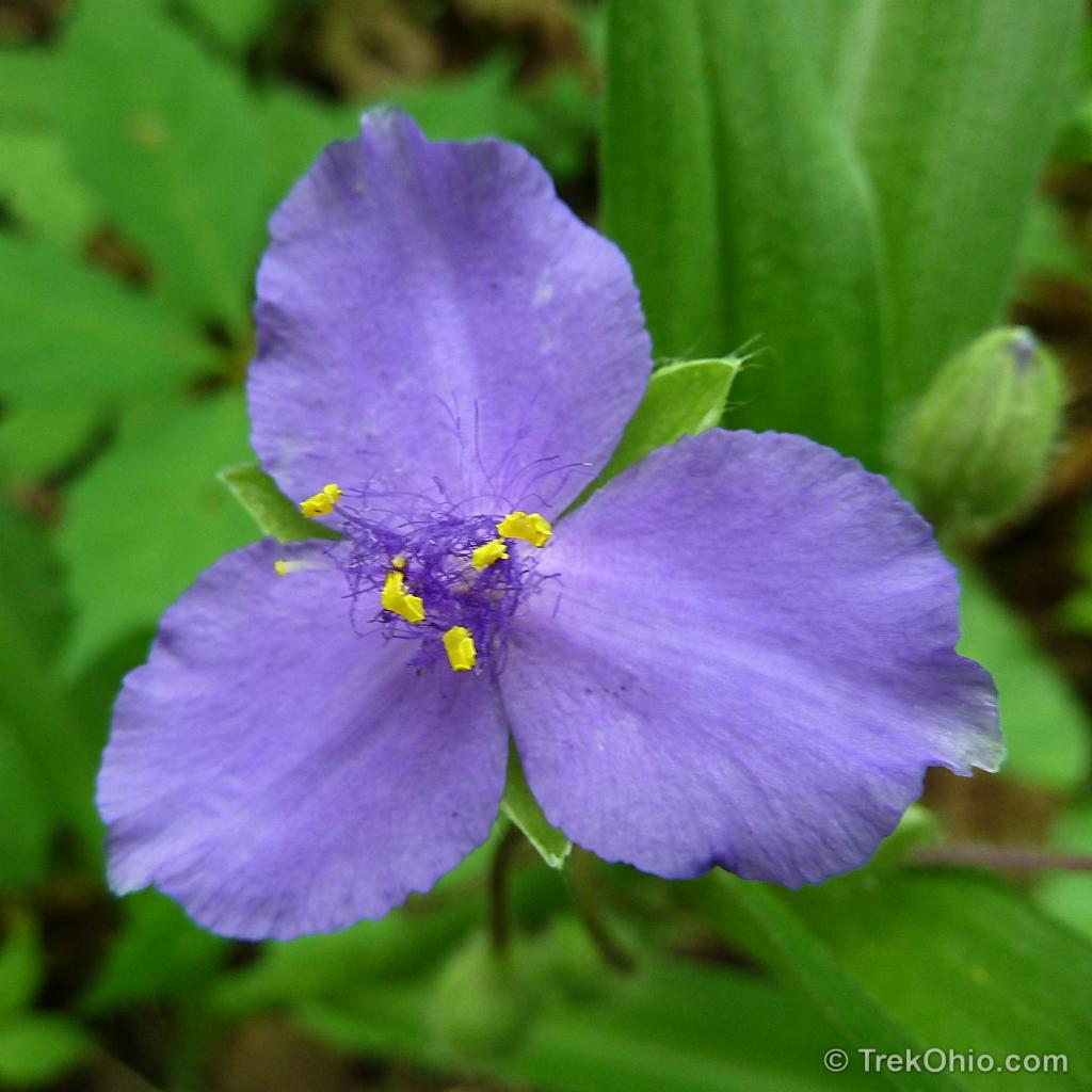
Since we were at Scioto Trail State Park mid-May, there were so many wildflowers along the trails that I thought they merited their own post. Here’s a look at some of the flowers that we saw, plus some of the living creatures that were near them.
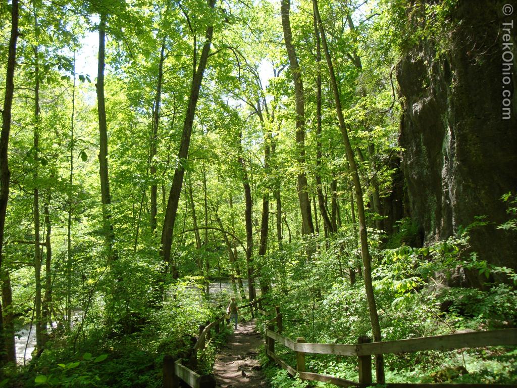
Years ago I went canoeing on the Little Miami River; the river serenely wound its way between the wooded river banks. But at Clifton Gorge, the Little Miami River is something altogether different; it plunges over falls and rapids between narrow cliffs of dolomite and shale. The river and surrounding cliffs are the main attractions of Clifton Gorge State Nature Preserve, a 268 acre preserve located adjacent to John Bryan State Park. The Little Miami River flows through both, with the nature preserve upstream where the river roils. You can enter the trail from John Bryon State Park on one end or from a parking lot in the town of Clifton on the other end. Or like us, you can choose an in-between point by using the parking lot off of SR 343 just before you enter the town of Clifton (see “Location” at the end of this article).
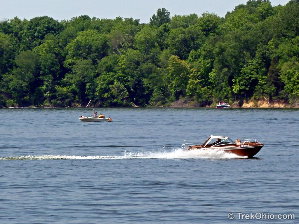
We only sampled a small part of the offerings at Caesar Creek State Park, but we liked what we saw! Caesar Creek caters to a diverse variety of interests. Whether you want to hike, camp, swim, fish, mountain bike, ride on a bridle trail, go boating, or even hunt fossils, Caesar Creek has it all.
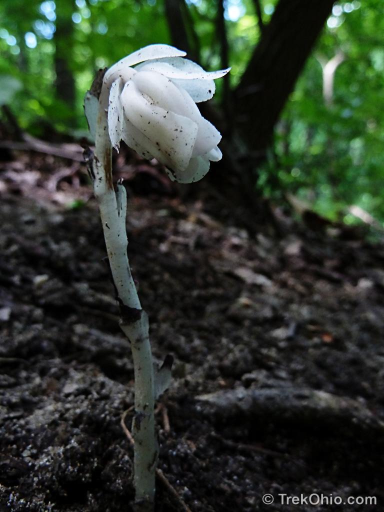
The white flower above is known by several names: Indian pipe, Ghost plant and Corpse plant. Like squawroot, Indian pipe can’t meet its own nutritional needs since it has no chlorophyll. It leads a parasitic life just as squawroot does.
The Emily Traphagen Preserve is part of Delaware County’s Preservation Park system. There are two short trails in the park:
White Tail Loop (0.6 miles), and
Meadow Trail (0.5 miles)
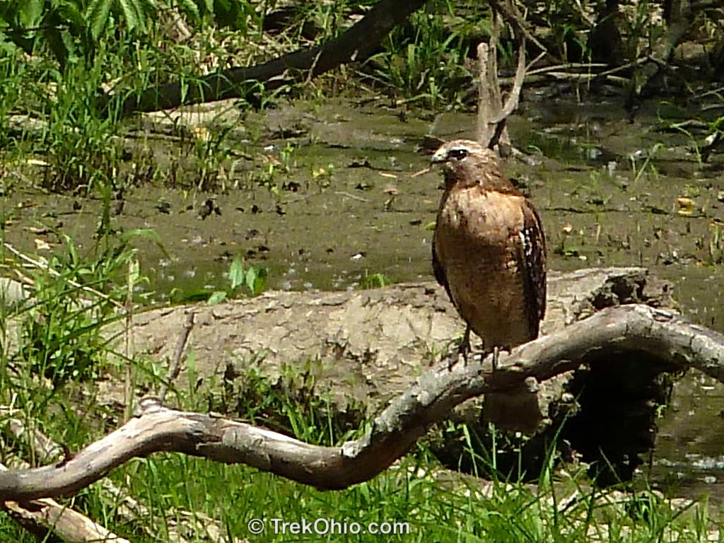
Both trails are loops. As you might expect, Meadow Trail is a mown path. However the White Tail Loop is an improved dirt trail that passes through the woods and by a marsh area. From White Tail Loop there is a side trail to what’s called the Pond Overlook. I spotted the red-shouldered hawk pictured below while visiting the overlook.
The Hocking Hills is one of the most scenic areas in the state of Ohio. It is also a hiker’s paradise with trails varying in difficulty from relatively easy ones (appropriate for young children) to more challenging trails that cover steep terrain or follow gorge rims.
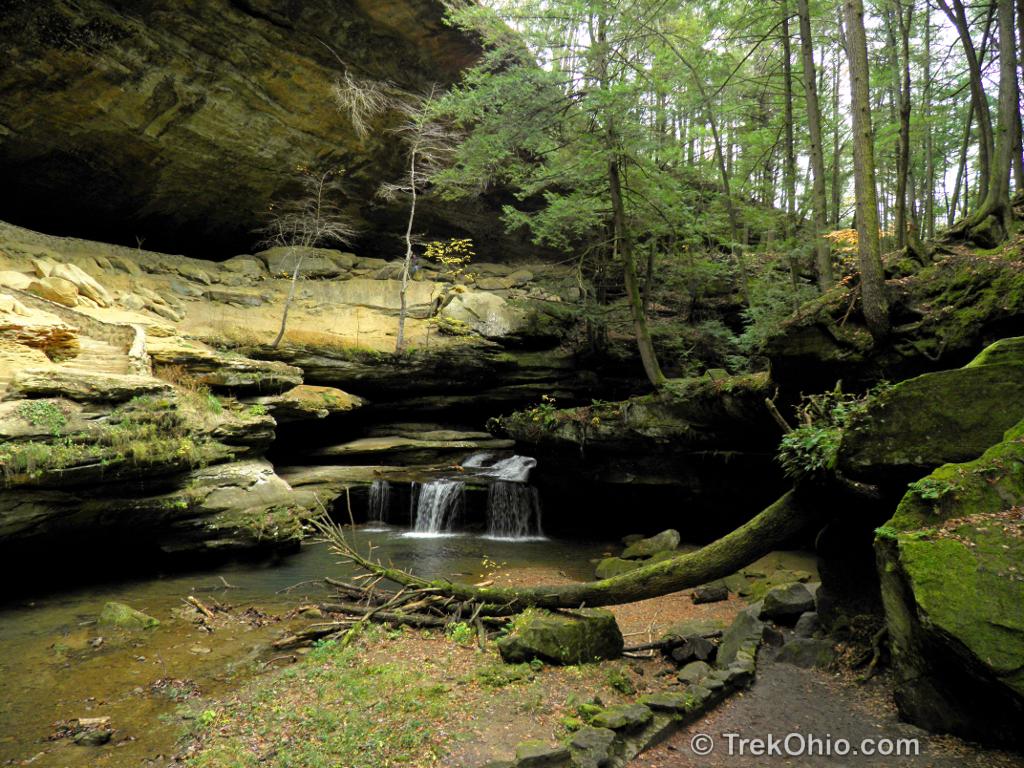
Caesar Creek Gorge State Nature Preserve is located in Oregonia, Ohio just west of Caesar Creek State Park and Caesar Creek Wilderness Area. The nature preserve is downstream from the dam located within the state park. We decided to hike the 2.25-mile trail at Caesar Creek Gorge State Nature Preserve because the preserve’s official site stated that the cliff walls making up the gorge rise some 180 feet (54.9 m) above Caesar Creek. The cliffs were formed when huge volumes of torrential, meltwater eroded the limestone bedrock at the end of the last ice age. Now a gently flowing creek traverses this scenic, forested gorge.
The TrekOhio Guide is designed to help you find interesting, natural sites in Ohio. We wanted to create a place online where you could learn about sites that were in the same geographical region regardless of whether the park, nature preserve or trail was managed by the federal government, the state government, a county government, or a non-governmental agency. In addition we wanted the information to be accessible via your cellphone or other mobile device, so it would be easy to adjust your trip plans, or find additional information while away from home. With that in mind, we made sure that the TrekOhio Guide has an easy-to-navigate, mobile-friendly layout. Our list currently includes over 900 parks and preserves in the state.
Boyer Nature Preserve is wonderful, mini-wetland that sits in the middle of suburban Westerville, Ohio. The site’s main feature is its stream-fed pond. Although it may look like an ordinary pond, it’s actually very special due to the way that it was formed. During the last ice age, Westerville was beneath approximately one thousand feet of ice (305 m). As the climate warmed, a large fracture formed near the edge of the melting glacier. Once that fracture became large enough, a huge slab of ice separated from the main body of the glacier and landed with a great thud in what is now known as Boyer Nature Preserve. When huge chunks of ice break off a glacier like this, it’s called calving.
It turns out that the immense glacier over Ohio had eroded great quantities of land as it moved south from Canada, and this eroded material became frozen inside the glacier while it was still growing in size. However as the glacier melted and shrank, it released the sand and gravel that it had carried with it. Together this sand and gravel is called glacial sediment. So much glacial sediment was deposited in what’s now Westerville that it buried the calved-off chunk of ice under a thick layer of sediment, and this sediment kind of insulated the calved ice. When that calved chunk of ice eventually melted, the layer of glacial sediments that used to be on top of the ice sank lower and lower as the ice melted. This created a low area that filled with water from the melting ice. A body of water that’s formed in this way is called a glacial kettle.
 Weird…