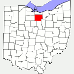
The following list of parks and preserves includes those managed by federal, state, county, and non-governmental agencies (such as the National Audubon Society, the Nature Conservancy, various historical societies, etc.).
We have tried to collect information on the activities and facilities available at various parks, but things may change without us knowing about it. So please double-check the information at the official site.
- Augusta-Anne Olsen (State Nature Preserve)
-
- Official Site
- Posts at TrekOhio
- Location:
- 4934 West River Road, Wakeman, Ohio 44889
- GPS coordinates: 41.272754, -82.408352
- View on Google Maps
- 132 acres in all
- Unspecified mileage of nature trail
- Supported activities:
- Good site for bird watching
- Miscellaneous info: Numerous varieties of spring wildflowers can be seen on the half-mile Spring Trail and on the River Loop Trail. The official website says that American Chestnut trees are also located here. The Sassafras Trail features one of the largest sassafras trees in the state as well as spectacular views of the Vermilion River.
- Reservoir (Monroeville City Park)
-
- Location:
- View on Google Maps
- Supported activities:
- Fishing
- Miscellaneous info: Walking track
- Location:
- Seneca Caverns (Private Cavern)
-
- Official Site
- Location:
- 15248 E. Township Road 178, Bellevue, Ohio 44811
- GPS coordinates: 41.226296, -82.874404
- View on Google Maps
- Facilities:
- Restroom facilities
- Veterans Memorial Lake Park (Norwalk City Park)
-
- Official Site
- Location:
- 205 S. Old State Rd, Norwalk, Ohio 44857
- GPS coordinates: 41.2334212, -82.5903982
- View on Google Maps
- Unspecified mileage of walking trail
- Supported activities:
- Fishing
- Facilities:
- Restroom facilities
- Disc golf course
- Willard Marsh (State Wildlife Area)
-
- Official Site
- Wildlife Area Map
- Official GPS Coordinates:
- GPS coordinates: 41.0096236, -82.7670574
- View on Google Maps
- Parking off Base Line Rd.:
- GPS coordinates: 40.9965402, -82.7748714
- View on Google Maps
- 1,676 acre in all
- Supported activities:
- Hunting
- Willard Reservoir Park (Willard City Park)
-
- Map for Fishing
- ODNR
- Parking & Boat Ramp:
- Located near or in New Haven Township, Ohio 44890
- GPS coordinates: 41.0573611, -82.6695163
- View on Google Maps
- 200 acres of water
- 2.4 miles of crushed limestone path around the reservoir
- Supported activities:
- Fishing
- Hunting
- Cross-country skiing
- Sledding
- Low-horsepower boating (depending on the park, this may mean boats with electric motors, boats whose motors do not exceed a specific horsepower, or boats with any horsepower motor as long as no wake is generated; check the official site for details)
- Facilities:
- Restroom facilities
Last Update: Sep 24, 2018
© Deborah Platt, Robert Platt and TrekOhio.com 2012 to 2021