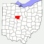
The following list of parks and preserves includes those managed by federal, state, county, and non-governmental agencies (such as the National Audubon Society, the Nature Conservancy, various historical societies, etc.).
We have tried to collect information on the activities and facilities available at various parks, but things may change without us knowing about it. So please double-check the information at the official site.
- Big Island Wildlife Area (State Wildlife Area)
-
- Official Site
- Wildlife Area Map
- Location:
- GPS coordinates: 40.570692, -83.266136
- View on Google Maps
- Area:
- 5,872 acres in all
- 1,200 acre marsh and wetland
- Supported activities:
- Fishing
- Hunting
- Facilities:
- Observation deck
- Greenspur (County Park)
-
- Official Site
- Location:
- GPS coordinates: 40.489245, -83.190207
- View on Google Maps
- 7 acres in all
- Miscellaneous info: The park is occasionally used by local Boy Scout Troup for campouts.
- Killdeer Plains (State Wildlife Area)
-
- Official Site
- Wildlife Area Map
- Electric Powered All Purpose Vehicle Use Permit
- Location:
- GPS coordinates: 40.7216272, -83.301621
- View on Google Maps
- 9,230 acres in all
- Supported activities:
- Fishing
- Hunting
- Good site for bird watching
- Low-horsepower boating (depending on the park, this may mean boats with electric motors, boats whose motors do not exceed a specific horsepower, or boats with any horsepower motor as long as no wake is generated; check the official site for details)
- Facilities:
- Restroom facilities
- Miscellaneous info: Sportsman Service Center
- Marion Tallgrass Park (Bike Path)
-
- Official Site
- Trail Map
- Location:
- 2093 Holland Rd W, Marion, Ohio 43302
- GPS coordinates: 40.592855, -83.185365
- View on Google Maps
- 12.44 miles of paved, multi-use trail
- Supported activities:
- Bringing your dog
- Prohibited activities:
- Horseback riding not permitted
- Facilities:
- Nature center
- Observation deck
- Myers Woods (County Park)
-
- Official Site
- Location:
- GPS coordinates: 40.702016, -83.234616
- View on Google Maps
- 5 acres in all
- Terradise Nature Preserve (County Park)
-
- Official Site
- Brochure
- Location:
- 1536 Whetstone River Rd N, Caledonia, Ohio 43314
- GPS coordinates: 40.6172171, -82.9776587
- View on Google Maps
- 18 acres in all
- Unspecified mileage of nature trails
- Supported activities:
- Good site for bird watching
- Paddling
Last Update: Jun 20, 2018
© Deborah Platt, Robert Platt and TrekOhio.com 2012 to 2021
Do you have any suggestions for off-road (dirt path) bicycling? I live near Caledonia.
Thank you for your help.
I’m not a mountain biker, but judging by the number of bikers passing us on the trails at Sells Park / Stroud’s Run State Park, the trails around Athens are quite popular. Somewhat closer, Alum Creek State Park has a network of mountain bike trails.
Terradise Nature Preserve is actually located at SR 746/Marion Willimasport Road (not SR 749 as it is appears) on the Marion County Nature Parks & Preserves main page.
Thought you would like to know. Nice site, by the way!
Thanks,
Steve
Steve, thanks for correction on the location, and for your kinds words about the site.