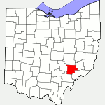
The following list of parks and preserves includes those managed by federal, state, county, and non-governmental agencies (such as the National Audubon Society, the Nature Conservancy, various historical societies, etc.).
We have tried to collect information on the activities and facilities available at various parks, but things may change without us knowing about it. So please double-check the information at the official site.
- Burr Oak (State Park)
-
- Official Site
- Trail Map
- Campground Map
- Park Map
- Lodge
- Posts at TrekOhio
- Lodge:
- 10220 Burr Oak Lodge Road, Glouster, Ohio 45732
- GPS coordinates: 39.5308132, -82.0372993
- View on Google Maps
- Area:
- 2,593 acres in all
- 664 acres lake
- Trail information:
- 10.6 miles of hiking trails
- 7 miles of bridle trails (also open to backpackers)
- 11.4 miles of bridle trail
- Supported activities:
- Fishing
- Hunting
- Camping
- Sledding
- Horseback riding
- Bringing your dog
- Low-horsepower boating (depending on the park, this may mean boats with electric motors, boats whose motors do not exceed a specific horsepower, or boats with any horsepower motor as long as no wake is generated; check the official site for details)
- Facilities:
- Restroom facilities
- Disc golf course
- Swimming beach
- Part of the Buckeye Trail passes through the area
- Luke Chute Conservation Area (Friends of the Lower Muskingum River (NGO))
-
- Official Site
- Location:
- On OH-266, 5 miles south of OH-266 & OH-60, Windsor Township, Ohio 43787
- GPS coordinates: 39.5399876, -81.7291539
- View on Google Maps
- 60 acres in all
- 2 miles of total trail
- Miscellaneous info: The Conservation Area features a Pollinator Habitat which includes many beautiful, native wild flowers. There are also forests and a clear water creek. A blight-resistant hybrid of American chestnut and Chinese chestnut trees has been planted at the site.
- ReCreation Land (AEP Public Recreation Area (NGO))
-
- Official Site
- Posts at TrekOhio
- List of campsite addresses
- Links to all their maps
- 60,000 acres in all
- About 14 miles of mountain biking trail, bridle trail, and Buckeye Trail
- Supported activities:
- Fishing
- Hunting
- Camping
- Mountain biking
- Good site for bird watching
- Horseback riding
- Bringing your dog
- Facilities:
- Restroom facilities
- Part of the Buckeye Trail passes through the area
- Permit only
- Miscellaneous info: Dog training area, picnic area, multiple camp sites, lakes, stocked fishing lakes
- Wayne NF – Athens Unit (National Forest)
-
- Official Site
- Trail Map
- Posts at TrekOhio
- Other external links of interest:
- North Country Trail
- Wayne NF – Camping Brochure
- Wayne NF Trail Map
- Burr Oak Cove Campground
- Monday Creek ATV/OHM Trail (ATV/Motorcycle/Mtn Bike/Hike)
- Monroe Outlook
- Ora Anderson Nature Trail
- Stone Church Horse Camp & Trail
- Wildcat Hollow (Camping, Hiking)
- Wayne NF Athens Unit – Hiking & Backpacking Brochure
- Monroe Outlook:
- 7946 Irish Ridge Road SE, Glouster, Ohio 45732 (estimated using Google Maps)
- GPS coordinates: 39.590626, -82.054943
- View on Google Maps
- Wildcat Hollow Hiking Trail:
- Co Rd 58, Glouster, Ohio 45732
- GPS coordinates: 39.5740114, -82.0663771
- View on Google Maps
- 67,224 acres in all
- Trail information:
- 84.5 miles of ATV / hiking / mountain biking trail in Monday Creek area
- 15 miles of loop trail for backpacking in Wildcat Hollow
- 5 miles of loop trail for day hikes in Wildcat Hollow
- 0.5 miles for the Ora E. Anderson Nature Trail (ADA accessible)
- 21 miles of bridle / hiking trails in the Stone Church Horseback Riding System
- 51 miles for the North Country Trail
- 1 miles for the Lake View Trail
- Supported activities:
- Fishing
- Hunting
- Camping
- Mountain biking
- Horseback riding
- Bringing your dog
- Facilities:
- Restroom facilities
- Wildcat Hollow Primitive Weapons Hunting Area (State Wildlife Area)
-
- Official Site
- Wildlife Area Map
- Location #1:
- Located near or in Ringgold, Ohio 43758
- Location #2:
- Located near or in Glouster, Ohio 45732
- Location #3:
- Located near or in Corning, Ohio 43730
- Supported activities:
- Hunting
- Miscellaneous info: The Ohio Dept. of Natural Resources strongly recommends purchasing a topographical map if you plan on hunting in this area.
- Wolf Creek Wildlife Area (State Wildlife Area)
-
- Official Site
- Wildlife Area Map
- Location:
- Located near or in Malta, Ohio 43758
- GPS coordinates: 39.572697, -81.949475
- View on Google Maps
- 3,911 acres in all
- Supported activities:
- Fishing
- Hunting
- Facilities:
- Archery range
- Miscellaneous info: Muskrat and mink trapping
Last Update: Jul 7, 2018
© Deborah Platt, Robert Platt and TrekOhio.com 2012 to 2021