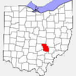
The following list of parks and preserves includes those managed by federal, state, county, and non-governmental agencies (such as the National Audubon Society, the Nature Conservancy, various historical societies, etc.).
We have tried to collect information on the activities and facilities available at various parks, but things may change without us knowing about it. So please double-check the information at the official site.
- Avondale Wildlife Area (AEP Public Recreation Area (NGO))
-
- 2015 News Report about part of the land being auctioned
- No longer included in AEP’s list of recreaton areas
- Location:
- Located near or in Roseville, Ohio 43777
- GPS coordinates: 39.808165, -82.1229882
- View on Google Maps
- 4,919 acres in all
- Supported activities:
- Fishing
- Hunting
- Bringing your dog
- Facilities:
- Permit only
- Miscellaneous info: It is no longer clear whether this property continues to be a wildlife area. AEP’s official site no longer lists it, and there was at least one news report about part of the land being auctioned off. | Features 122 lakes
- Buckeye Lake (State Park)
-
- Official Site
- Hunting Map
- Park Map
- Location:
- 2905 Liebs Island Road, Millersport, Ohio 43046
- GPS coordinates: 39.9047361, -82.5307596
- View on Google Maps
- 3,100 acres lake
- Supported activities:
- Fishing
- Hunting
- Cross-country skiing
- Bringing your dog
- Paddling
- Boating with high horsepower motors
- Ice skating
- Facilities:
- Restroom facilities
- Miscellaneous info: While construction is underway at the dam, the park’s beaches are closed.
- Perry (State Forest)
-
- Official Site
- APV Trail Map
- Brochure
- 4,567 acres in all
- Trail information:
- 24 miles of hiking trail
- 8 miles of bridle trail
- 16 miles of ATV trails
- Supported activities:
- Fishing
- Hunting
- Mountain biking
- Horseback riding
- Facilities:
- Restroom facilities
- Miscellaneous info: APV riding area
- Wayne NF – Athens Unit (National Forest)
-
- Official Site
- Trail Map
- Posts at TrekOhio
- Other external links of interest:
- North Country Trail
- Wayne NF – Camping Brochure
- Wayne NF Trail Map
- Burr Oak Cove Campground
- Monday Creek ATV/OHM Trail (ATV/Motorcycle/Mtn Bike/Hike)
- Monroe Outlook
- Ora Anderson Nature Trail
- Stone Church Horse Camp & Trail
- Wildcat Hollow (Camping, Hiking)
- Wayne NF Athens Unit – Hiking & Backpacking Brochure
- Monroe Outlook:
- 7946 Irish Ridge Road SE, Glouster, Ohio 45732 (estimated using Google Maps)
- GPS coordinates: 39.590626, -82.054943
- View on Google Maps
- Wildcat Hollow Hiking Trail:
- Co Rd 58, Glouster, Ohio 45732
- GPS coordinates: 39.5740114, -82.0663771
- View on Google Maps
- 67,224 acres in all
- Trail information:
- 84.5 miles of ATV / hiking / mountain biking trail in Monday Creek area
- 15 miles of loop trail for backpacking in Wildcat Hollow
- 5 miles of loop trail for day hikes in Wildcat Hollow
- 0.5 miles for the Ora E. Anderson Nature Trail (ADA accessible)
- 21 miles of bridle / hiking trails in the Stone Church Horseback Riding System
- 51 miles for the North Country Trail
- 1 miles for the Lake View Trail
- Supported activities:
- Fishing
- Hunting
- Camping
- Mountain biking
- Horseback riding
- Bringing your dog
- Facilities:
- Restroom facilities
Last Update: Jul 10, 2018
© Deborah Platt, Robert Platt and TrekOhio.com 2012 to 2021