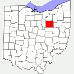
The following list of parks and preserves includes those managed by federal, state, county, and non-governmental agencies (such as the National Audubon Society, the Nature Conservancy, various historical societies, etc.).
We have tried to collect information on the activities and facilities available at various parks, but things may change without us knowing about it. So please double-check the information at the official site.
- Barnes Preserve (County Park)
-
- Official Site
- Location:
- 3396 Sylvan Rd., Wooster, Ohio 44691
- GPS coordinates: 40.778085, -81.89725
- View on Google Maps
- 76 acres in all
- 0.9 miles of paved, ADA accessible trail
- Supported activities:
- Bringing your dog
- Prohibited activities:
- Hunting not permitted
- Horseback riding not permitted
- Facilities:
- Handicap accessible
- Observation deck
- Brown’s Lake Bog Preserve (Nature Conservancy)
-
- Official Site
- State Nature Preserve
- Location:
- Brown Rd., Shreve, Ohio 44676
- GPS coordinates: 40.6829768, -82.0686636
- View on Google Maps
- 80 acres in all
- 0.87 miles of boardwalk and earthen trail
- Supported activities:
- Good site for bird watching
- Prohibited activities:
- Dogs not permitted
- Facilities:
- Boardwalk
- Miscellaneous info: Glacially-shaped terrain, including a kettle-hole lake and kames (glacially-formed hills). | The preserve is owned and managed by the Nature Conservancy, but it is also a designated state nature preserve. The website of the Ohio Dept. of Natural Resources states that the preserve is 99 acres, while the Nature Conservancy’s website says that it is 80 acres.
- Freedlander Park (City Park)
-
- Official Site
- Park Map
- Observatories of Ohio
- Fishing regulations
- Location:
- 400 Hillside Dr., Wooster, Ohio 44691
- GPS coordinates: 40.8382694, -81.9391963
- View on Google Maps
- 29 acres in all
- Supported activities:
- Fishing
- Facilities:
- Restroom facilities
- Disc golf course
- Observatory
- Miscellaneous info: swimming pools
- Funk Bottoms (State Wildlife Area)
-
- Official Site
- Wildlife Area Map
- Location:
- Located near or in Jeromesville, Ohio 44840
- GPS coordinates: 40.757558, -82.131500
- View on Google Maps
- 1,498 acre in all
- Supported activities:
- Hunting
- Good site for bird watching
- Facilities:
- Observation deck
- Johnson Woods (State Nature Preserve)
-
- Official Site
- Posts at TrekOhio
- Location:
- 13240 Fox Lake Rd., Marshallville, Ohio 44645
- GPS coordinates: 40.88875, -81.744283
- View on Google Maps
- 206 acres in all
- 1 miles of total trail
- Miscellaneous info: Old growth forest
- Killbuck Marsh (State Wildlife Area)
-
- Official Site
- Wildlife Area Map
- Posts at TrekOhio
- Local Wildlife Management HQ:
- 1691 Centerville Rd., Shreve, Ohio 44676
- GPS coordinates: 40.683339, -81.964324
- View on Google Maps
- 5,671 acres in all
- 4 miles of walking-only trail for wildlife observation
- Supported activities:
- Fishing
- Hunting
- Good site for bird watching
- Secrest Arboretum (Botanical Garden)
-
- Official Site
- Park Map
- Location:
- 1680 Madison Ave., Wooster, Ohio 44691
- GPS coordinates: 40.7829842, -81.919392
- View on Google Maps
- 115 acres in all
- Supported activities:
- Bringing your dog
- Facilities:
- Restroom facilities
- Miscellaneous info: Located on campus of OSU Ohio Agricultural Research and Development Center
- Shreve Lake (State Wildlife Area)
-
- Official Site
- Map for Fishing
- Enhanced Map for Fishing
- Posts at TrekOhio
- Location:
- Critchfield Rd. & Brown Rd., Shreve, Ohio 44676
- GPS coordinates: 40.683339, -82.047622
- View on Google Maps
- Area:
- 228 acres in all
- 58 acres lake
- Supported activities:
- Fishing
- Hunting
- Wooster Memorial Park (Spangler Park) (City Park)
-
- Official Site
- Trail Map
- Friends of the Park
- Calendar of Events
- Location:
- 5197 Silver Rd., Wooster, Ohio 44691
- GPS coordinates: 40.812611, -82.0315787
- View on Google Maps
- About 320 acres in all
- 9.3 miles of earthen, foot trails
- Supported activities:
- Bringing your dog
- Prohibited activities:
- Mountain biking not permitted
- Horseback riding not permitted
- Facilities:
- Restroom facilities
- Miscellaneous info: Hiking on primitive of trails through pristine woodlands; the park has park pavilions, scenic overlooks, fall color and spring wildflowers. Friends of the park offer organized, group hikes (see link for Calendar of Events).
Last Update: Jul 11, 2018
© Deborah Platt, Robert Platt and TrekOhio.com 2012 to 2021