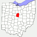
The following list of parks and preserves includes those managed by federal, state, county, and non-governmental agencies (such as the National Audubon Society, the Nature Conservancy, various historical societies, etc.).
We have tried to collect information on the activities and facilities available at various parks, but things may change without us knowing about it. So please double-check the information at the official site.
- Cedar Fork Park (County Park)
-
- Official Site
- Location:
- 7702 County Highway 29, Bellville, Ohio 44813
- GPS coordinates: 40.629056, -82.645056
- View on Google Maps
- 22 acres in all
- Unspecified mileage of trails described as being short
- Supported activities:
- Fishing
- Prohibited activities:
- Camping not permitted
- Miscellaneous info: The trails lead to overlooks of Cedar Fork Creek. Most of the park is not readily accessible because the creek acts as a barrier.
- Fishburn Reserve (County Park)
-
- Official Site
- Location:
- 3800 Jackson Rd., Mt Gilead, Ohio 43338
- GPS coordinates: 40.487167, -82.719
- View on Google Maps
- 25 acres in all
- Facilities:
- Permit only
- Miscellaneous info: Currently access facilities are not available.
- Gleason Family Nature Reserve (County Park)
-
- Official Site
- Location:
- 3092 Ohio 314, Fredericktown, Ohio 43019
- GPS coordinates: 40.461033, -82.695772
- View on Google Maps
- Unspecified mileage of mowed grass trail
- Mt. Gilead (State Park)
-
- Official Site
- Trail Map
- Campground Map
- Park Map
- Posts at TrekOhio
- Location:
- 4119 State Route 95, Mt. Gilead, Ohio 43338
- GPS coordinates: 40.5485054, -82.8209415
- View on Google Maps
- Area:
- 181 acres in all
- 32 acres lake
- 6.7 miles of bridle / hiking trails
- Supported activities:
- Fishing
- Camping
- Cross-country skiing
- Horseback riding
- Bringing your dog
- Paddling
- Low-horsepower boating (depending on the park, this may mean boats with electric motors, boats whose motors do not exceed a specific horsepower, or boats with any horsepower motor as long as no wake is generated; check the official site for details)
- Facilities:
- Disc golf course
- Miscellaneous info: Extensive re-working of the dam was just completed. The lake has been re-stocked with game fish. Additional work to be completed includes a new pedestrian bridge across the upper dam, and replacement of un-sound boards in steps and boardwalks, as well as re-routing some of the trails to avoid wet areas.
- Sautter Memorial Park (County Park)
-
- Official Site
- Location:
- 8972 County Road 46, Galion, Ohio 44833
- GPS coordinates: 40.677726, -82.7501327
- View on Google Maps
- 80 acres in all
- Unspecified mileage of gravel trails
- Supported activities:
- Good site for bird watching
- Sheedy Sanctuary (County Park)
-
- Official Site
- Location:
- 148 County Road 204, Centerburg, Ohio 43011
- GPS coordinates: 40.3546891, -82.7276267
- View on Google Maps
- About 40 acres in all
- Trail information:
- 1.4 miles for the long loop trail
- 0.7 miles for the short loop trail
- Facilities:
- Observation deck
Last Update: Jun 20, 2018
© Deborah Platt, Robert Platt and TrekOhio.com 2012 to 2021