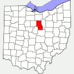
The following list of parks and preserves includes those managed by federal, state, county, and non-governmental agencies (such as the National Audubon Society, the Nature Conservancy, various historical societies, etc.).
We have tried to collect information on the activities and facilities available at various parks, but things may change without us knowing about it. So please double-check the information at the official site.
- Fowler Woods (State Nature Preserve)
-
- Official Site
- Posts at TrekOhio
- Location:
- 7815 Olivesburg-Fitchville Road, Greenwich, Ohio 44837
- GPS coordinates: 40.97355, -82.4699
- View on Google Maps
- 187 acres in all
- 1.25 miles of total trail
- Supported activities:
- Good site for bird watching
- Prohibited activities:
- Dogs not permitted
- Facilities:
- Handicap accessible
- Boardwalk
- Miscellaneous info: One of the few remnants of Ohio’s old growth (primeval) forests. | Spectacular display of spring flowers. | Handicap accessible boardwalk trail. | As of 2014, a large section of the Beechdrop trail was closed to visitors. This was because emerald ash borer has infested many of the ash trees; the dying ash trees are dropping limbs and are a hazard to visitors.
- Gorman Nature Center (County Park)
-
- Official Site
- Trail Map
- Location:
- 2295 Lexington Ave., Mansfield, Ohio 44907
- GPS coordinates: 40.699975, -82.5585577
- View on Google Maps
- 150 acres in all
- More than 3 miles of hiking trail
- Kingwood Center (Botanical Garden)
-
- Official Site
- Blog
- Garden Map
- Location:
- 50 Trimble Rd., Mansfield, Ohio 44906
- GPS coordinates: 40.7610741, -82.5498928
- View on Google Maps
- 47 acres in all
- Prohibited activities:
- Dogs not permitted
- Facilities:
- Restroom facilities
- Malabar Farm (State Park)
-
- Official Site
- Alternative Official Site
- Campground Map
- Park Map
- Trail descriptions
- Restaurant
- Calendar of Events
- Posts at TrekOhio
- Location:
- 4050 Bromfield Road, Lucas, Ohio 44843
- GPS coordinates: 40.6522967, -82.4013005
- View on Google Maps
- 1,000 acre in all
- Trail information:
- 2.53 miles of hiking trails
- 5.27 miles of hiking / bridle trail
- Supported activities:
- Fishing
- Camping
- Cross-country skiing
- Sledding
- Good site for bird watching
- Horseback riding
- Bringing your dog
- Ice skating
- Facilities:
- Restroom facilities
- Handicap accessible
- Historic farm
- Miscellaneous info: Farm market; youth hostel
- Mohican SP (State Park)
-
- Official Site
- Trail Map
- Campground Map
- Cottage Area Map
- Park Map
- Lodge
- Posts at TrekOhio
- Wolf Creek Grist Mill
- Lodge:
- 3116 State Route 3, Loudonville, Ohio 44842
- GPS coordinates: 40.60966, -82.2598947
- View on Google Maps
- Covered Bridge:
- Park Rd., Perrysville, Ohio 44864
- GPS coordinates: 40.613337, -82.316760
- View on Google Maps
- Pleasant Hill Dam:
- Located near or in Perrysville, Ohio 44864
- GPS coordinates: 40.623094, -82.324272
- View on Google Maps
- 1,110 acre in all
- Trail information:
- 7.75 miles of hiking trail
- 24.5 miles of mountain biking trail (also open to hikers)
- 3 miles of bridle / snowmobile trail
- Supported activities:
- Fishing
- Camping
- Mountain biking
- Good site for bird watching
- Horseback riding
- Bringing your dog
- Paddling
- Boating with high horsepower motors
- Snowmobiling
- Facilities:
- Restroom facilities
- Handicap accessible
- Miscellaneous info: The mountain bike trail was voted the #1 mountain bike trail in Ohio by Mountain Bike Action Magazine, and a “must ride” according to National Geographic Explorer Magazine. Because it is also open to hikers, it was once named “Trail of the Month” by Runners World Magazine. There is also a snowmobile trail and a working grist mill with museum.
- Richland B&O Trail (Bike Path)
-
- Official Site
- Trail Map
- Bellville trailhead:
- Located near or in Bellville, Ohio 44813
- View on Google Maps
- 18.4 miles of multi-use trail (foot traffic / cycling / skiing)
- Supported activities:
- Cross-country skiing
- Bringing your dog
- Prohibited activities:
- Horseback riding not permitted
- Facilities:
- Restroom facilities
- Miscellaneous info: No motorized vehicles are permitted.
Last Update: Jul 3, 2018
© Deborah Platt, Robert Platt and TrekOhio.com 2012 to 2021