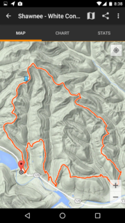
 One feature we often include with our articles is a map of our hike. Originally we used a handheld Magellan Explorist 310 to do the job of mapping our hike. But as we acquired more capable smart phones, we'd switched over to Google's MyTracks application for Android phones. This app had a bit of a learning curve and some idiosyncrasies, but we became accustomed to it and it became our goto application for mapping. We used it for finding our way on the trail (or back to our car) and afterwards to Read more ➜
 GPS Mapping Apps: MyTrails – a Replacement for Google MyTracks
One feature we often include with our articles is a map of our hike. Originally we used a handheld Magellan Explorist 310 to do the job of mapping our hike. But as we acquired more capable smart phones, we'd switched over to Google's MyTracks application for Android phones. This app had a bit of a learning curve and some idiosyncrasies, but we became accustomed to it and it became our goto application for mapping. We used it for finding our way on the trail (or back to our car) and afterwards to Read more ➜ 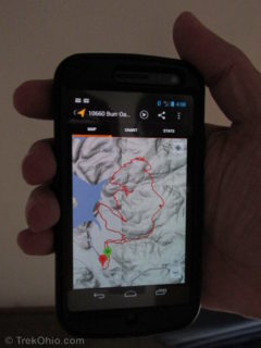 Does this seems familiar:
Her: Wow, I can see for miles. What a great view!
Him: beep-ding ... Hang on, got to check this e-mail, and Twitter, and look at Facebook and ...
A hike is an opportunity to get some exercise, unwind from daily stress, and enjoy nature. One argument for not bringing a smartphone on hikes is that it can destroy the natural experience for you and those traveling with you.
So, should you bring your smartphone with you on hikes? Yes, definitely! A smartphone
Does this seems familiar:
Her: Wow, I can see for miles. What a great view!
Him: beep-ding ... Hang on, got to check this e-mail, and Twitter, and look at Facebook and ...
A hike is an opportunity to get some exercise, unwind from daily stress, and enjoy nature. One argument for not bringing a smartphone on hikes is that it can destroy the natural experience for you and those traveling with you.
So, should you bring your smartphone with you on hikes? Yes, definitely! A smartphone  Topographic maps provide information on the geographic features and terrain contours of a given area. You can see where the lakes, streams, fields and forests are located. Brown lines depict changes in elevation and let you know where the ridges and hollows are located. As with a street map, roads, highways, towns, and villages, and political boundaries are also depicted.
With a compass and a good topographic map, you can travel cross-country through areas without trails and reach
Topographic maps provide information on the geographic features and terrain contours of a given area. You can see where the lakes, streams, fields and forests are located. Brown lines depict changes in elevation and let you know where the ridges and hollows are located. As with a street map, roads, highways, towns, and villages, and political boundaries are also depicted.
With a compass and a good topographic map, you can travel cross-country through areas without trails and reach