There are three different trail groupings at Blackhand Gorge State Nature Preserve, but for the longest time we only knew of the main parking lot and the trail head that leads off from there. So at the end of this post there’s a map and directions showing the location of them all. The icon used to locate the feature on the map is described in parentheses after each heading.
Blackhand Trail, Quarry Rim Trail & Chestnut Trail
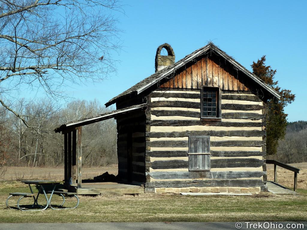
(Cabin Icon)
There is an old log cabin at the main parking lot across from the main trail.
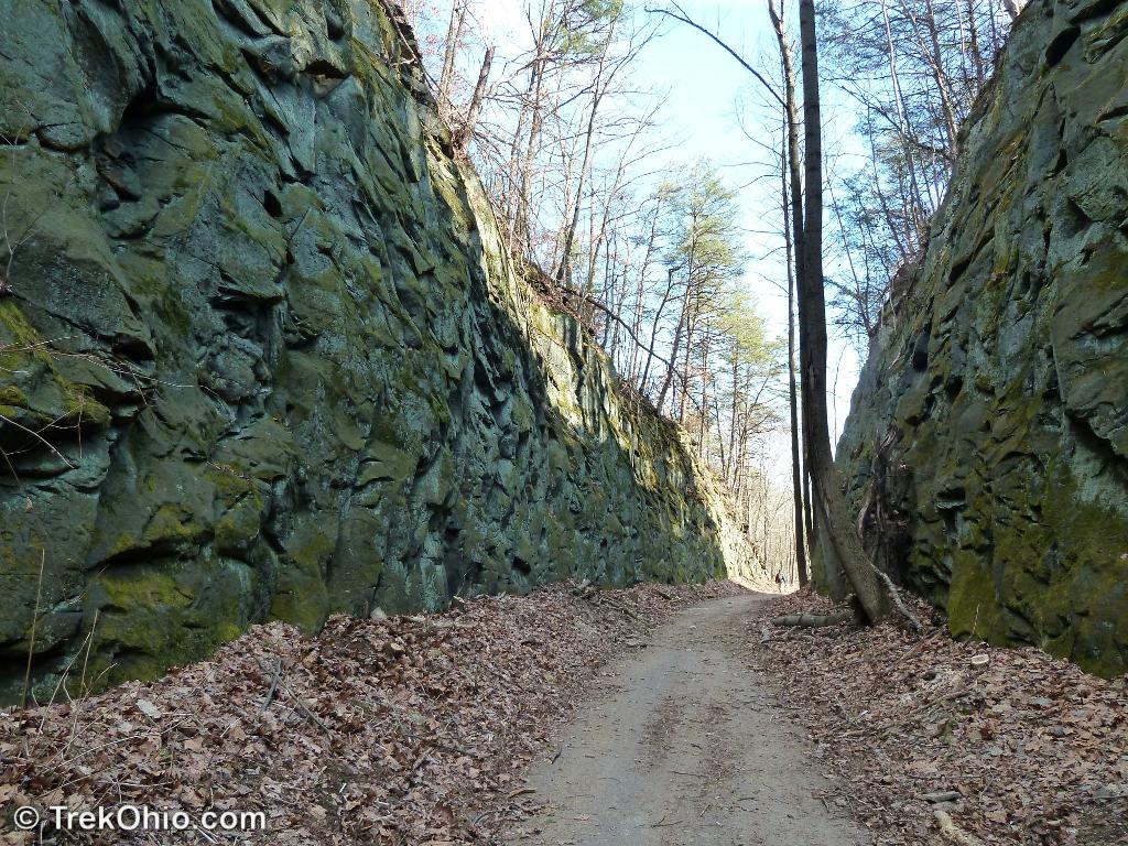
The main trail, known as Blackhand Trail extends 4.2 miles along the south side of the river starting at the main parking lot. This is a bicycle rail trail and is used by bicyclists and pedestrians. It is flat, paved, and suitable for families, small children, dogs, and strollers. This trail was originally the rail line used by steam locomotives. You can still see the “deep cut” where engineers had to cut through a large outcropping of bedrock to lay the rail. On the opposite side of Licking River you’ll eventually see Blackhand Rock (a sign marks its location). On your side of the river, hills and forest will rise above the river valley.
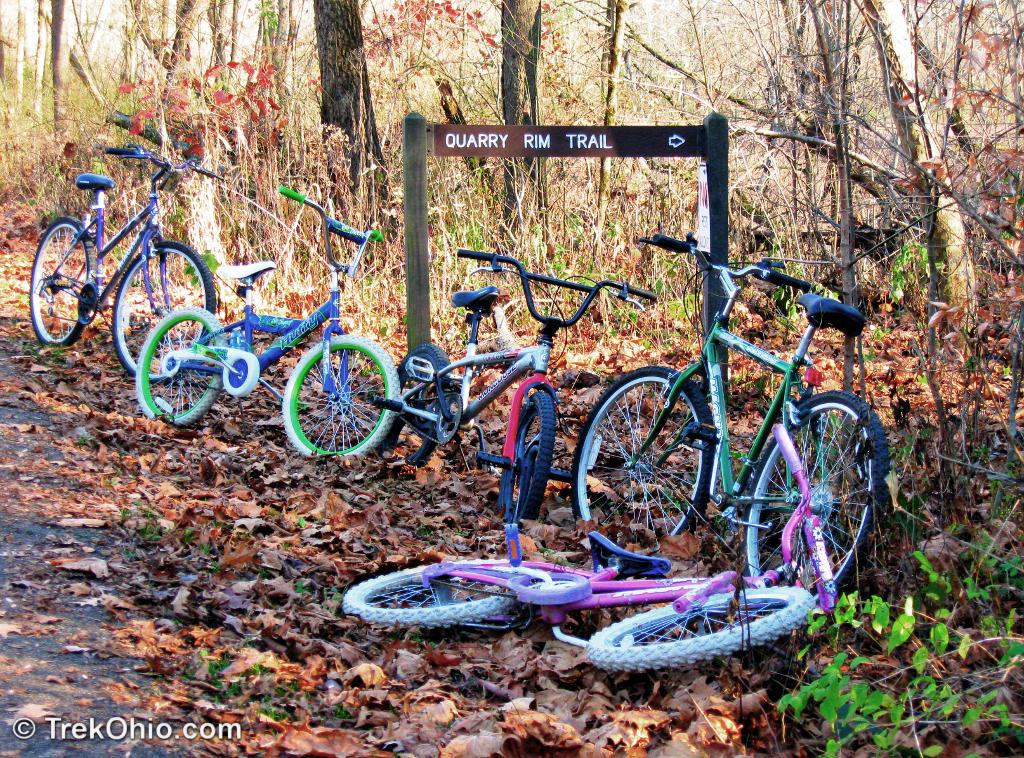
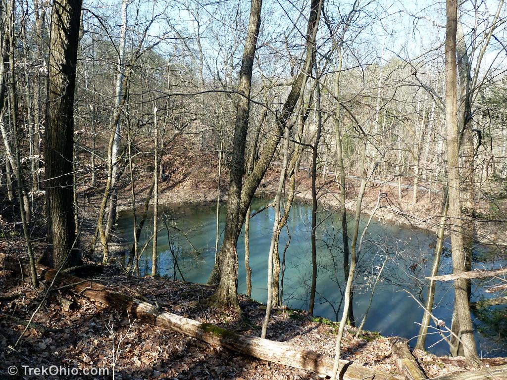
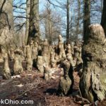
There are two side trails off the main trail (not suitable for small children). Follow the main trail till you see a sign to the left that says Quarry Rim Trail. This trail ascends to a ridge line and loops around several abandoned rock quarries that have filled to become small lakes. The trail is well laid out (with bridges and wooden stairs in places) and quite pretty. My favorite times to go are in the autumn to take in the colored leaves, or when the leaves have fallen to get a better look at the contour of the land. The trail terminates back on the paved path.

Farther along the paved path, is the trail head for the Chestnut Trail. This trail is not a loop (you’ll backtrack on the return), but it follows the ridges above the gorge and passes a seasonal waterfall.
The Marie Hickey Trail
(Car Icon)
The Marie Hickey Trail at Blackhand Gorge Nature Preserve is a hidden gem. It is my favorite trail in Central Ohio. When you park at the North Parking Lot (the car icon on the Google Map below), you’ll see a kiosk. Near the kiosk, there’s a dirt road behind a fence that leads straight ahead and two trail entrances to the left and right. The trail on the right goes uphill, while the one on the left descends gently a short ways and leads to a grassy, mowed path. Both the left and right trails are trail heads for the Marie Hickey Trail (it’s a loop). We generally begin with the mowed grassy path to the left.
Follow the grassy path, you’ll go past a field of milkweed which is often covered with butterflies in summer. Continuing on, the path turns and passes through a grove of bushes and small trees; this part of the trail may be a bit mucky in the spring. Soon you’ll end up at a wooden foot bridge.

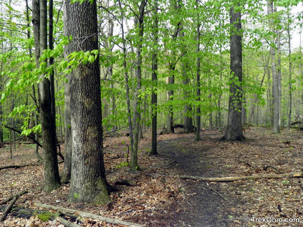
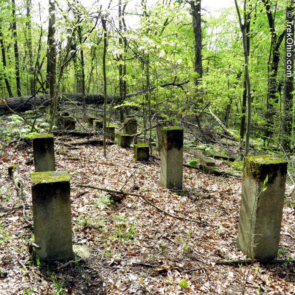
Shortly after crossing the bridge, you’ll see a sign for the Oak Knob Trail. This is a side trail that loops back to the main trail. If want to hike this knob, follow the sign and ascend up the hill on the Oak Knob Trail. At one point you may glimpse (to the right) the remains of an old building foundation. The trail leads to the top of a scenic U-shaped plateau and winds around the plateau edges and then goes back down to another bridge and joins up with the Marie Hickey Trail again. As you are descending the knob to go back toward the Marie Hickey Trail, you may glimpse the remains of building foundations and the remains of some grooved paving heading down the hill (path for horses?).
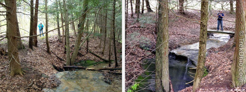
At the intersection with the Maria Hickey trail, go left up the hill. You’ll go up and down (crossing another stream), and soon you’ll see a dark grove ahead. This is a small hemlock grove containing a narrow stone gorge and a seasonal waterfall below a small, wooden bridge. You are about halfway along the trail.
After the grove, the trail eventually climbs to a bluff overlooking the Licking River. If you arrive in the spring, listen carefully as you climb the hill. You may hear falling water. There’s a small unmarked side trail leads down to a pair of seasonal waterfalls.

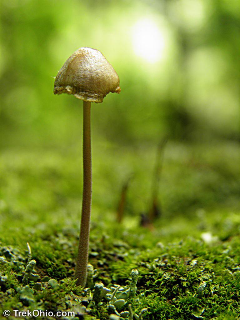
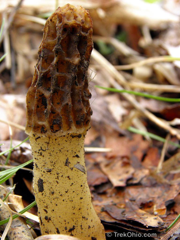
Back up at the cliff edge, the trail follows along the cliff. To the right you may glimpse a natural gas well. Follow the path as it turns to the right and heads up hill. To your left will be a valley and (in the distance) a rail line, to your right (in the distance) a meadow. In late spring, you may see mushrooms along the trail. We’ve also seen deer on many occasions.
At the top of the hill, the trail will merge with the dirt service road for a ways, and then head back into the woods (you’ll see a small wood post with an arrow on the left side of the road). Both the road and the trail terminate back at the parking lot.
The Canal Lock Trail
(Ship Icon)
The Canal Lock Trail head is to the west of the Licking River on the south side of the road. Either walk across the bridge over the Licking River from the main parking lot, or park in the small gravel lot just to the west of the Licking River on the north side of the road. The trail head is across the road and a bit to the west.
Follow the path till you see the sign that says “Lock 16”. Then descend the small hill to the left and down into the (dry) floor of the lock. Proceed through the lock and follow a channel that soon leads back up the hill.

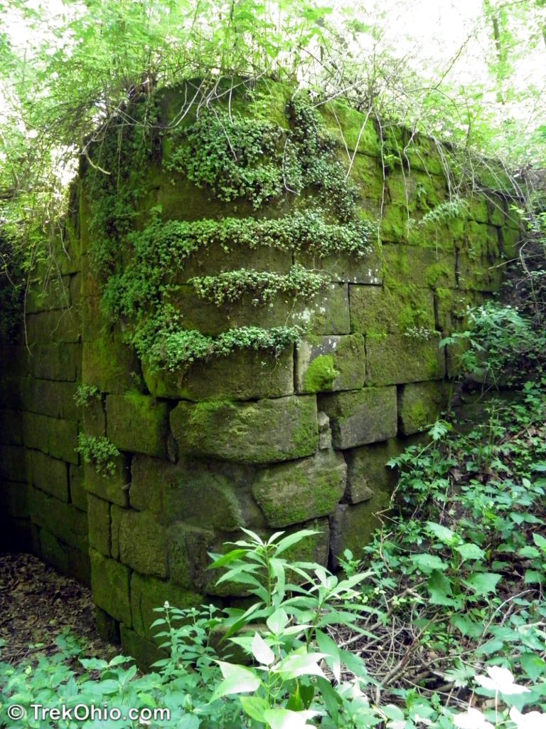
The trail will continue (past the wooden posts) to the left paralleling the river. This is the former path of the Interurban rail (long since gone). You’ll eventually end up at the abandoned rail tunnel.
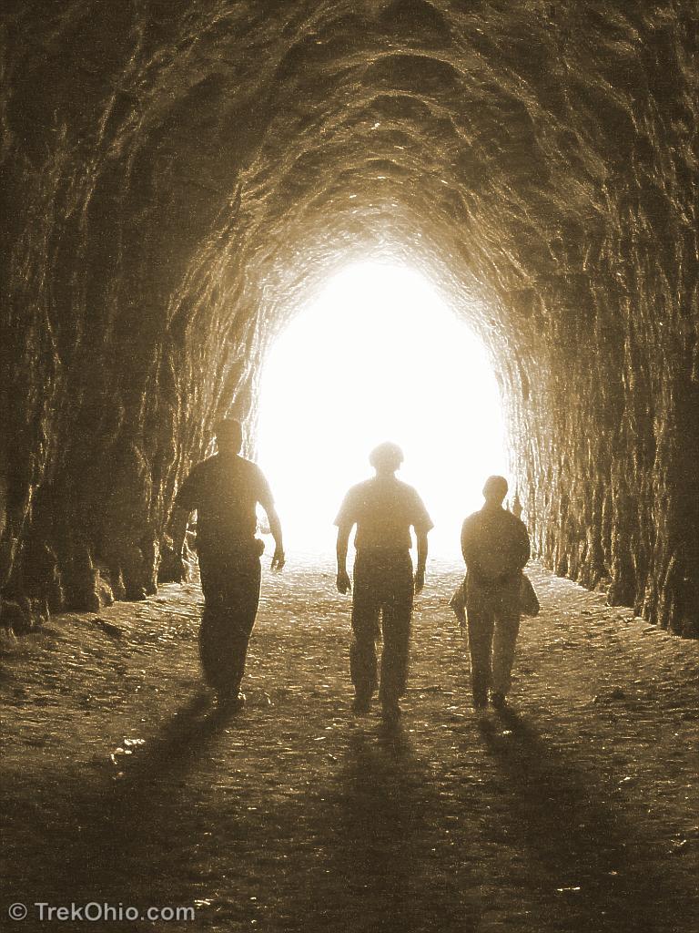
There are other photos of both the lock and the tunnel at Blackhand Gorge – A Step Back In Time, a post in which I discuss how the history of Ohio transportation impacted this area.
Additional information
- TrekOhio: Blackhand Gorge: A Step Back in Time — We discuss the history behind many of the features at Blackhand Gorge.
- TrekOhio: Licking County Parks & Nature Preserves — This is the county where Blackhand Gorge is located; check out this page for official links and information on nearby parks and preserves.
Location
There are three markers on the map below. It is a screenshot of Google Maps. To see it in more detail, click on it to view a larger version of the image, or view it directly on Google Maps where you can zomm in or out.
The significance of each icon is explained below.
- Cabin Icon
- This is the trail head for the main trail, known as the Blackhand Trail. It is a paved multi-use trail. Diverging from this are two dirt trails, the Quarry Rim Trail and the Chestnut Trail. An outhouse is at the main parking lot near the trail head for Blackhand Trail; it is not open to the public during the winter. And I chose the house-like icon because there is a log cabin there.
- Car Icon
- This is the preserve’s North Parking Lot. From here there are two trail heads leading to the Marie Hickey Trail (it’s a loop). Diverging from this trail is the Oak Knob Trail.
- Ship Icon
- This is where you go to hike the Canal Lock Trail which leads to Lock 16 and beyond that the abandoned, inter-urban tunnel. There is parking on the north side of the road a short ways west of the Licking River. The trailhead is on the opposite side of the road a bit farther west than the parking lot. You’ll see a bicycle stand near the trail head.
To drive to these locations from State Route 16, get off onto SR 146 South (towards Zanesville). Shortly after the exit turn right onto CR-273. Now you have three choices:
- To go the Marie Hickey Trail (car icons), prior to the Licking River bridge there will be a turnoff to the right onto Rock Haven Rd (if you cross the bridge, you’ve missed the turnoff). After a few minutes, you’ll see a small gravel parking lot with a wooden kiosk to the left. This is the trail head.
- To go to the Canal Lock Trail while on CR-273 and just prior to the bridge over the Licking River, you’ll see the trail head for the Canal Lock Trail on your right (ship icon) and almost immediately after this, there’s a small gravel parking lot to the left. Park here and cross the road to go to the Canal Lock.
- To go to the main parking lot to explore the Blackhand Trail (cabin icon), while on CR-273 continue across the bridge over the Licking River. Follow the road and it will turn sharply right. Immediately after the turn you’ll see a parking area for Blackhand Gorge. Follow the road and it will turn sharply right. Immediately after the turn you’ll see a parking area for Blackhand Gorge.
On what is the return trip to the Columbus area for us, we often have a late lunch at the Bob Evans at the intersection of SR 16 and Cherry Valley Rd.
More on Licking County
 Dawes Arboretum: Cypress Swamp
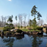 Dawes Arboretum
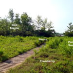 Cranberry Bog: The World’s Only Floating Island
 Dawes Arboretum Scarecrows
Would love to know how long these trails are, anyone have any idea?
As mentioned above, the multi-use trail is 4.2 miles. Checked my GPS – Marie Hickey trail is 2.6 miles. Quarry Rim is fairly short – I’d guess around a mile or so. It’s perhaps 1/2 mile (one way) through the canal lock to the tunnel. i don’t have data on the Chestnut Trail but recall it as relatively short.
Thanks, I didn’t think I could handle the 4.2 mi, and was hoping the others would be shorter.
The multi-use trail is 8.4 miles round trip. But, since it is a multi-use trail, you can traverse it by bicycle. It’s a pleasant scenic ride. For hiking, the Marie Hickey Trail is one of our favorites. We’ve also gone through the gorge on kayaks.
Thanks Bob for all your great info, we had a nice hike and definitely plan on going back.
This is an awesome post! Thanks for the information. We hiked the Marie Hickey trail this past weekend and really enjoyed it. What appeared to be the waterfall was some cool carved out caves to hike.
We hiked the canal trail that leads to the large cave and the big rock this evening. Great short hike. Does anyone know if this can lead to the Marie Hickey trail? It looks like Jamison may have stated it does, but a little confused since not familiar with the area. Thanks.
I was born in Toboso and went to elementary school there, so I have a very special place in my heart for BHG. A couple of things to add here. The waterfall is more commonly accessed from the canal lock trail. Once you walk through the tunnel, the typical thing people do is go down a bit to the path on the left that leads to another part of the canal path on the river.
If you walk past that turn and go just a hundred feet or so, there is another small unmarked path on the right, and it leads to the base of that waterfall.
Also, the ranger in charge there now has done a lot of work clearing old trails, and has reopened the Beaver Dam trail, which was from the 80s when I lived out there. It had been grown over and unmarked for the better part of 20 years, but has since been cleared and joined to the quarry rim trail.
As for Marie Hickey, I agree, it’s my favorite short trail in Ohio. I used to run multiple loops of it when I lived near there a few years ago.
I’ve had Blackhand Gorge on my might want to hike list. I think I’ll move it up on my list. Thanks for sharing this.
Your welcome. I’m glad the post was of some use to you.
Wow. That is awesome post. From Your beautiful photos, I love Mini-waterfall. It is just to my mind!
Thank you, Sartenada. We had been on this trail many tomes before we realized this little waterfall was nearby. If was a fun discovery for us. 🙂
Great post, Deb! I love the gorgeous pictures too. 😉
Thank you, Malou. 🙂