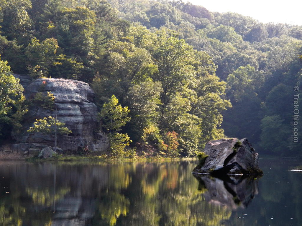
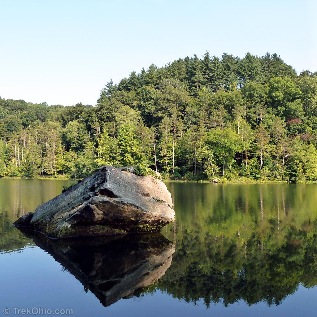
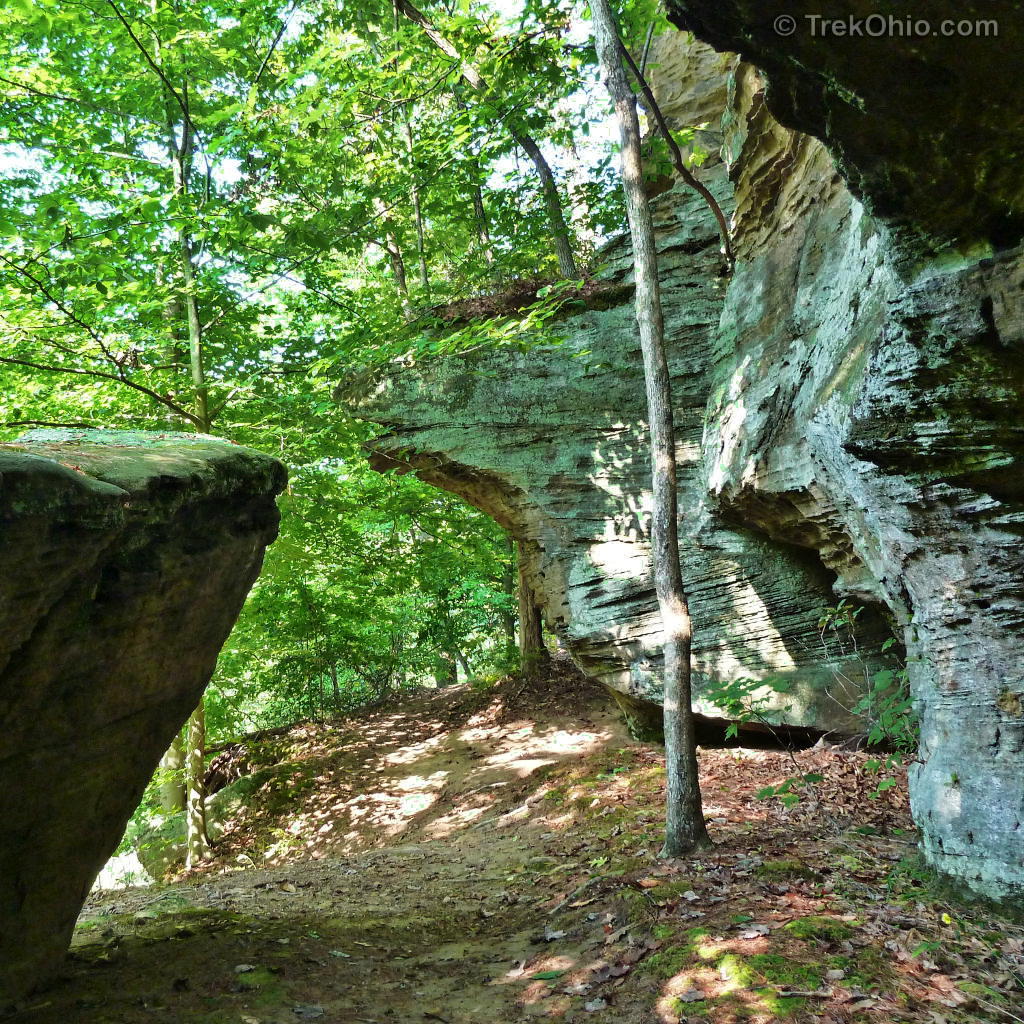
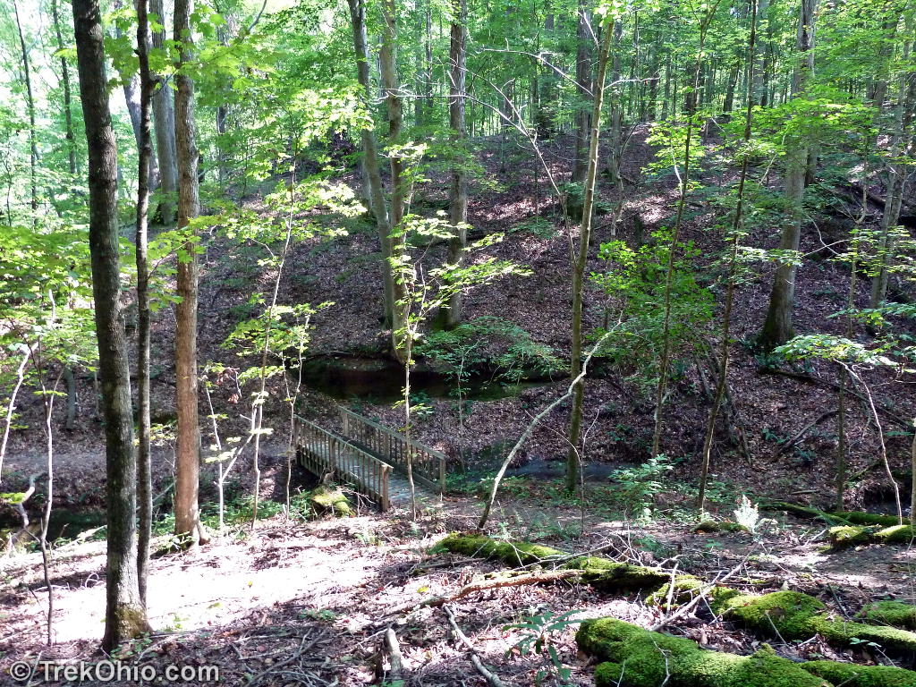
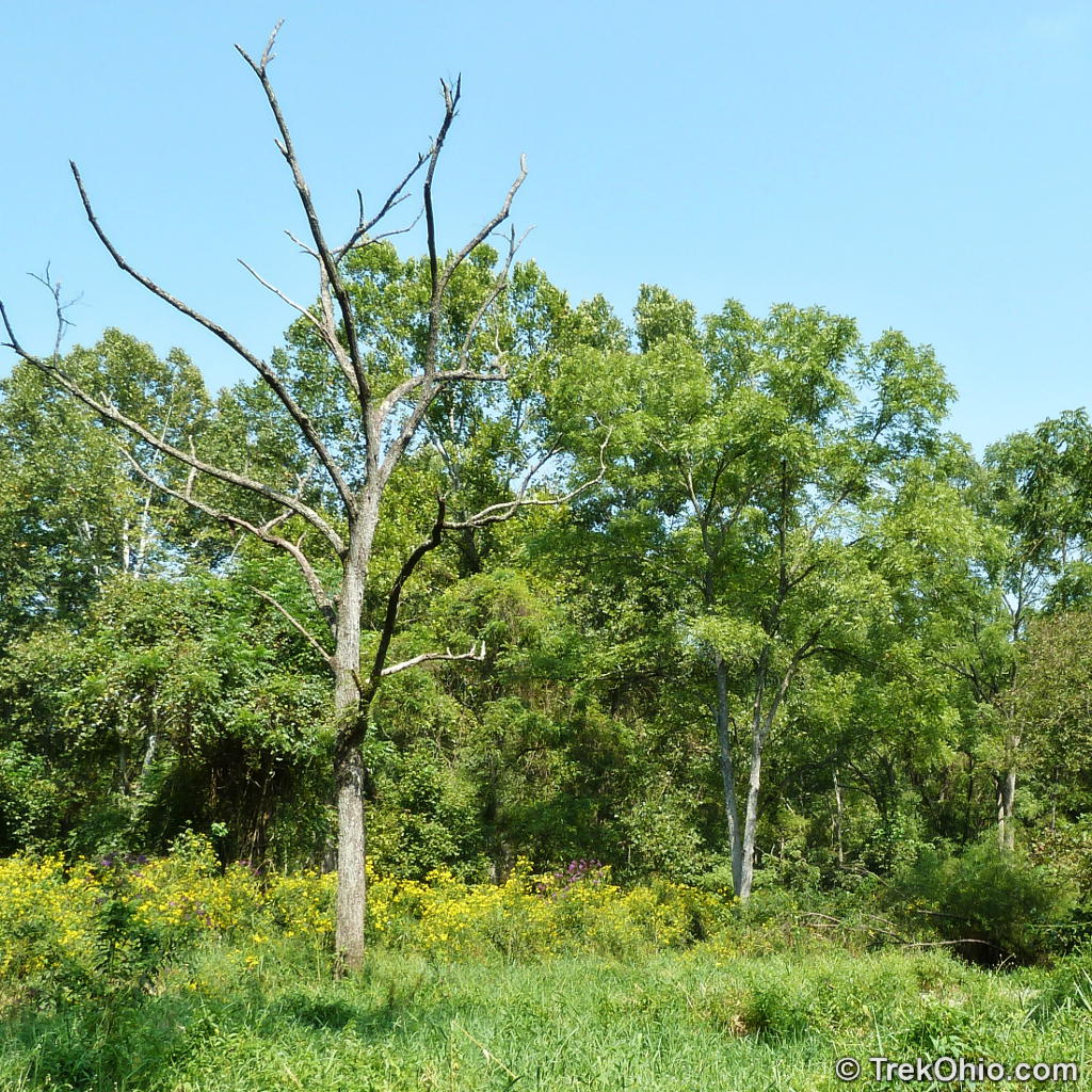
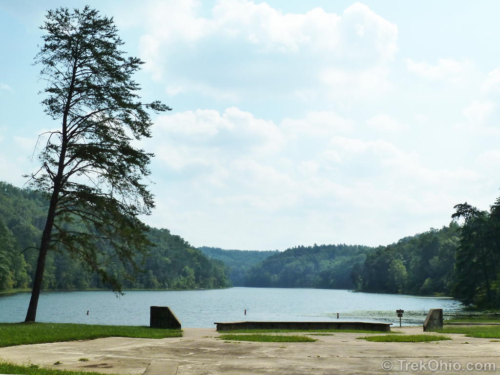
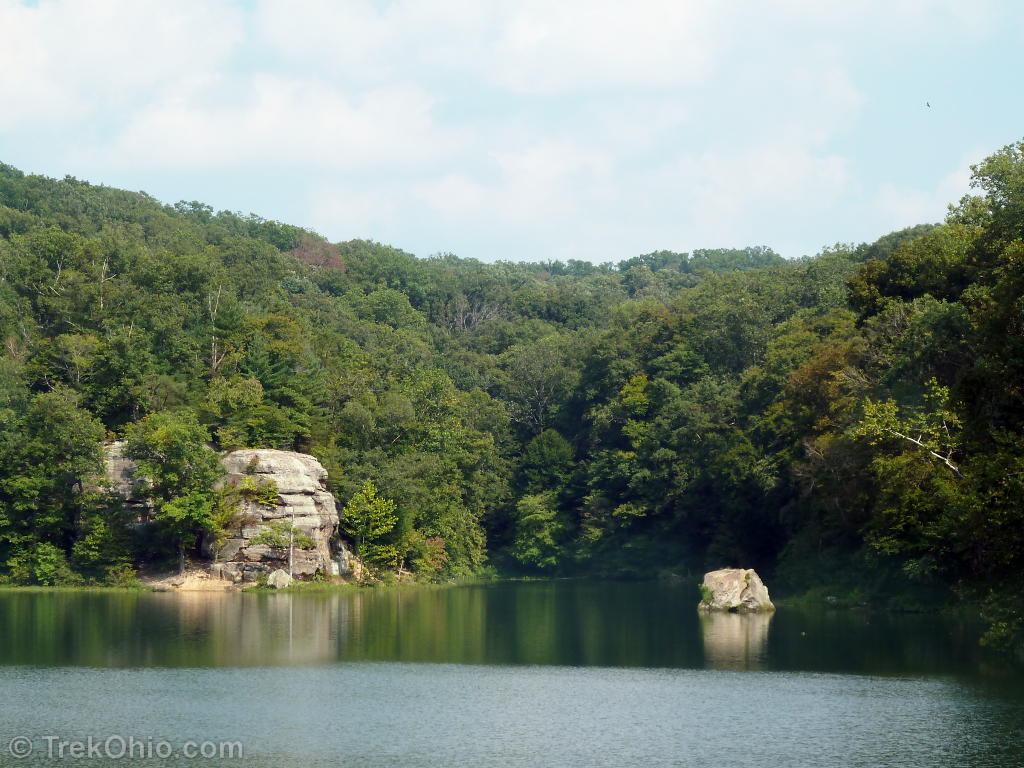
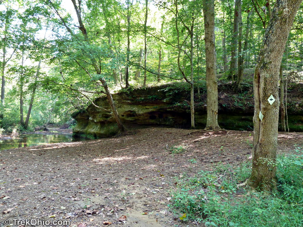
This past September we visited Lake Vesuvius in Wayne National Forest. We followed the Lakeshore Trail counter-clockwise around the lake. This trail is supposed to be 8 miles long. The first mile had us traveling past a number of cliffs and outcroppings; if you were to just go a mile and then turn around, you’d have a very scenic hike of moderate difficulty. You’d even get to see the cliff and watery slump block pictured above.
The Lakeshore Trail
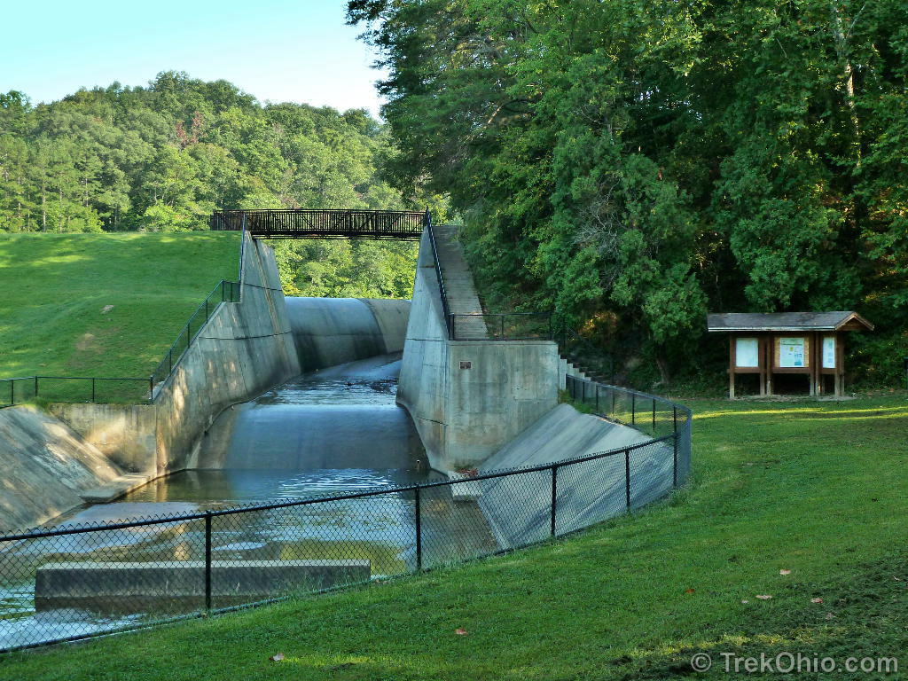
Once you go up the steps that lie on the right-hand side of the causeway, you have a choice of going clockwise (to the left) over the bridge, or like us you can go to counter-clockwise (to the right) where you’ll soon begin to see a number of cliffs and outcroppings.

Since we went counter-clockwise around the lake, the boardwalk was the last leg of our journey.

Going beyond the first mile
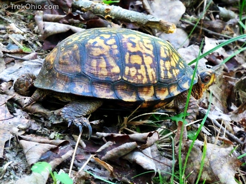
The eastern box turtle lives on land in woodlands; you are most likely to see them out and about after a rain. When alarmed they can withdraw their head, limbs and tail, and close door-like plates over their shell openings so they are completely encased in their shells.
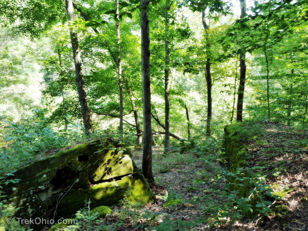
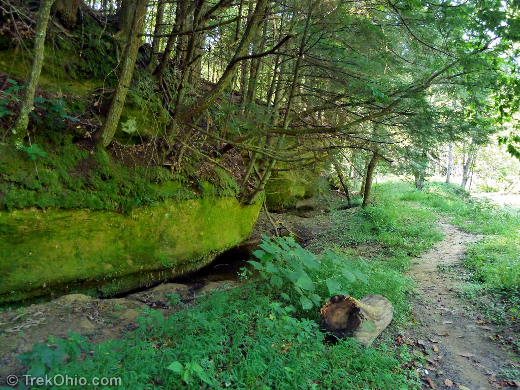
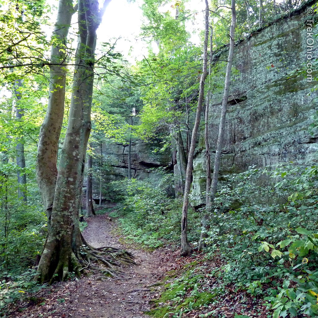
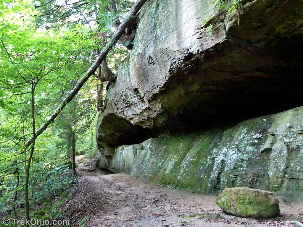
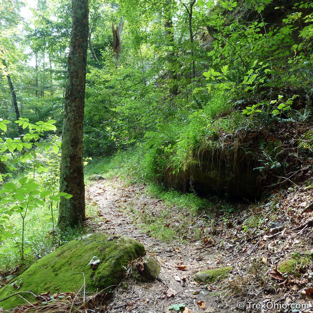
To get the whole way around the lake you actually have to follow the feeder creek a considerable distance upstream from the lake to get to a place where it is narrow enough to cross. In the above photo I am walking along the creek with outcroppings on one side and the creek on the other.
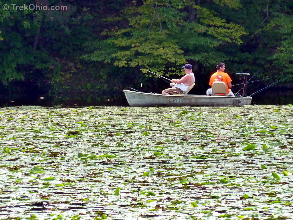
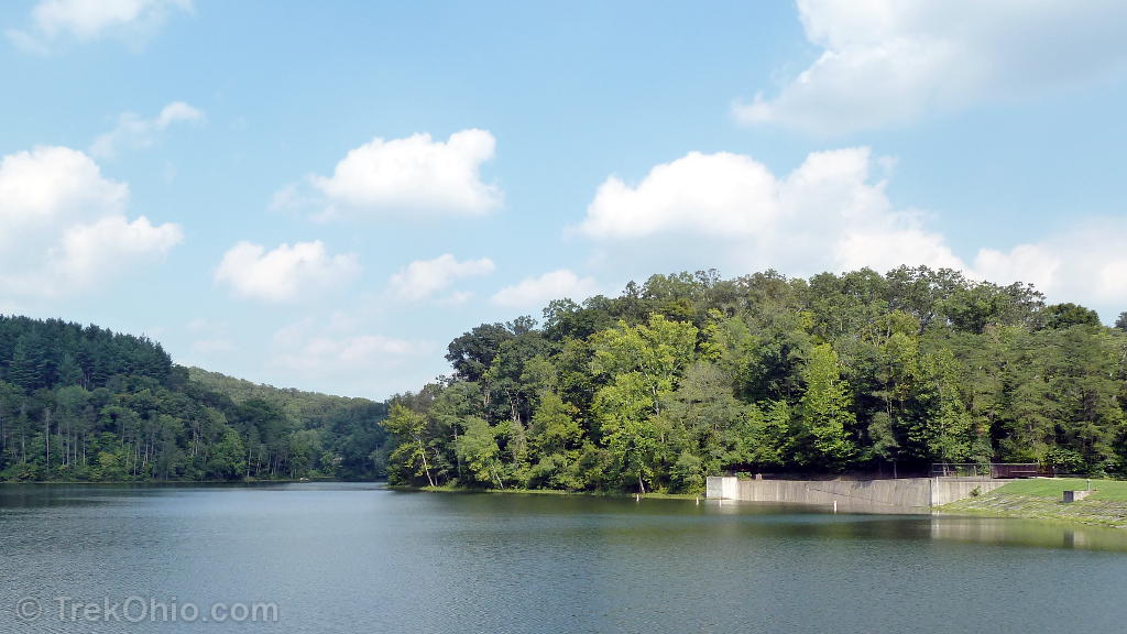
While going around the lake we caught sight of the beach a couple of times from the other shore, but it is deceptively far away due to the distance that you have to go upstream around the creek. Sadly for us since we were there after Labor day, the restrooms, fountain, and soda machines in the beach area were all shut down for the winter. At this point we are about a mile and a half from completing our hike.


Navigating the trail
If you are not hiking this trail, you can click here to skip this part.
After reading Roberta’s comment below, it occurred to me that I didn’t address possible navigation issues that you might encounter on the Lakeshore Trail. At trail junctures near the dam, the trail signage is exceptionally good.
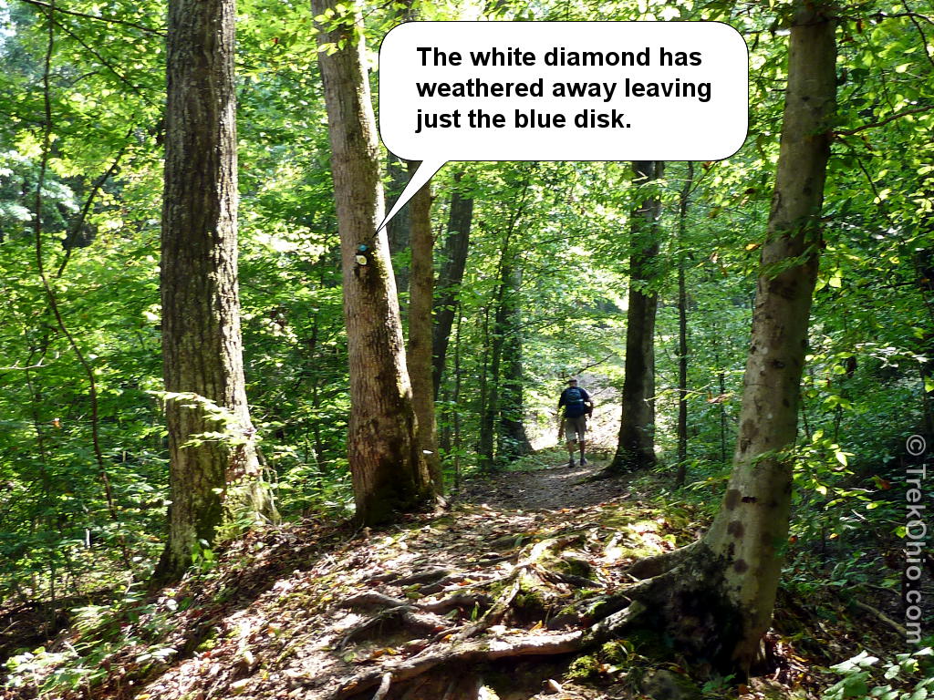
The Lakeshore Trail’s blaze is a plastic white diamond with a blue disk (circle) around one of the nails attaching it to the tree. In cases where two trails join for some distance, the same white diamond will show two different colored disks. When there is a turn or you might have misgivings (like, “Am I supposed to wade across this stream?”), the white diamond is sometimes marked with an arrow.

Okay, so far so good. So let me start presenting what I consider to be some of the difficulties. It turns out that the white diamonds are made of a plastic that weathers over time, becoming brittle and falling apart. So at some points all that was left of the blaze was the blue disk; the diamond had crumbled away. The weathered diamonds were frequently encountered the farther you were away from the dam.
With that said here are the three points that I thought were the trickiest points to navigate when going counter-clockwise around the lake.
While traversing the floodplain meadow I had some misgivings about whether we were still on the trail because it was so overgrown. It seemed like it could be an animal trail. However after following it awhile I did see a blaze confirming that this was the Lakeshore Trail.
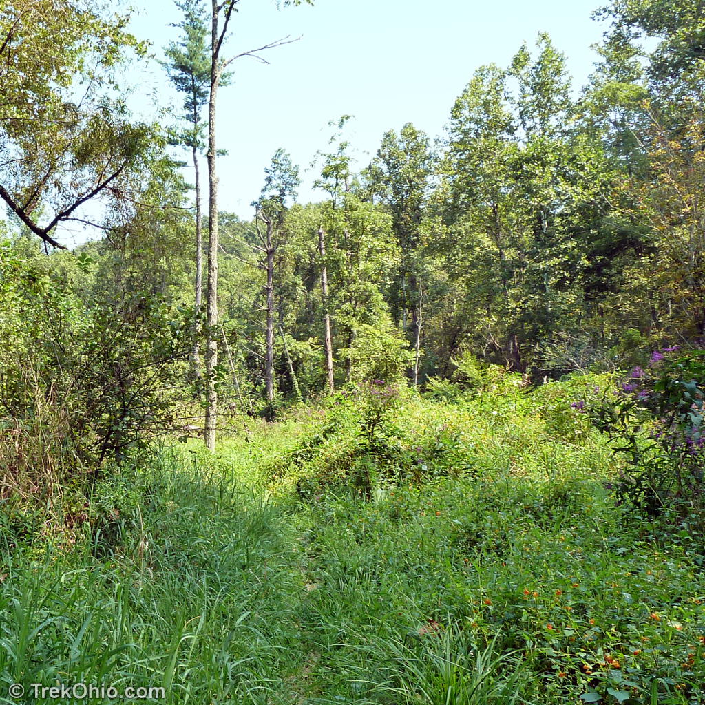
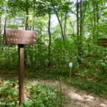
Note that the sign below preceded the overgrown trail through the meadows. Since we hadn’t noticed any point where we could have left the trail, this added to our confidence that we were still on the Lakeshore Trail.
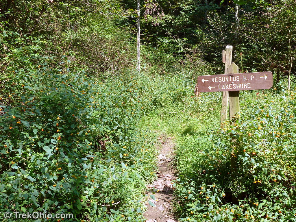
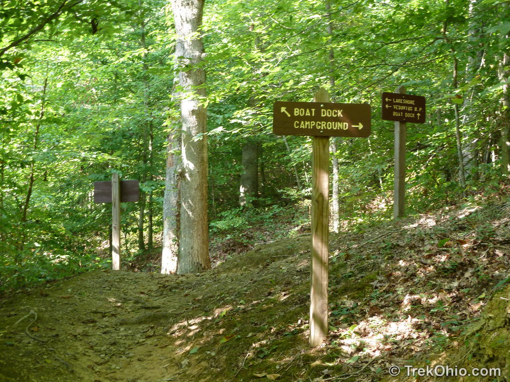
This next part ended up being the most confusing part of the trail for us. We had just recently made it through the close, overgrown trail through the floodplain meadow when we encountered the sign and trail juncture below.
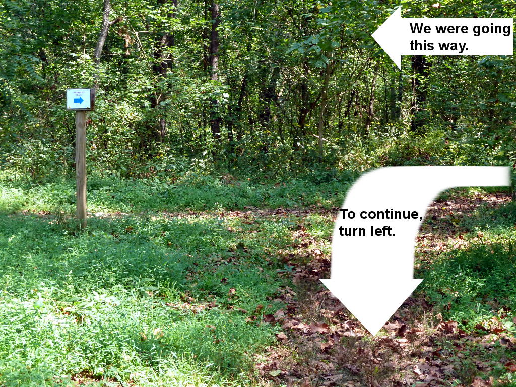
We had misgivings about making the sharp turn because there were no blazes that we could see from the juncture and because the trail was so wide it had a sort of access-road feel to it. We did follow it some distance without seeing a blaze, so we turned around and came back to the juncture. We then went straight and we ended up on a bridle trail. Since it was a bridle trail the trail bed was reinforced with gravel, and the stream crossings had some synthetic material meant to reduce erosion. It looked like the photo below.

We thought that perhaps the Lakeshore Trail coincided with this bridle trail for a while, but when we finally came across a blaze, it had colored disks, but not the blue disk that signified the Lakeshore Trail. This meant that we had left our trail, so we went back to the juncture and once again tried making the sharp turn. This time we went farther down the trail and eventually saw a blaze confirming that we were on the Lakeshore Trail. This juncture was the only point where we went astray.
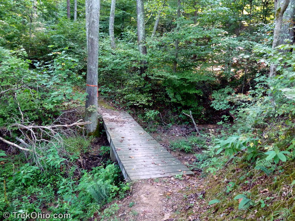
We also had some misgivings about the stream crossing pictured below. When we got to this point, the blaze had no colored disk to indicate which trail it was, and there was another blaze on the same tree at a 90 degree angle from the first one. However we did follow the arrow across the stream and that was the correct choice.

So the points discussed above were the junctures where we were not completely sure which way to go.
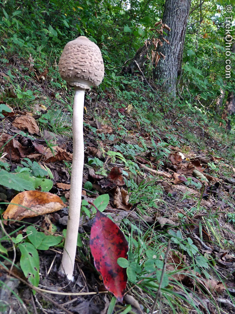
Flora and Fungus
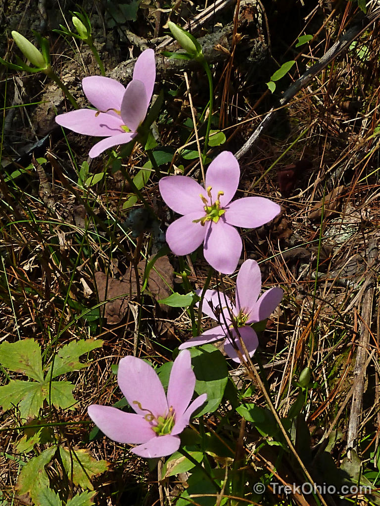
Besides enjoying the view of the lake and the outcroppings, I also enjoyed seeing a large variety of wildflowers including some species that I hadn’t seen anywhere else all summer. In fact most of the photos that I posted in Wildflowers of September were photographed during this hike.

Vesuvius Iron Furnace
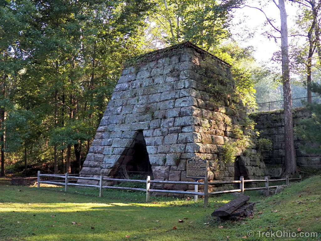
This iron-producing furnace was built in 1833, and it continued operating until 1906. In 1863 it was the first furnace in the Hanging Rock Iron region to shift from using a cold blast furnace to the then-experimental hot blast furnace. Bob posted an article about such furnaces, so if you are interested in how these worked or what they used to look like, check out his article, Nineteenth Century Ohio Iron Furnaces.
Additional information
- TrekOhio: Lawrence County Parks and Nature Preserves — This is the county where Lake Vesuvius is located; check this page for links to official sites, and for information on nearby parks and preserves.
- TrekOhio: Topological map of the Lake Vesuvius area
- USDA: Lake Vesuvius Brochure & Trail Map (PDF)
- Recreation.gov: Lake Vesuvius Recreation Area
- BackpackOhio.com: Vesuvius Backpack Trail
- RockClimbing.com: Rock climbing at Lake Vesuvius
Location
- Address: CR-29 & CR-44 N, Pedro, Ohio 45659
- Directions: Located 6.5 miles north of Ironton, Ohio, just off State Route 93. Turn on County Road 29 and follow the signs to the Recreation Area (1 mile).
- GPS Coordinates: 38.6057442, -82.6317587
- Google Maps: View on map or get directions
There are flush toilets not too far from the parking lot.
More on Federally Managed Sites
 Wayne National Forest (Athens Unit): Wildcat Hollow
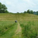 Hopewell Culture National Historical Park: Seip Mound
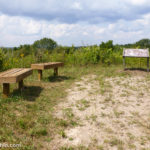 Wayne National Forest (Athens Unit): Monroe Outlook
 Cuyahoga Valley National Park: Beaver Marsh
I enjoyed this trail very much. The slump block captured my mind, because in my childhood there was a similar one in a river which was near to our home and I dived from it “all the time” when swimming in the river.
Just wonderful, I love how you cover everything so very beautifully. What a wonderful place.
Just last night, in my garden, I (quite accidentally) dug up a tiny box turtle! Sweetheart of a thing. I placed her in the rosemary for protection, so she can re-bury herself…. 🙂
Thanks, FeyGirl. What a surprise to dig up a hibernating turtle! You didn’t happen to photograph her while she was in the rosemary, did you?
December 8th I had ventured out at night when I realized no one had brought the mail in. While I was going down the driveway, it looked like there was a lump of something on the concrete which struck me as odd. Afterwards I went back with a flashlight so I could see what it was, and it was a bullfrog. I was really surprised to see one out and about so late in the year. Hopefully he’s found a place to tuck in for the winter. We are supposed to have snow tonight and tomorrow.
Oh, I tried…. But I was so incredibly concerned for her, that all thoughts of my camera disappeared! Of course an hour later, when I couldn’t find her — ERGH!
Look at him!! He needs to get to hibernating, himself! What a cutie. Poor guy though, what’s he doing out and about?
what an interesting place to explore!
The place had a lot going for it: rock outcroppings, cliffs, an abundance of wildflowers, and a very cute turtle. 🙂
Reblogged this on WISDOM OF THE AGES and commented:
this place looks very interesting and beautiful, I bet the wildlife is diverse as well.
I’m flattered that you thought the post was worth re-blogging. 🙂
just seen a video of some guy walking that trail, he did sections, described some of the ups and downs and even commented they needed better signs to avoid getting lost. he ran into to others who came from teh other direction so each to tell the other which way to go to stay on the lake trail. looks like a very interesting place.
Roberta, after reading your comment I decided to add a new section to this post called, Navigating the trail where I discuss the three points in the trail that I thought were somewhat confusing. It is probably too much detail for people who aren’t actually hiking the trail, but it might be of some help to those who do plan on hiking it.
It was an interesting place. To me the cliffs and outcroppings add to the scenic beauty of the place, but apparently rock climbers are drawn to Lake Vesuvius because it has some interesting formations to climb. I would imagine it has a wide range of wildlife, too.