Mohican State Park is one of my favorite places for hiking. The park contains a scenic gorge with the Clear Fork branch of the Mohican River flowing through it. The park is 1,120 acres with the 4,795 acre Mohican Memorial State Forest adjacent to it.
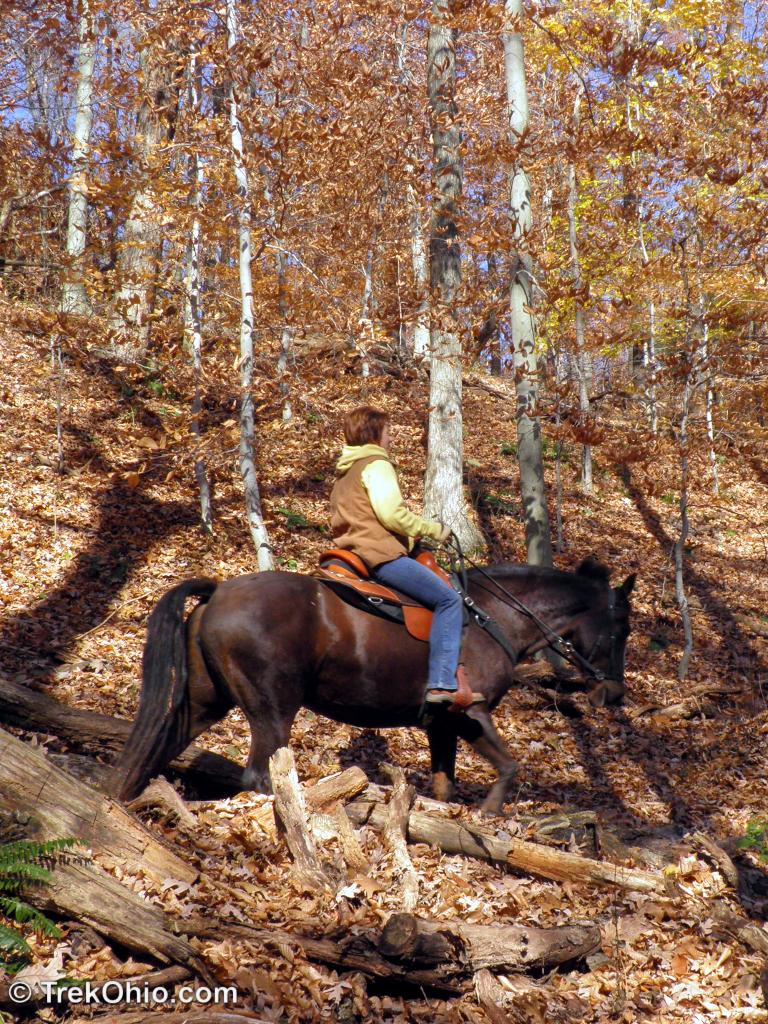
Recreational opportunities abound with several campsites, hiking trails, horseback trails, fly fishing, and boating all available. If that’s not enough, nearby there are canoe liveries, the 18.6 mile Butler to Mansfield bike trail, and the Mohican State Park Lodge. Also, nearby is Malabar Farm State Park.
A handy map of the park can be found here.
I’ve hiked on several of the trails, but I have one favorite route which starts at the covered bridge. You can reach the trail head from SR-97, by turning off at the Mohican State Park sign and immediately turning sharply to the left and heading down the steep narrow road that descends to the bottom of the gorge. At the bottom you’ll find the river spanned by the covered bridge.
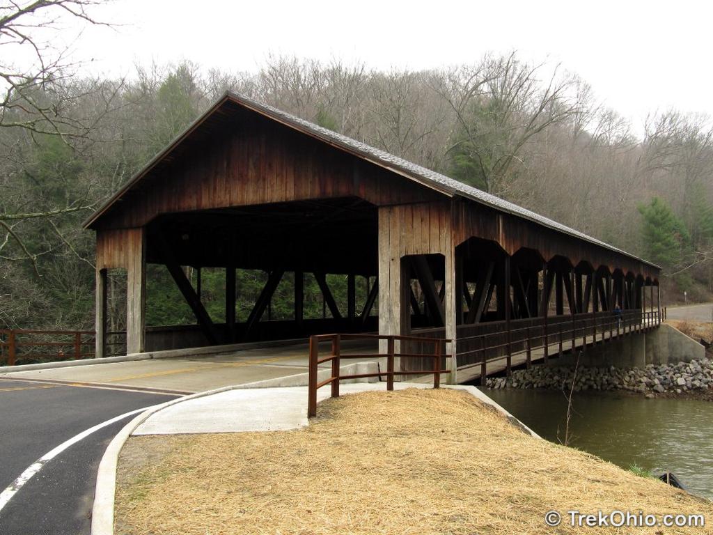
If you park at one of the handful of parking spots at the south side of the covered bridge, the trail head will be to the west (behind you). If these parking lots are full, cross the bridge and then turn right into the parking area. Here you’ll also find outhouses, and a scenic picnic area and kids playground along the banks of the river. Farther along is a primitive (no electric) campsite also along the river bank.
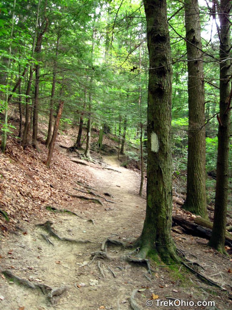
OK, back to the trail head. As you start along the trail, notice that it is marked with white blazes. The trail follows above and parallel to the river, gradually descending to the river itself at trail intersection.
When you reach the river, you’ll notice an intersecting trail from the left. The sign on the trail reads “Big Lyons Fall’s”. This is the trail you want to follow. Eventually you’ll see another cross-trail labelled “Stage Coach Trail”. Bypass it, it’s an alternate path to Little Lyons Falls.
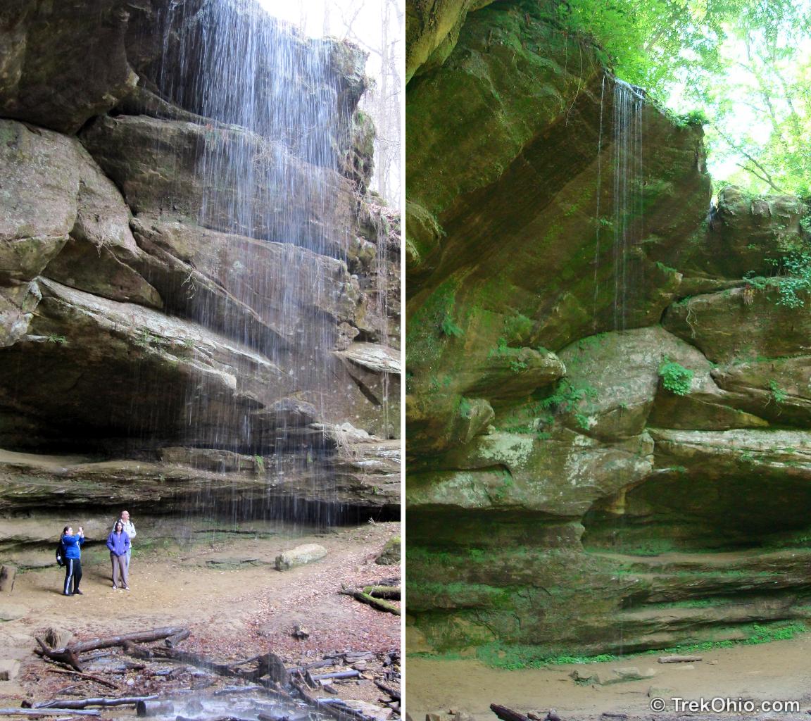
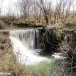
Proceed on the Big Lyons Falls trail until it terminates at the base of a cliff. There’s a small recess cave area and the aforementioned Big Lyons Falls. The volume of water depends on the season and amount of recent rain. It’s best in the spring.
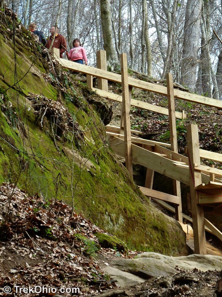
Continue following the trail that ascends the cliff to the right of the waterfall. This used to consist of a steep dirt path and heavily eroded stone steps to scramble over. A group of volunteers put in a wooden staircase (a rather major effort, but one that will be greatly appreciated). Last time we went, it was unfinished and blocked the ascent. It is now completed and is a great improvement over the previous eroded stone steps.

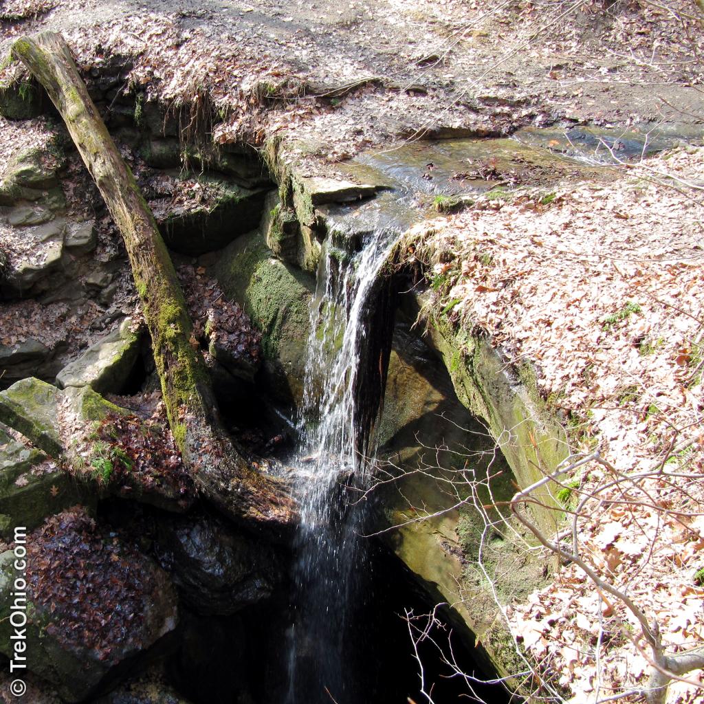
You’ll eventually wind up at the second waterfall – Little Lyons Falls. A smaller fall, you’ll approach from the top of the falls.
After viewing the falls (careful!) follow the trail across the stream. You’ll eventually end up at the rim of the river gorge. Follow the trail to the left till you get to Pleasant Hill Dam.
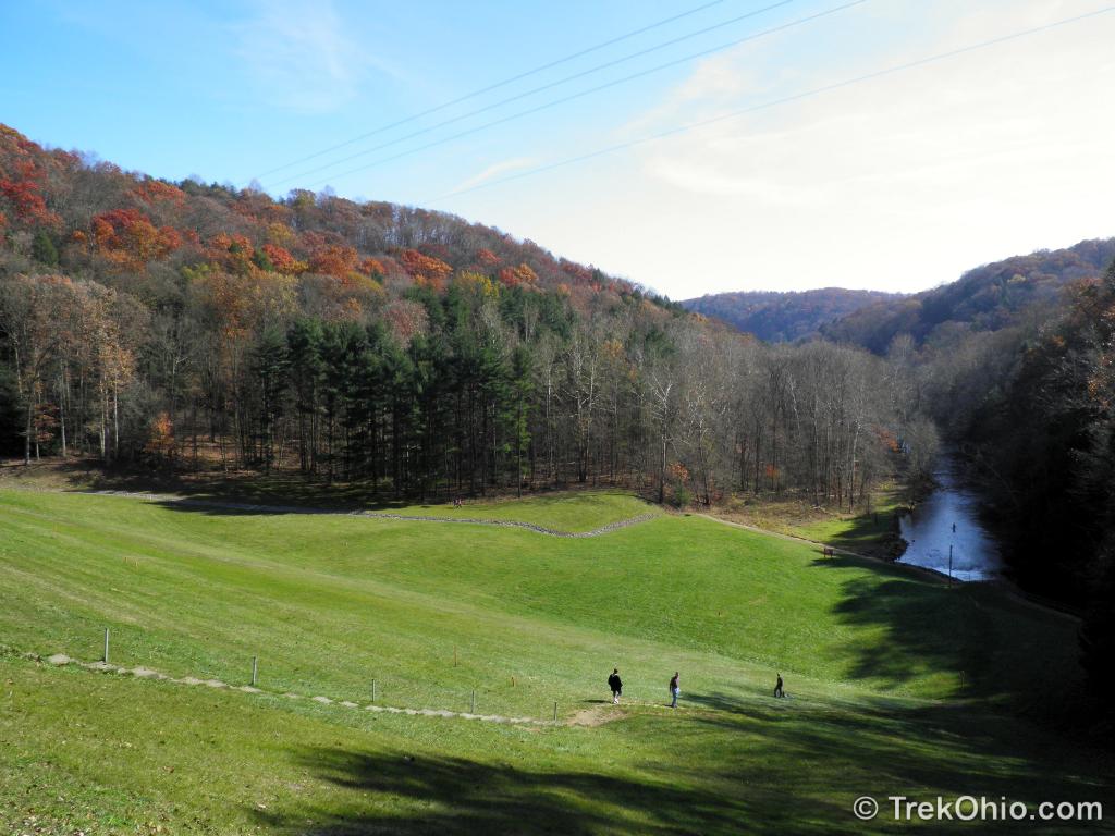
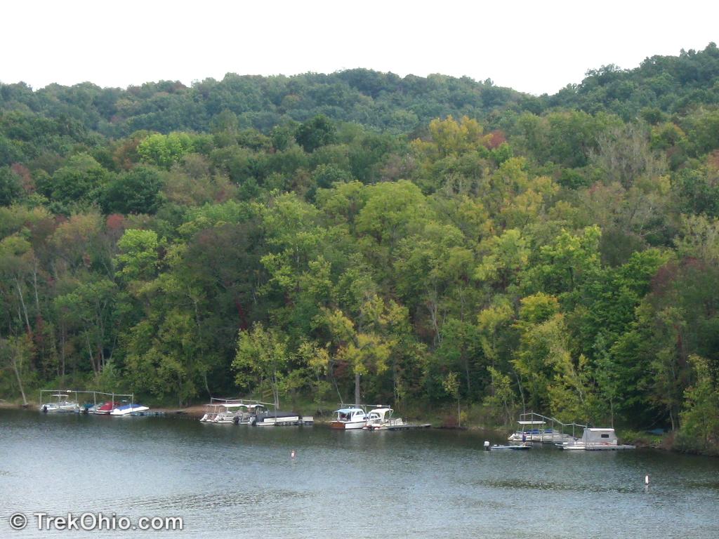
You’ll emerge at a roadway that crosses the top of a large earthen dam. On one side will be a scenic lake, and the other will contain the Mohican River springing from the dam’s spillway tunnel and a great view of the gorge valley.
If you want a quick rest, this is the place. To the left is a parking area, shaded picnic tables and real restrooms with plumbing (these are only open from Memorial Day to Labor Day).
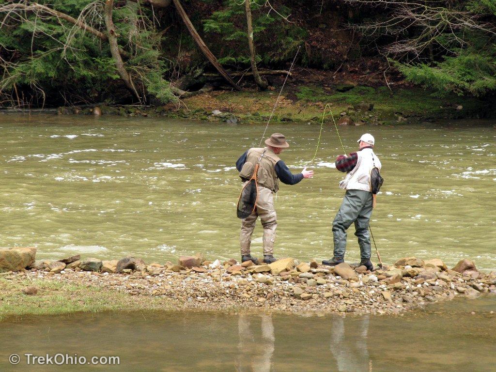
When you are ready to return, proceed along the walkway and follow the steps down the grassy face of the earthen dam to the gorge valley floor. You’ll often see fly fisherman trying their luck in the river.
Follow along the Pleasant Hill Trail, which is flat and parallels the river a few feet away. Eventually you’ll end up back at the covered bridge.
Before leaving, you may want to visit the fire tower and the gorge overlook. In particular, the gorge overlook provides a stunning vista of the Clearfork-Mohican gorge.
If you’ve gotten an early start, it may now be lunch time. A few suggestions:
- If you’ve packed a lunch, either the picnic tables near the covered bridge, or at the Pleasantville Dam provide a scenic setting for lunch
- The nearby Mohican State Park Lodge offers good food and a beautiful lakeside setting. However they do close between lunch and dinner, so if you are trying to do a late lunch, this isn’t the place to go.
- If you are headed back to I-71, may I suggest the Der Dutchman (formerly Dutch Heritage) restaurant. They offer a nice buffet and delicious homemade pie
- We also like Malabar Farm Restaurant on the premises of nearby Malabar Farm State Park.
Location
The park’s official address is the lodge’s address. However if you’d like to try this hike, you should either park at the covered bridge, or at Pleasant Hill Dam.
- Lodge
-
- Address: 3116 State Route 3, Loudonville, Ohio 44842
- Note: This is the park’s official address. However if you’d like to try this hike, you should either park at the covered bridge, or at Pleasant Hill Dam.
- GPS Coordinates: 40.60966, -82.2598947
- Google Maps: View on map or get directions
- Covered Bridge
-
- Address: Park Rd., Perrysville, Ohio 44864
- GPS Coordinates: 40.613337, -82.316760
- Google Maps: View on map or get directions
- Pleasant Hill Dam
-
- Address: Perrysville, Ohio 44864
- GPS Coordinates: 40.623094, -82.324272
- Google Maps: View on map or get directions
More on Waterfalls
 Indian Mound Reserve
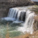 Visiting Three Waterfalls in Miami County
 Clifton Gorge in Spring
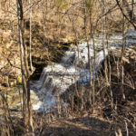 Fallsville Wildlife Area – Waterfall
The Girlfriend and I plan on going this weekend for a day hike trying to escape the the craziness that Memorial Day brings to the Lake Erie Islands.
How long would you say this trail takes? Trying to plan a day to drive out there from Cincinnati.
Really depends on your hiking speed. It’s just under 4 miles round trip with half the hike on hilly terrain and second half a flat trail following the river. For a day trip if you got an early start, you’d have time to do the hike and also visit nearby Malabar Farm if you were so inclined.
Now I want to visit there. And they have primitive camping!
Neita, we love Mohican. We haven’t camped there, but I think it would be fun. 🙂
I google’d it. It’s a bit of a drive from Maryland but I’ll put it on my wish list. Thanks for bringing attention to it.
cool place! great shots!
Thanks, marviiilous!
So beautiful. My heart was captured by the water fall photo!
Thank you! I think it has captured our hearts, too. We have been here many times. I took the flower photos published in the post, Unfurling, during our last trip to this place.