Indian Mound Reserve is a 169-acre park that’s managed by the Greene County park district. We were very favorably impressed by the park’s historic and natural features. Among the historic features are:
- Williamson Mound: a Native American, earthen mound constructed by the Adena culture between 500 B.C. and 100 A.D.
- Pollock Works: a Native American, earthen wall constructed by the Hopewell culture between 100 B.C. and 500 A.D.
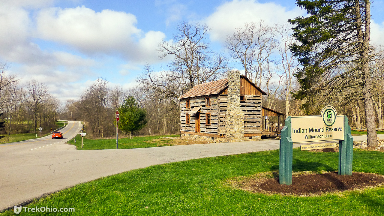
- A historic log cabin that’s currently being renovated
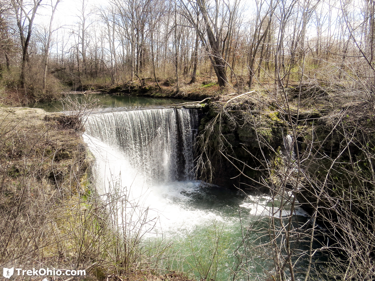
- A dam created that formerly powered a couple of historic mills; both are now long gone — the water cascading over the dam is known as Cedar Cliff Falls
Natural features include Massie Creek Gorge, cliffs, slump blocks, white cedar, wildflowers, ferns, and a small wetland. The park includes about four miles of hiking trails with a number of footbridges and stairs.
This historic log cabin is near the entrance to the park. It is believed that the cabin was originally build in Clark County around the year 1814, but in the late 19th century, the family of Samuel R. Heathcock dismantled the cabin log by log and moved it to its current site. The park is currently renovating the cabin.
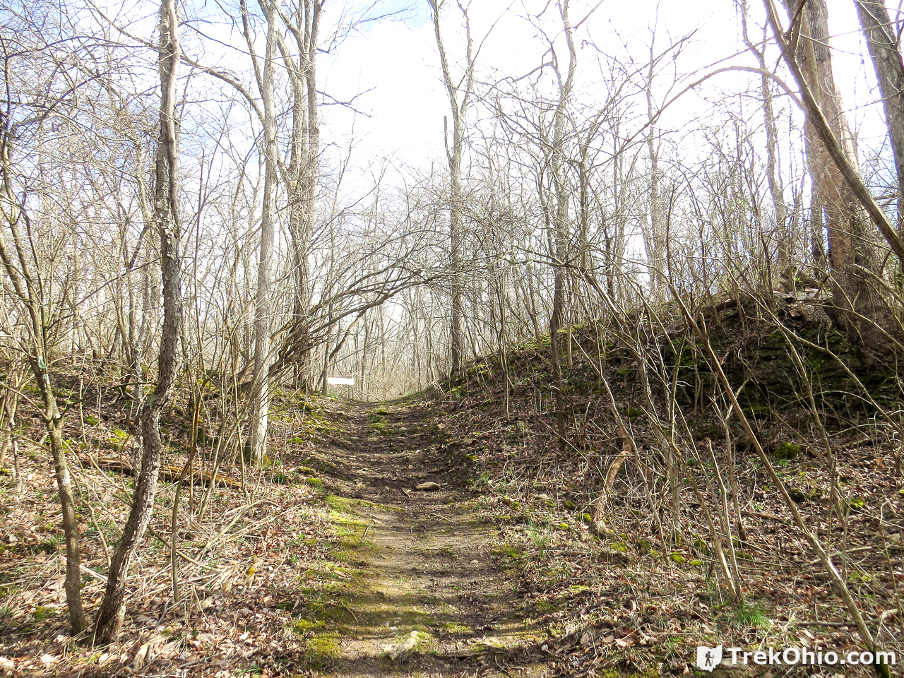
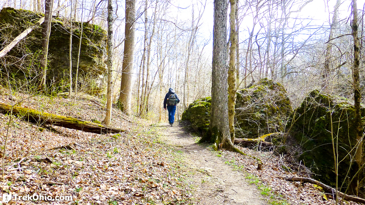
We started by going to the trailhead across the lawn from the parking lot; it was labeled, “Pollock Works .28 Mi”. This took us to the Enclosure Loop Trail, the Indian Loop Trail, and the Old Channel Trail (traced in yellow, then orange below). After this we returned to the parking lot and headed out to do the Mound Trail, the Lower Gorge Trail, and the Cedarcliff Trail to the waterfall (traced in magenta and blue below). When the trail names on the signs didn’t match those on the official map, I made a note of that below.

Pollock Works
After entering the trailhead labeled, “Pollock Works”, the trail passed through a woods with relatively young trees. However soon we had arrived at the actual Pollock Works. This is an earthen enclosure or wall made by Native Americans belonging to the Hopewell Culture. It is believed that the enclosure was built between 100 BC and 500 AD.
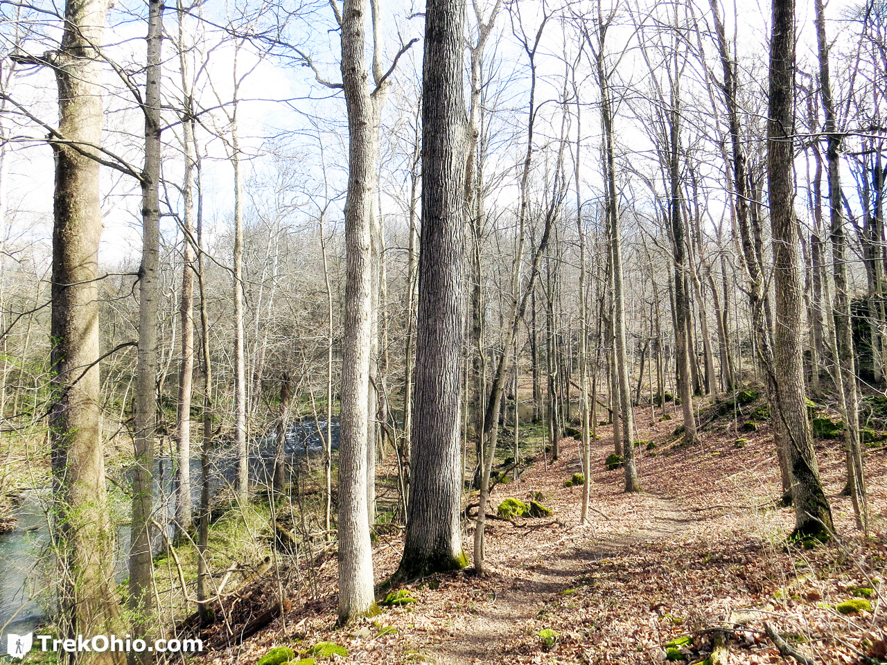
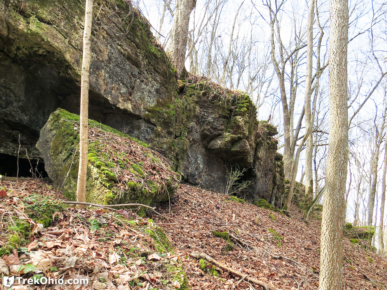
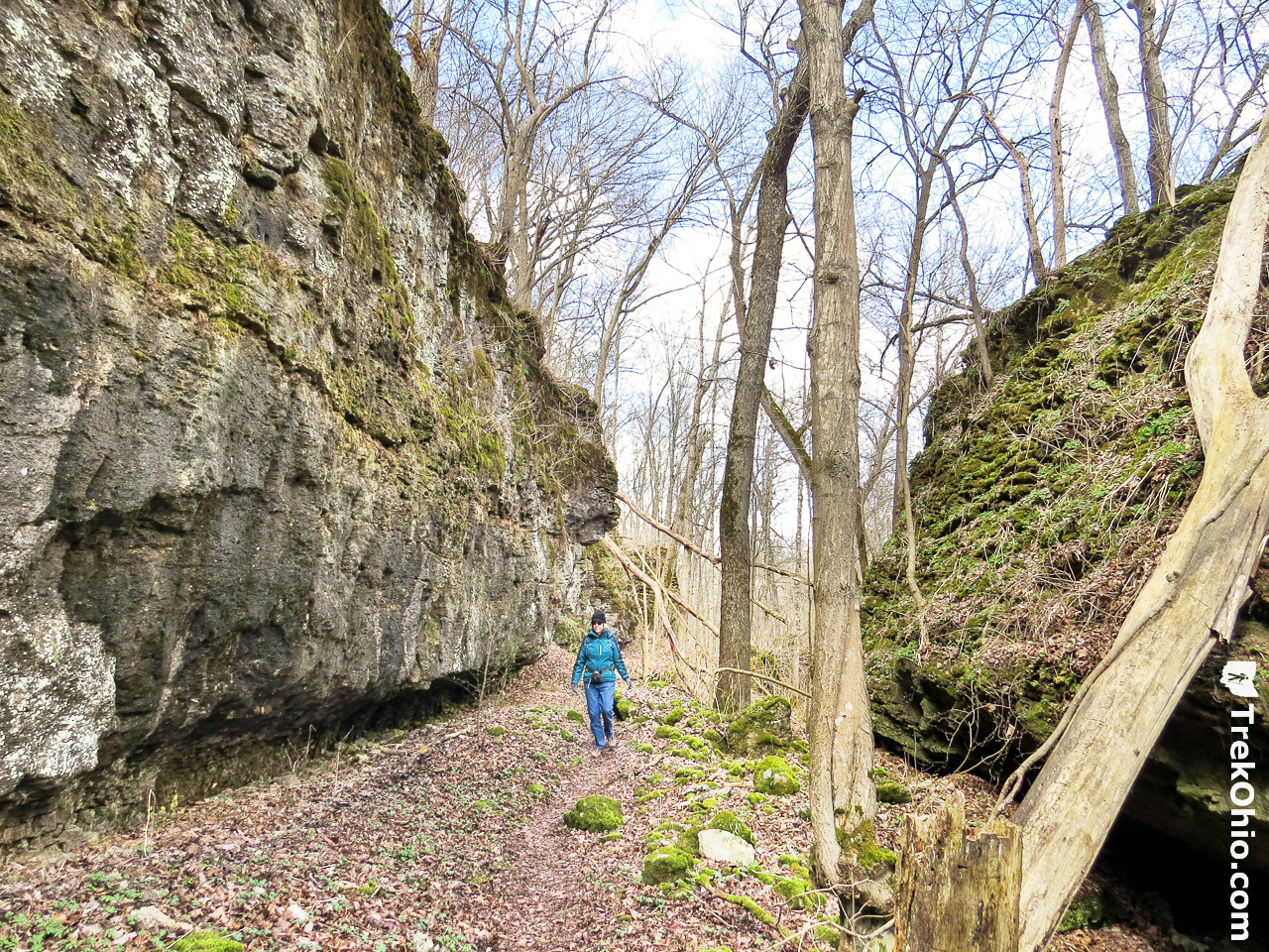
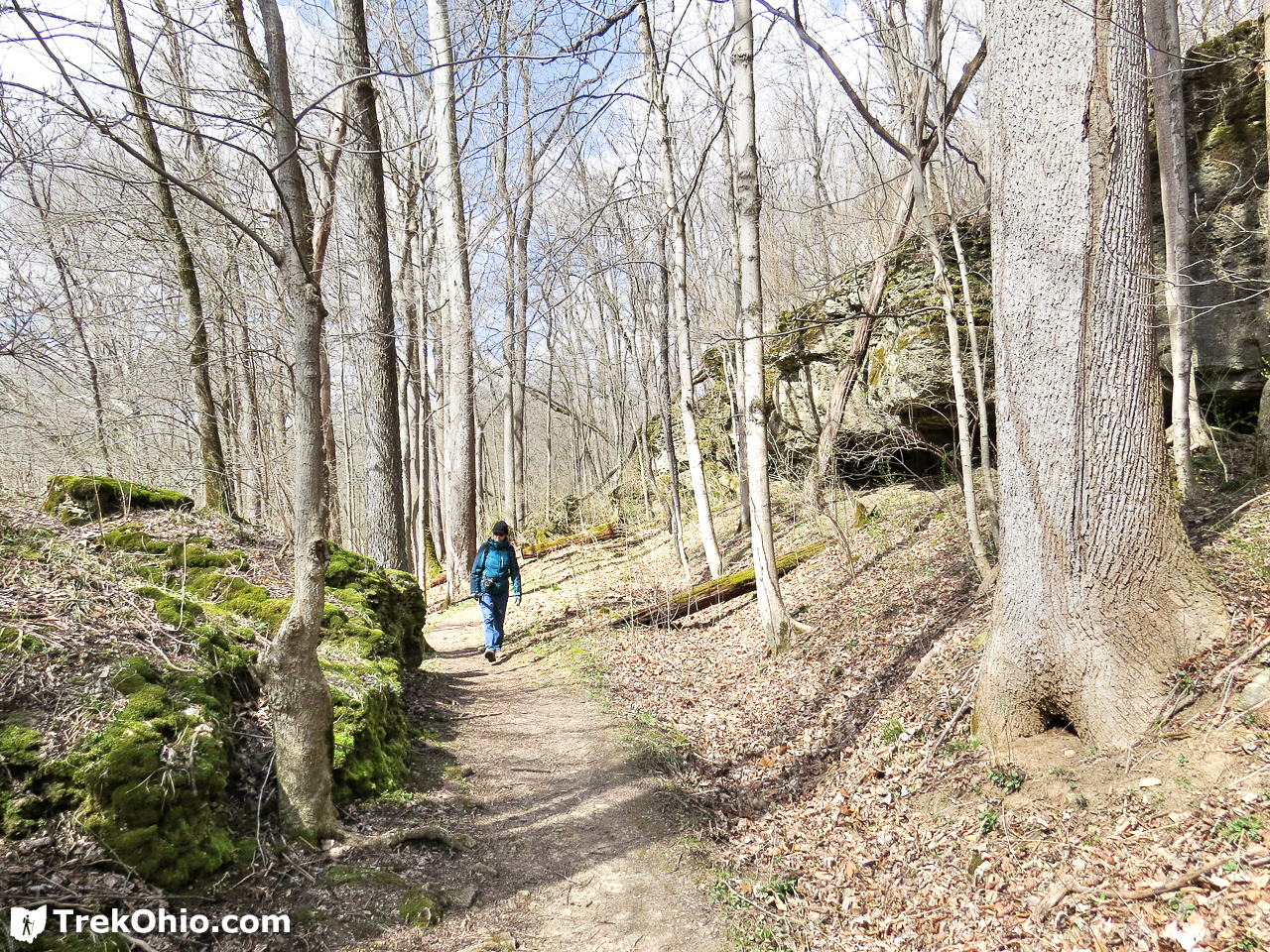
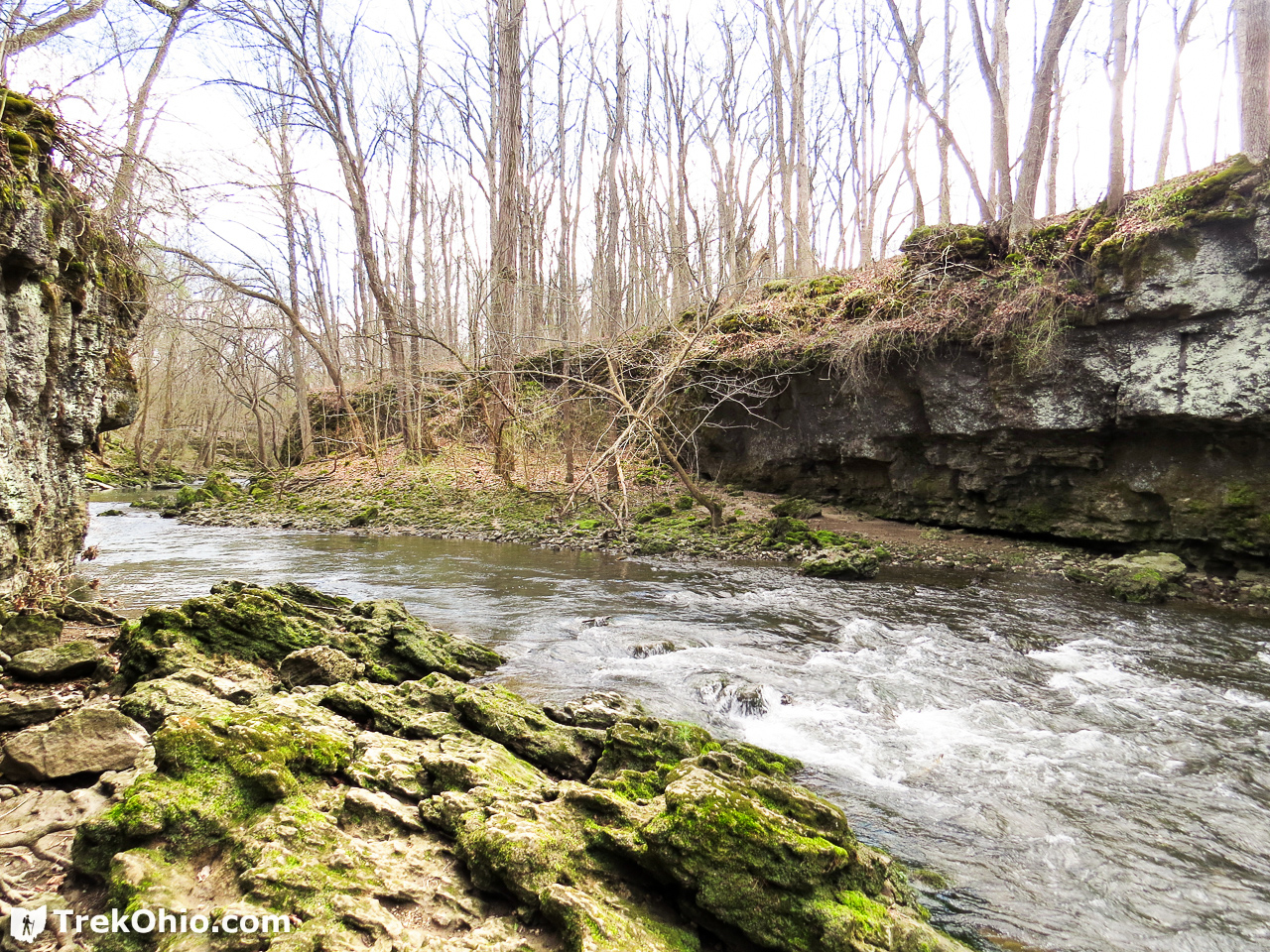
We then walked the Enclosure Loop Trail, followed by the Enclosure Loop Trail, followed by the Indian Loop Trail. I particularly enjoyed the Indian Loop Trail because this drew up close to Massie Creek and some impressive cliffs and slump blocks. Although we were visiting March 20th, we also caught sight of some early-blooming spring wildflowers in this area.
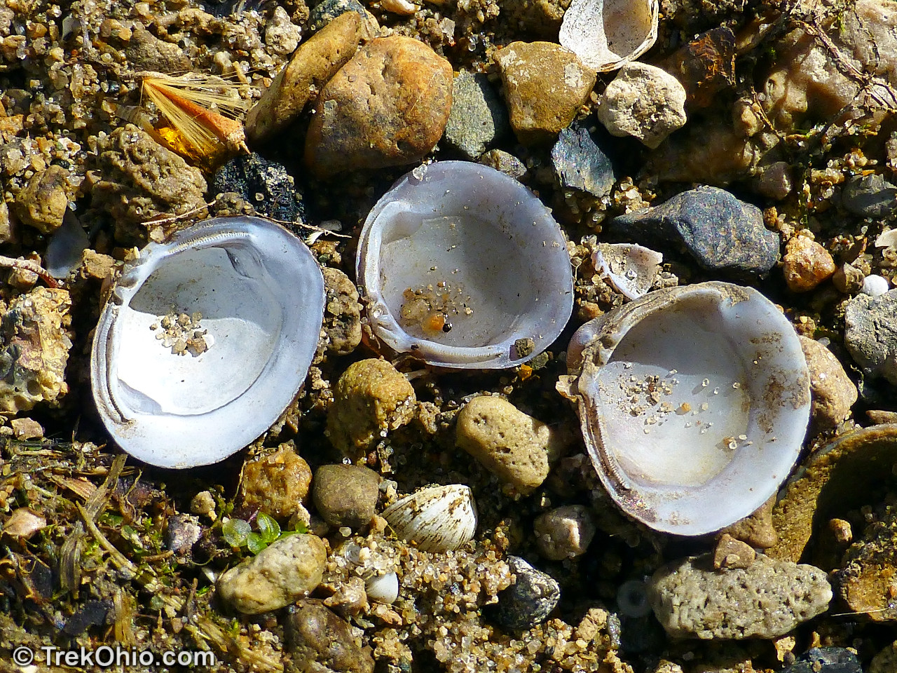
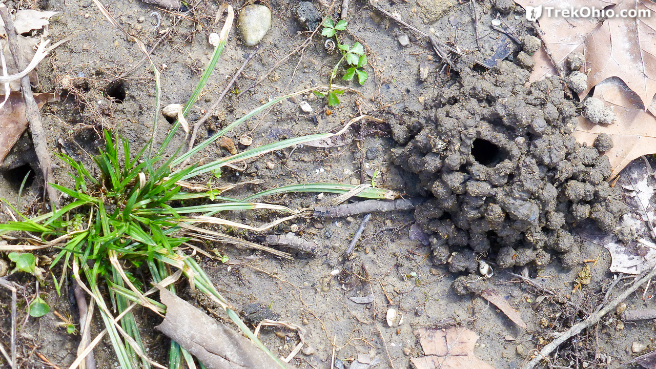
We saw signs that both fresh water mussels and crawfish lived in Massey Creek. These animals are both indicators of good water quality.
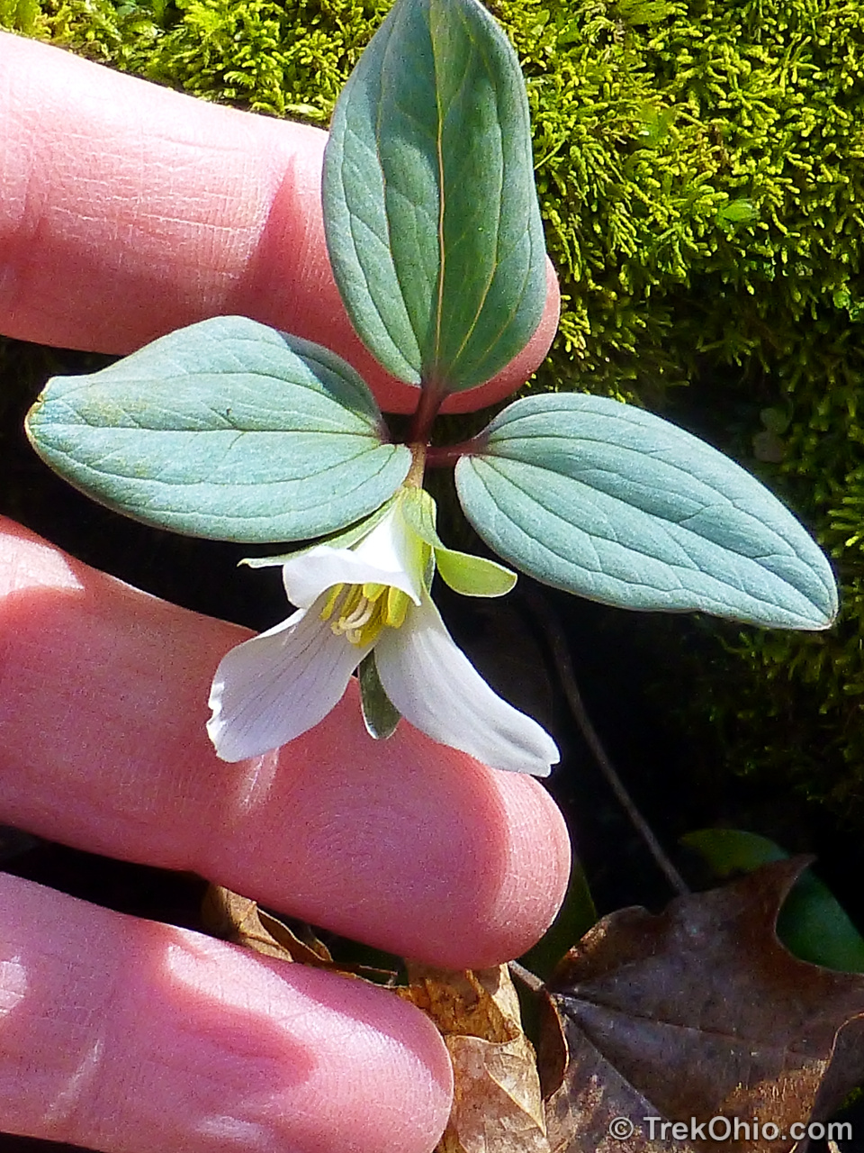
Some boulder-sized slump blocks were covered with both moss and snow trillium. This is our tiniest, earliest-blooming trillium. Other wildflowers that we saw included Harbinger of Spring, hepatica, and bloodroot.
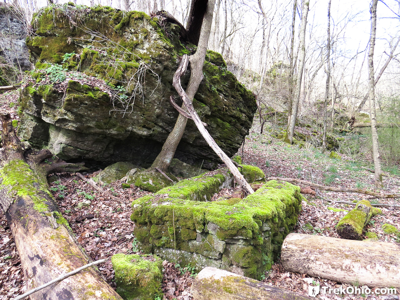
We passed the ruins of a small building’s foundation.
The Mound and the Falls
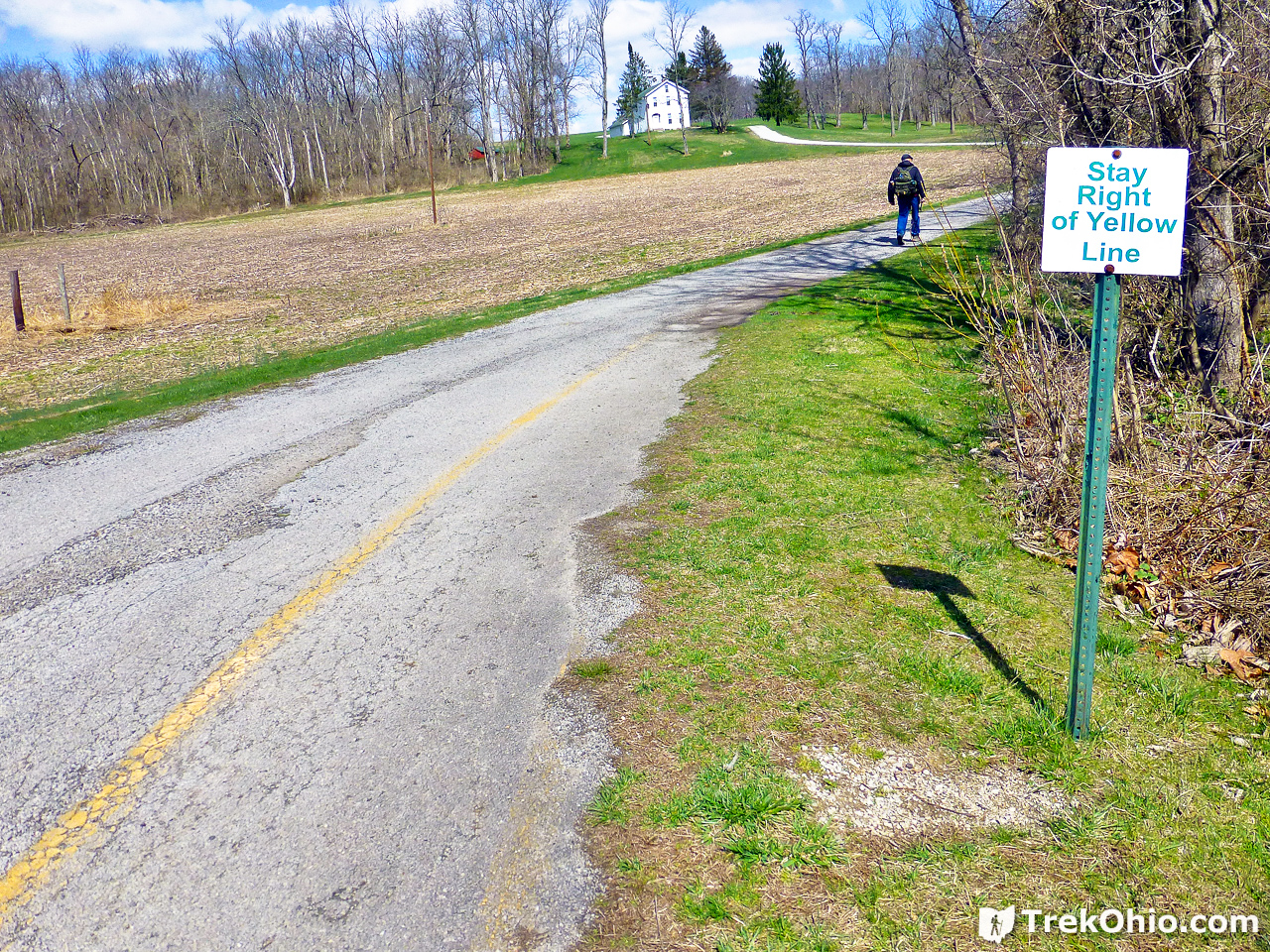
From the log cabin, it looks like the park’s driveway continues beyond the parking lot, that is not the case. From here on out the driveway is a private road that leads pack to a private residence. However, visitors to the park have to walk along the right-hand side of this private road to hike the trails leading to the Williamson Mound and Cedar Cliff Falls.
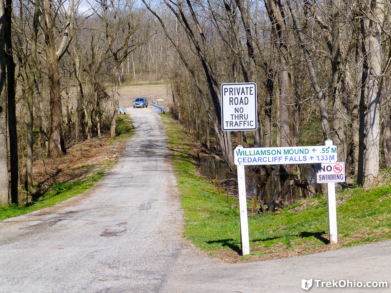
It was a relatively short walk to Williamson Mound, and it ended up being bigger than I was expecting. There was a sign at the bottom of the mound saying that the stairs up the mound were closed, except there were no stairs. From looking over the park’s brochure, a photo of the mound showed stairs that are no longer there. This resulted in some confusion as to whether it was okay to climb to the top of the mound using the dirt path that remained.
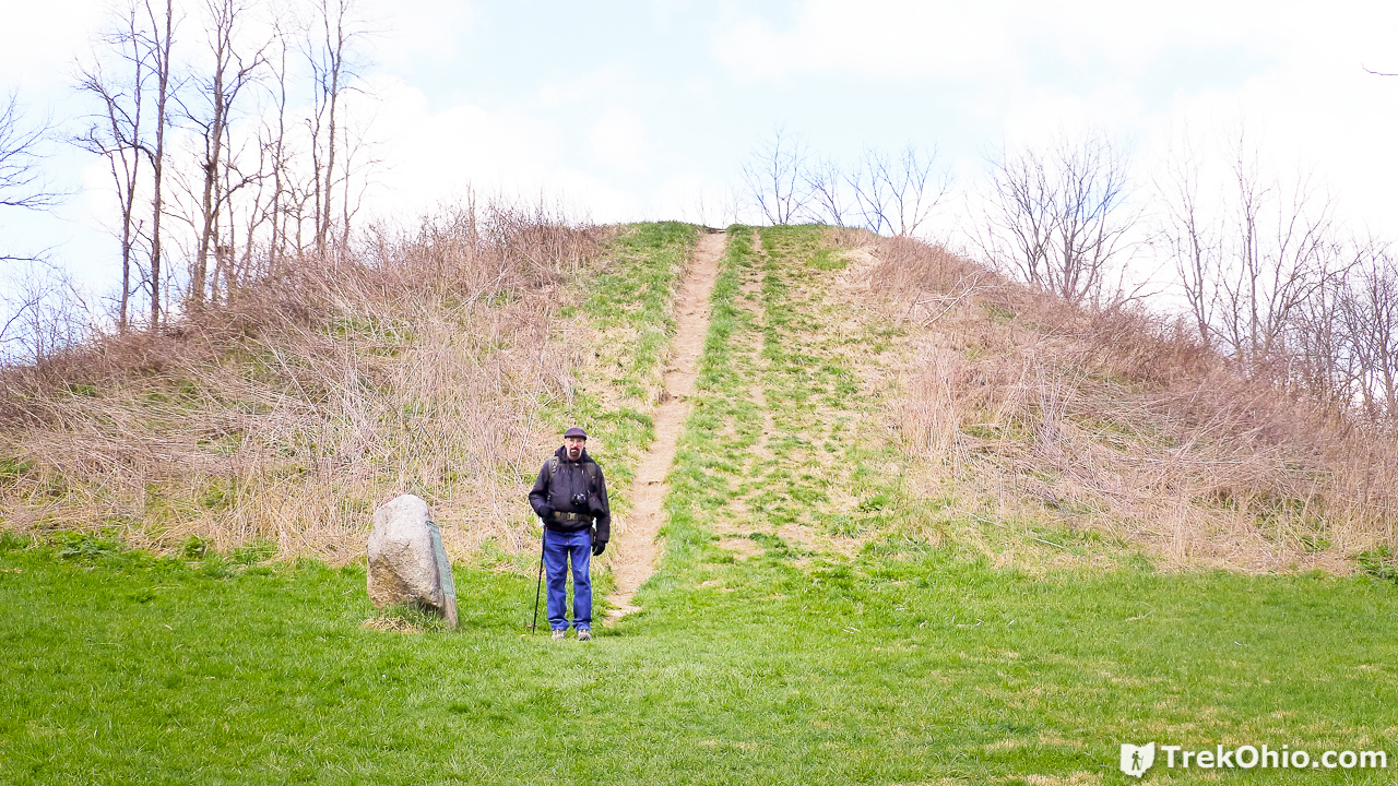
Since the mound was never excavated, it is not clear whether it was a burial site, a look out site, or perhaps served some other service. It is believed to have been constructed by the Adena Indians between 500 BC and 100 AD. Originally it is believed to have been between 30 and 40 feet high, and 144 feet in diameter. However, it has been somewhat degraded from erosion and man-made disturbances.
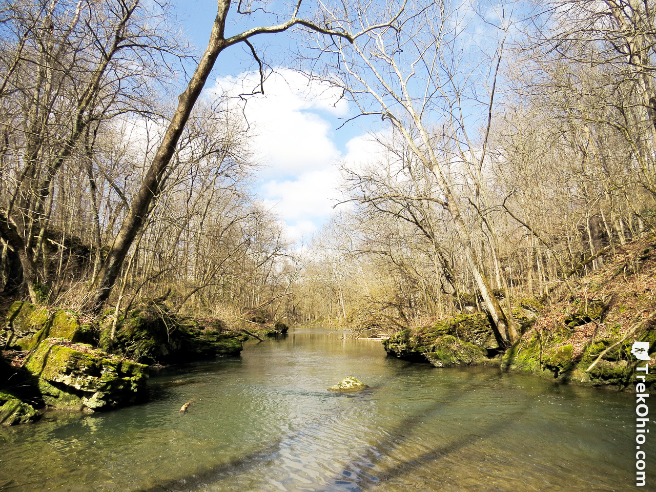
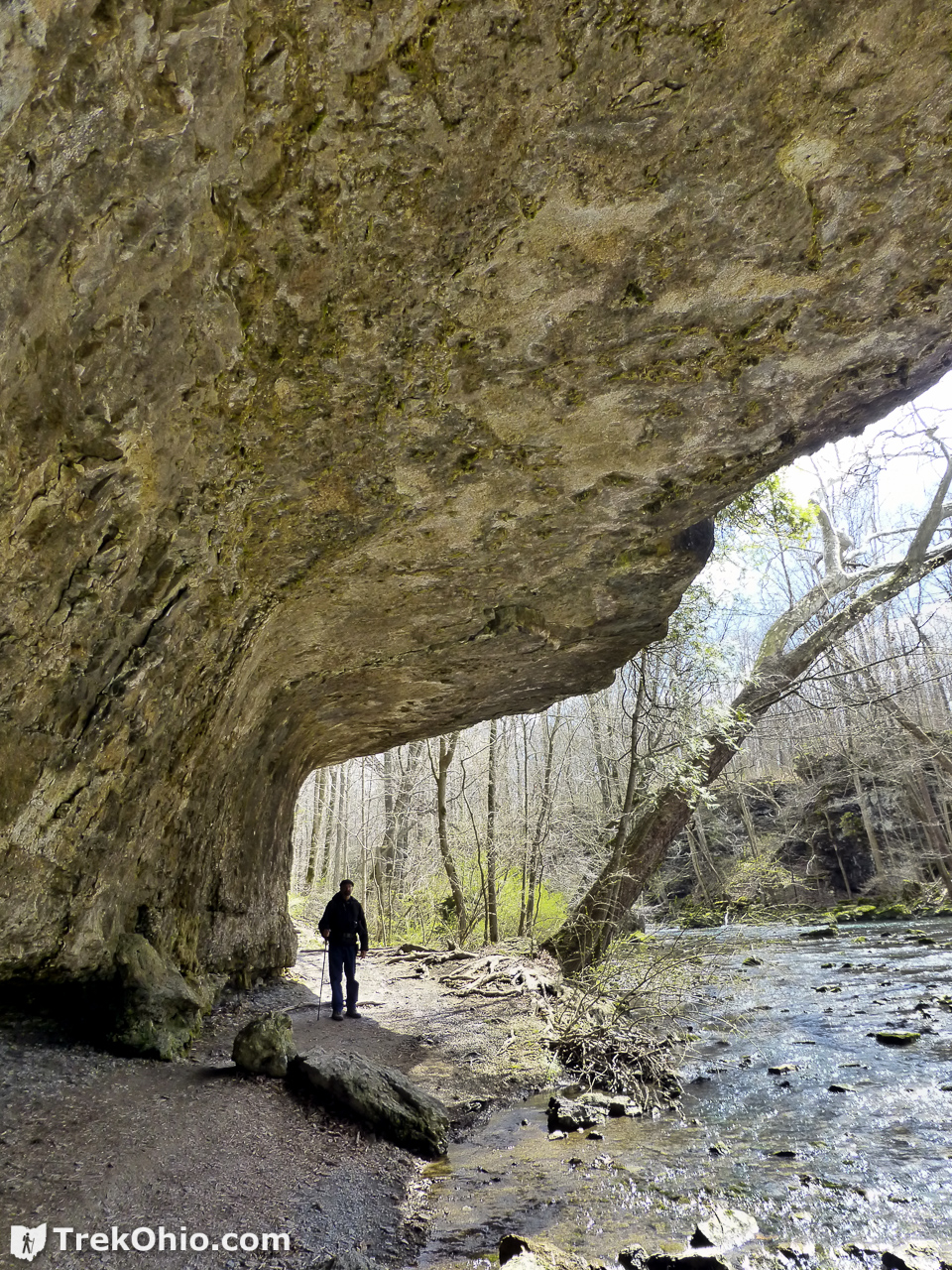
We retraced our path back from the mound until we came to the point where the trail branched. By crossing over a small footbridge we were on our way down the Lower Gorge Trail. We passed some impressive cliffs and slump blocks along the way.
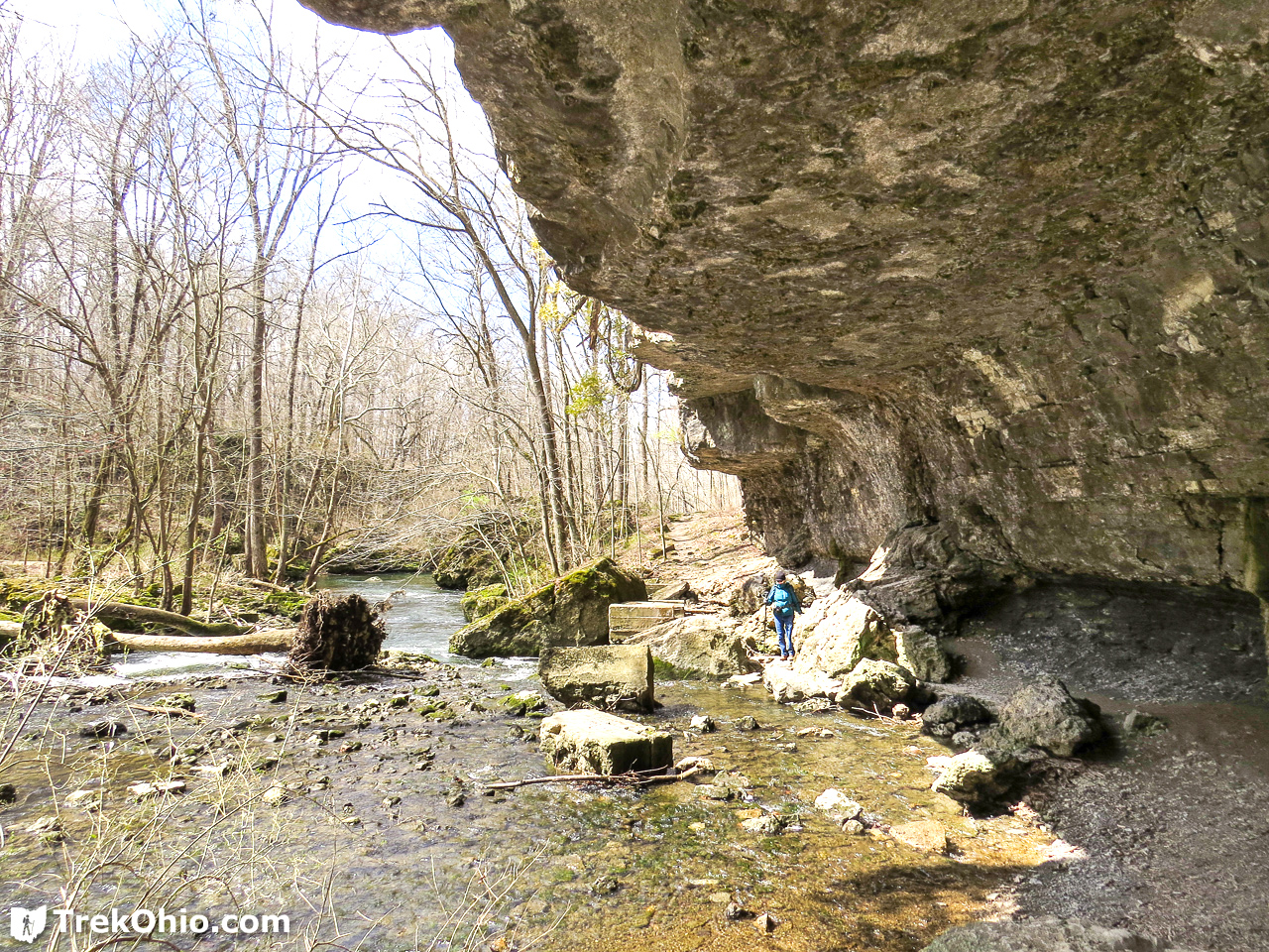
We eventually came to a really large cliff by the water’s edge next to concrete slabs that probably once supported a bridge.

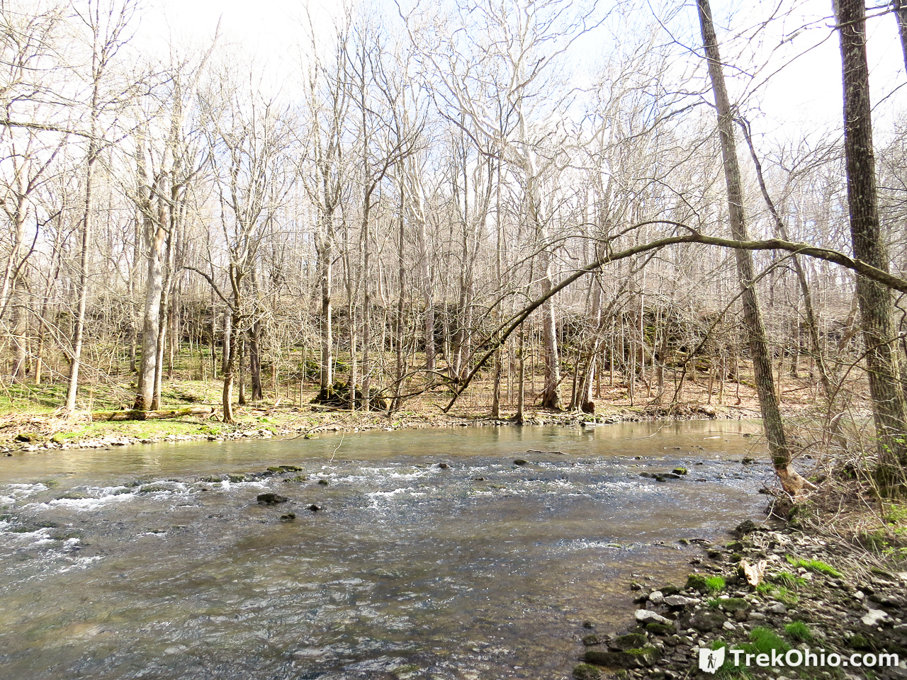
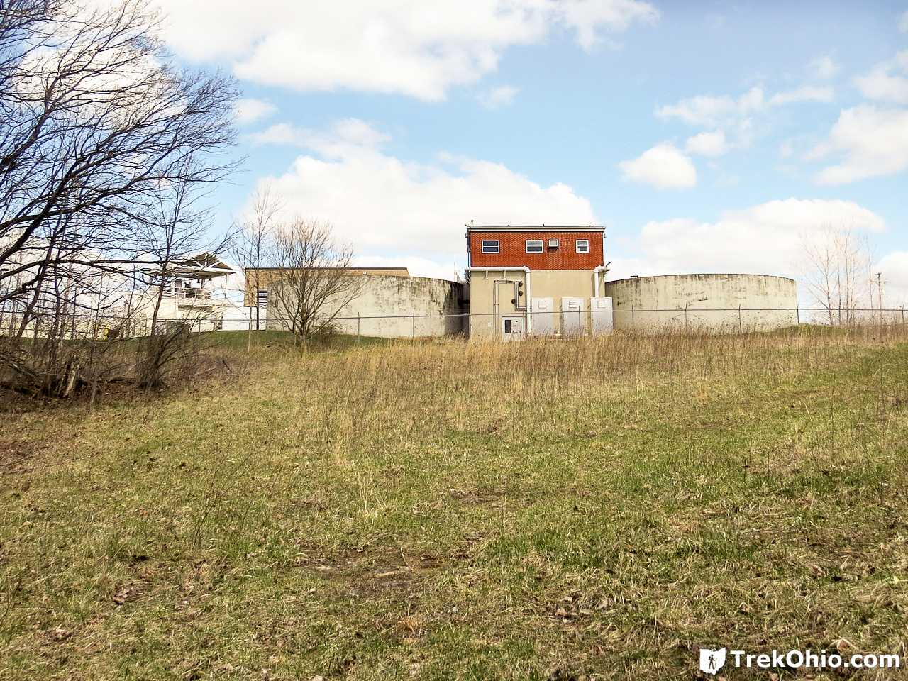
After continuing on a ways, we reached a large wooden staircase that took us up to the rim trail. On the map this is called the “Upper Rim Trail”, but on the trail-side signs it seemed to be called the “Cedarcliff Trail”. After walking along this rim trail a short ways, we noted this water treatment plant above the trail.
Near here there is another staircase leading back down into the gorge, and dead-ending at the creek. This staircase was concrete with a steel railing. I’m not sure if it was meant to do anything other than afford another view of the creek, but we took advantage of it. Below is a photo showing the view from the base of the staircase.
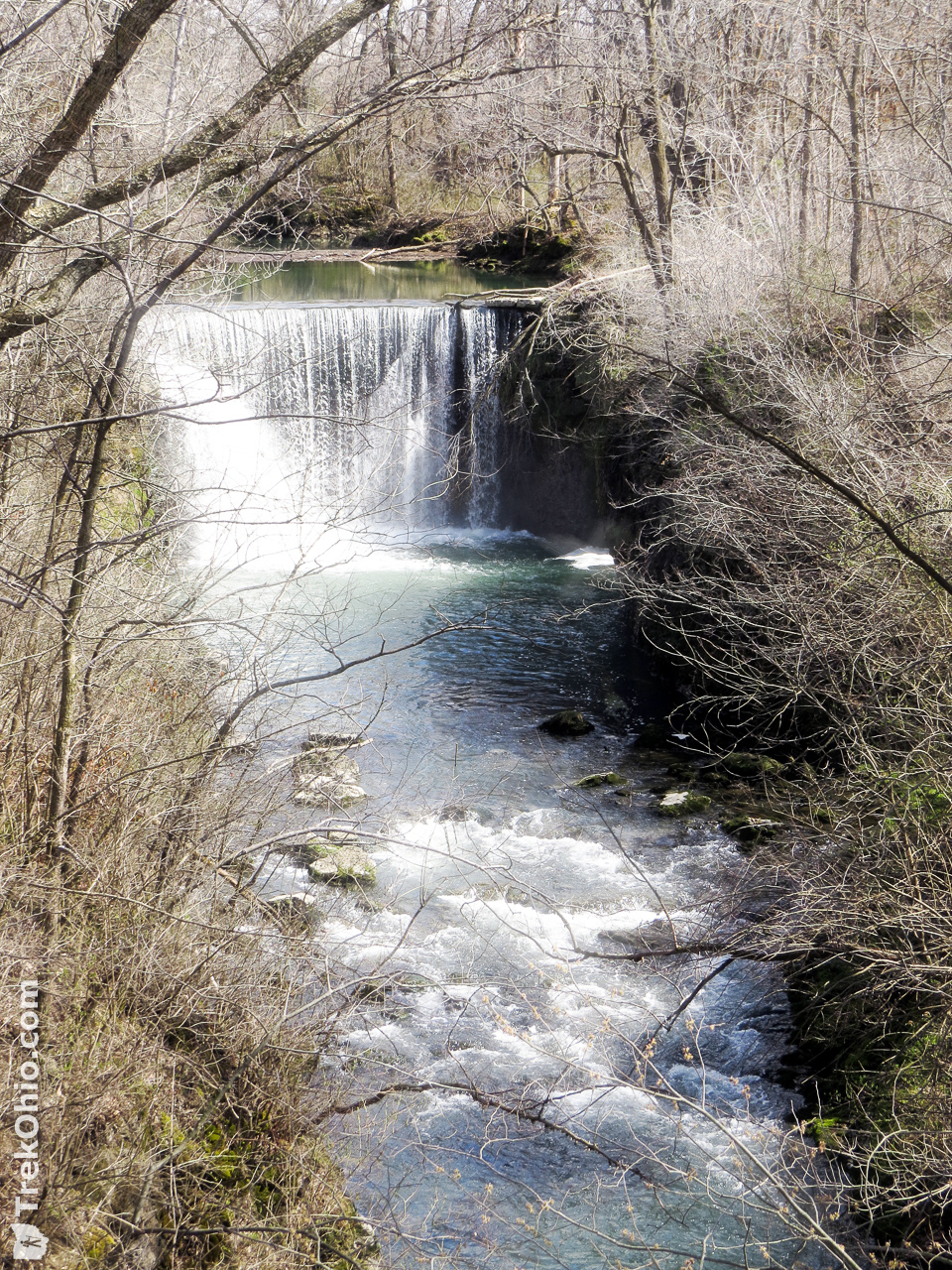
We climbed back up to the rim trail again, and continued on to Cedar Cliff Falls. We photographed the falls from the observation deck (the topmost photo in this article). However, you can also get a good view of the falls from a downstream footbridge that crosses Massie Creek.
If you cross the creek via this bridge, there is lawn with a picnic shelter and a parking lot. So visitors who just wanted to view the falls without doing much hiking could park here.
Cedar Cliff Falls flows over a dam constructed of stone blocks. The blocks were built to form an arch that bends toward the incoming water. Apparently the pressure produced by the water hitting the arch presses the stone blocks together and seals them against the water. Apparently two different mills made use of the hydropower produced here: first Harbison Mill (until 1917), then Hager Straw Board and Paper Company (until the late 1930s). At this point we hiked back to the parking area.
Additional information
- TrekOhio: Waterfalls!!! – our list of Ohio waterfalls
- TrekOhio: Guide to Common Spring Wildflowers in Ohio
- TrekOhio: Greene County Parks & Preserves
Location
- Address (approximate): 2651 US-42, Cedarville, Ohio 45314
- Directions:
- GPS Coordinates: 39.737751, -83.828793
- Google Maps: View on map or get directions. Note that a portion of Indian Mound Reserve is known as Peterson Park, Google Maps uses this name rather than ‘Indian Mound Reserve’.
More on Greene County
 Clifton Gorge in Spring
 Spring Valley Wildlife Area
 John Bryan State Park
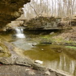 Glen Helen Nature Preserve
I went here for the first time back in March, it’s a great park.
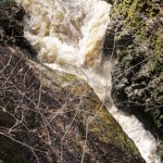
If you continue past the stairs on the lower rim trail there are some smaller waterfalls on Massies Creek that I thought were amazing. The trail does dead end there, so you have to backtrack to the stairs to get to the Upper Rim trail.
Matt, that’s an oversight on our part! I think we did see the waterfalls that are describing. Here’s a photo:
Yes, that’s the spot. For me that was the best part of the park.