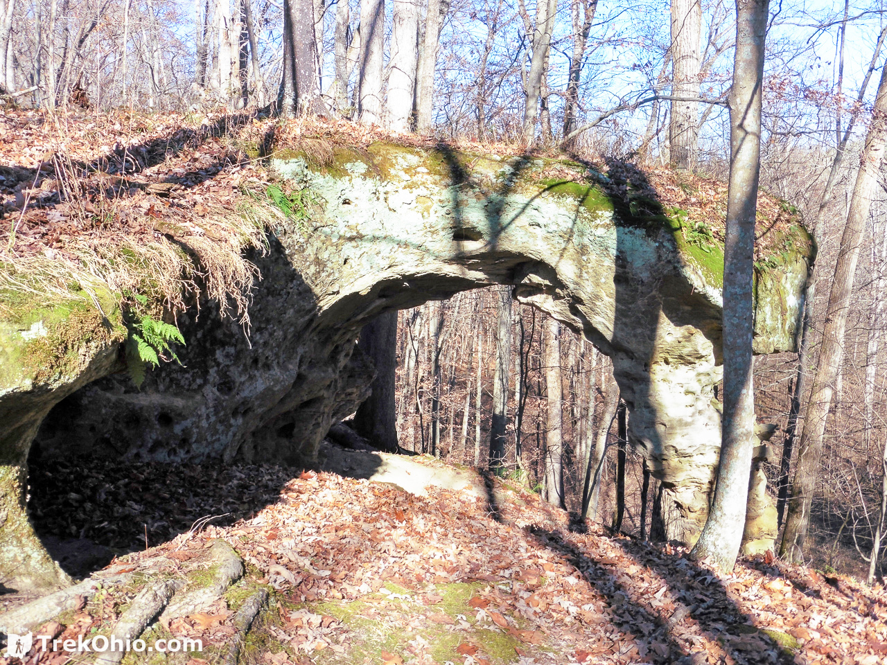
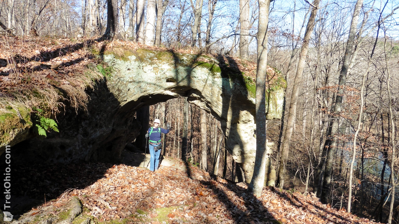
The day after Thanksgiving Bob and I decided to hike to Arch Rock, one of Ohio’s 80 or so natural arches. A natural arch is simply a hole through a rock outcropping that was produced by erosion. In some cases, the hole isn’t that big. However Ohio does have a number of arches that are big enough for a person to stand beneath the arch with room to spare. Arch Rock is one of these larger arches. It has a 9.7-foot span with 8.25 feet of clearance.
Getting Oriented
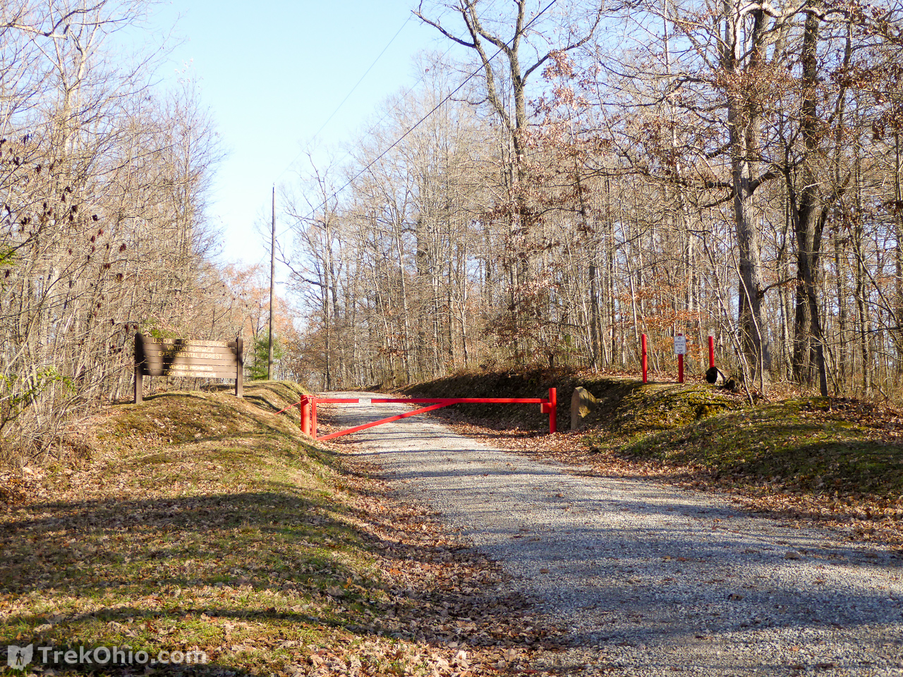
As you approach the area on a gravel road (the Experimental Forest Road), you will encounter an orange gate dead ahead with a parking area off to the left. After parking you continue following this gravel road on foot until you reach the center of the research complex where there are a number of buildings, a picnic area, and public outhouses. Trails emerge from the center like spokes on a wheel. All of these trails are basically gravel, forest roads.
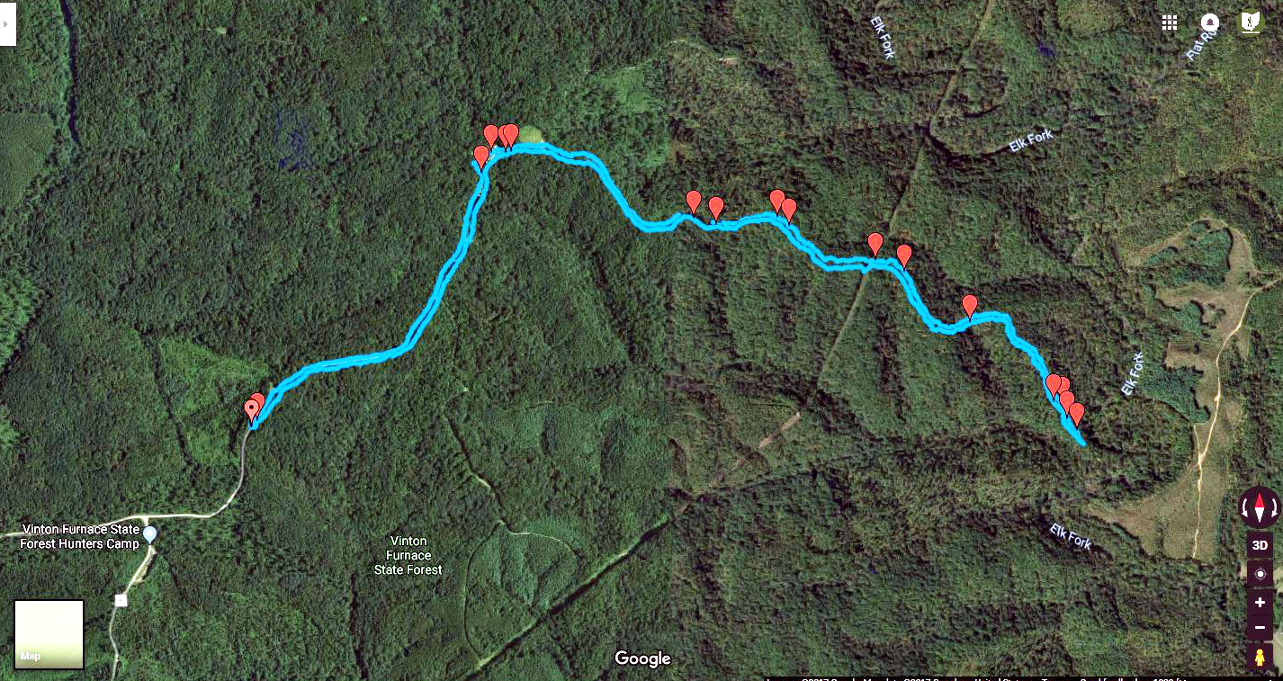
In the map below, you park in the lower, left corner (just above the “tent” icon which is identifying the location of a campsite for hunters). You then walk toward the headquarters where you will have a choice of trails. Each trail is represented by a line of blue dots on the map. We followed the “Arch Rock” trail, but as you can see on the map below this trail does not extend the entire way to the natural arch which lies near the creek, Elk Fork (marked by one of the stars on the map below). On this map the trail terminates at a dashed line that crosses the map diagonally. This dashed line marks a cleared area that must represent a right-of-way for some utility (for instance, buried gas lines). For the sake of comparison, immediately below the map is a GPS trace of our hike to the arch. You can “see” the dashed line from the map on the satellite view of the GPS trace because the area is cleared of trees and makes a line or ridge in the satellite view.

Because we weren’t sure what the trail was going to be like after passing the utility right-of-way, and because we have previously been in the situation where we couldn’t figure out where a natural arch was because we were standing above it ![]() , we decided to make use of a GPS tool. In our case, we were using the Android App, MyTrails. Bob discusses this tool in our post about MyTrails, but one of its features is that it lets you enter the GPS coordinates for a way point. So as soon as we parked at Vinton Furnace Experimental Forest, we entered the coordinates for Arch Rock (which are 39.190667, -82.371583), and we started tracing our hike. If at any point we wanted to reassure ourselves that we were still heading toward the arch, we could compare the trace of our hike to the way point showing the arch’s location.
, we decided to make use of a GPS tool. In our case, we were using the Android App, MyTrails. Bob discusses this tool in our post about MyTrails, but one of its features is that it lets you enter the GPS coordinates for a way point. So as soon as we parked at Vinton Furnace Experimental Forest, we entered the coordinates for Arch Rock (which are 39.190667, -82.371583), and we started tracing our hike. If at any point we wanted to reassure ourselves that we were still heading toward the arch, we could compare the trace of our hike to the way point showing the arch’s location.
Many GPS devices and apps allow you to upload someone else’s GPS trace, so you can essentially follow their trail while you are hiking. If you would like to do that, feel free to download the GPX file showing our hike to Arch Rock. With that said, I do think it is possible to hike there without the high-tech assistance. In this post I will include representative images of the trail quality, and point out a few landmarks that you might want to make note of.
The distance from the parking lot to the arch and back again was 5.4 miles with a cumulative gain in altitude of 1387 feet.
From Parking Lot to Forest Headquarters
The gate marks the end of your drive, but the gravel road is open to foot traffic. Park to the left and head out on your way. It is about nine tenths of a mile to the forest headquarters.
Once you come to center of the research complex, you’ll find a variety of buildings including residential areas.

It was about lunch time when we arrived so we took advantages of the picnic area to have a pleasant meal.

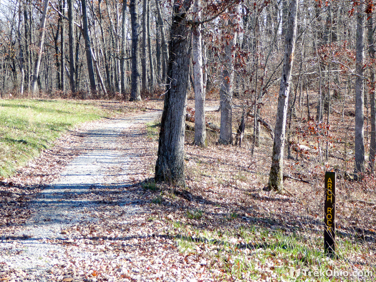
The Gravel Road called Arch Rock
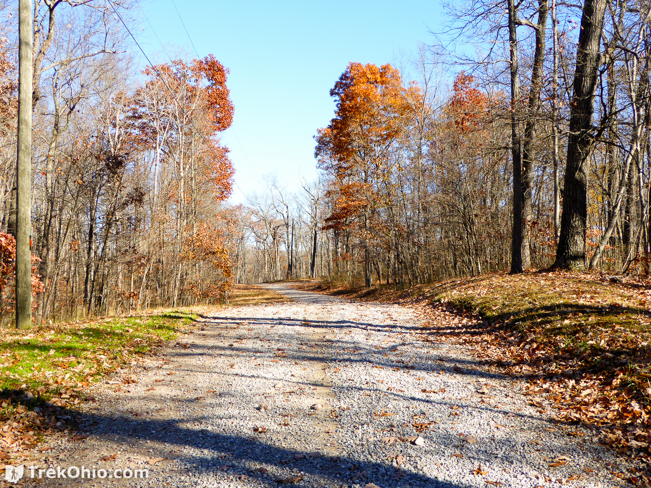
To follow the Arch Rock gravel road head off in the direction of the out houses. A short way beyond these, you’ll see a vertical sign announcing the road.
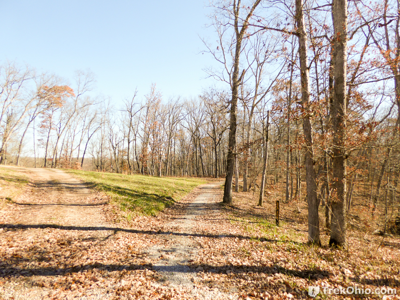
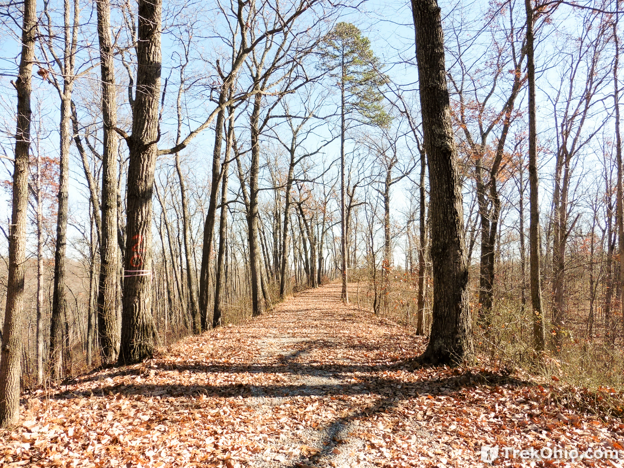
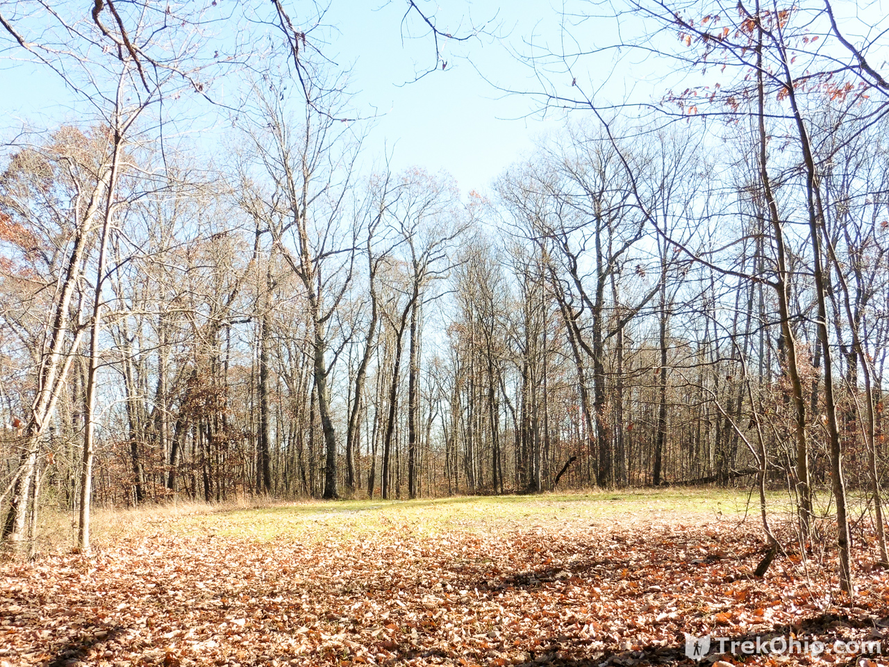
It was a beautiful day when we were there. Most of the trail followed a ridgeline. In the photo below fallen leaves are concealing the gravel road surface.
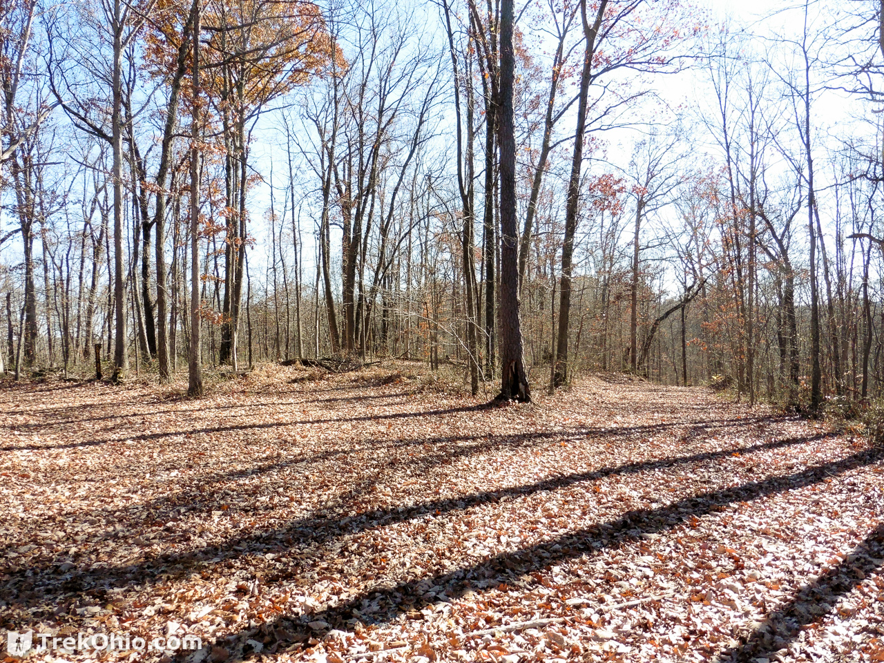
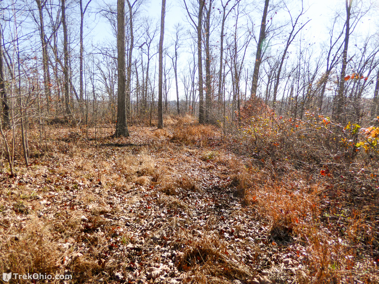
You will occasionally pass broadly cleared areas like the one below. In this case the trail continues off to the right.
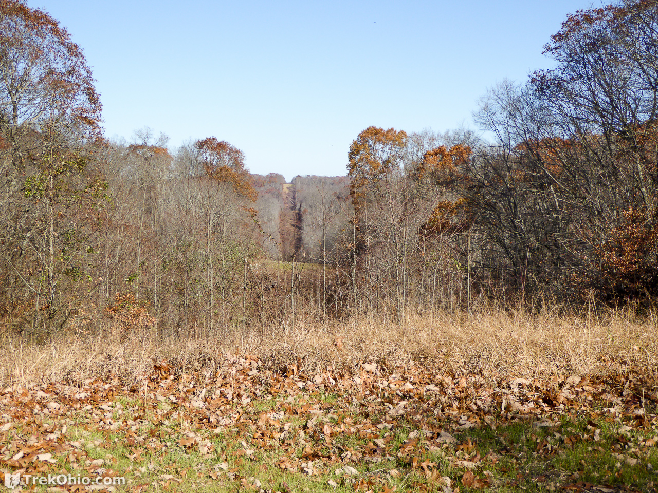
The Utility Right-of-Way
Out of nowhere, a lawn comes into view. After you enter this area, it is clear that you are on a right-of-way.
Here Be Dragons
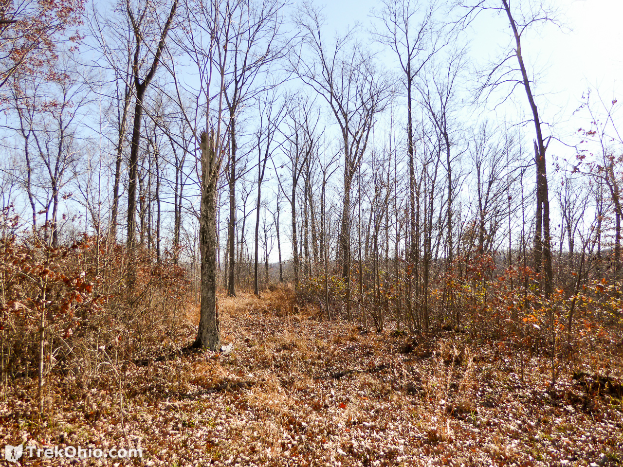
So now that we’ve passed through the clearance that makes up the right-of-way for some utility, we are beyond the end of the road shown on the map. Before us was a road just as broad and clear as the one we had been hiking on prior to the utility area. So at this point it looks like finding the arch is going to be a piece of cake.
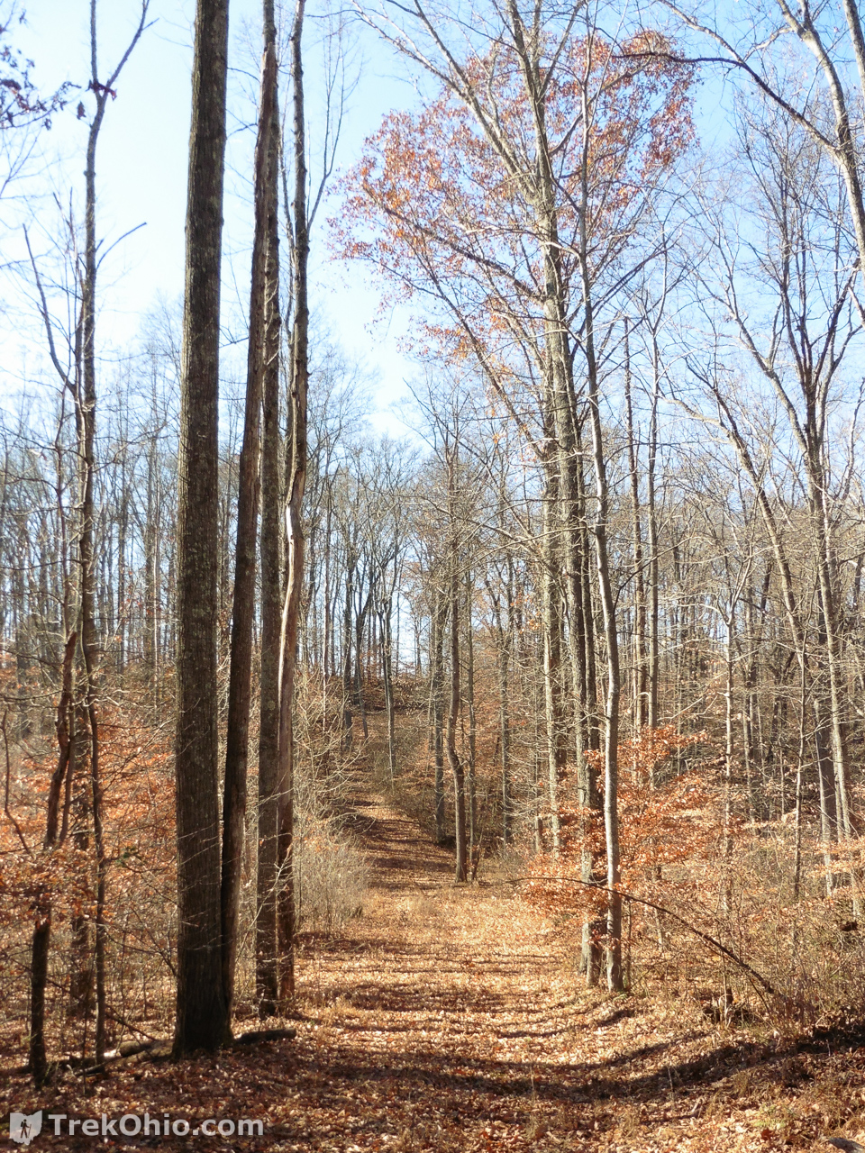
As we continued on the trail it began to become a bit more rough with us having to step over an occasional fallen timber, and with perhaps a few more weeds popping up in the trail. But overall the trail was broad and easy to pick out.
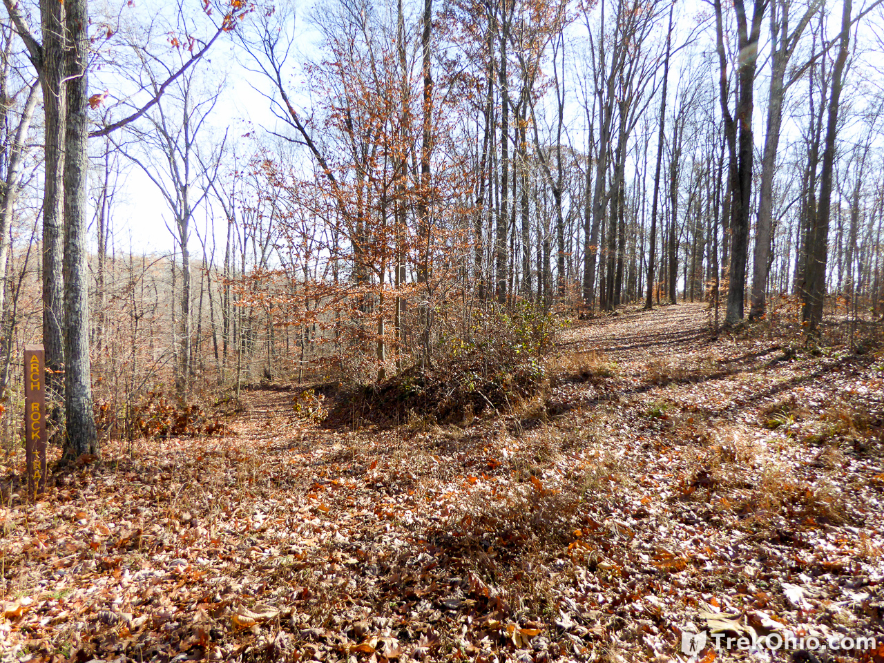
Then we came to a fork in the trail. The main trail seemed to be heading up and to the right in the photo below, but that’s not the right way for this hike. In the far left of the photo below you can see a vertical sign saying “Arch Rock Trail.” At this point you leave the broad trail and enter this foot path. This is the last sign that you’ll see on the way. There are no blazes to reassure you that you are still on the path. So at this point you’ll be picking out the trail because it is less brushy and weedy than the surrounding territory.
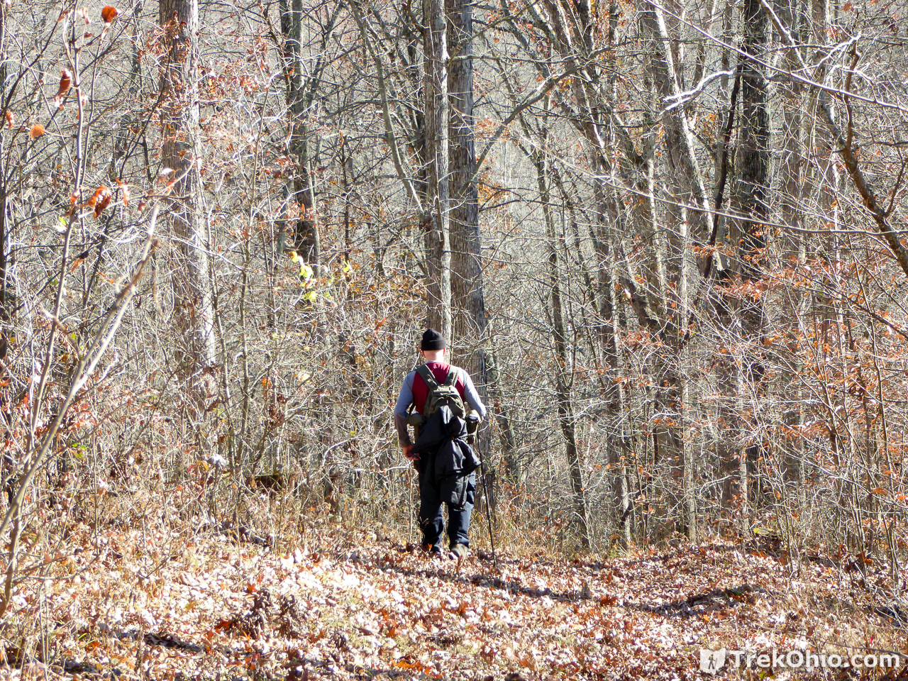
Arch Rock Trail: the Foot Path
I think this is a great time of year to visit this area. Although you can see that the trail is somewhat weedy in the photo below, most vegetation has died back, so I think this would be a harder hike in the summer when undergrowth would be at its peak.
I just wanted to point out the landmark below. There’s what looks like a dead tree snag to the left of the trail, except it is apparently refusing to die because there are fresh branches emerging out of it. At any rate if you see this you can reassure yourself that you are still on the right trail.
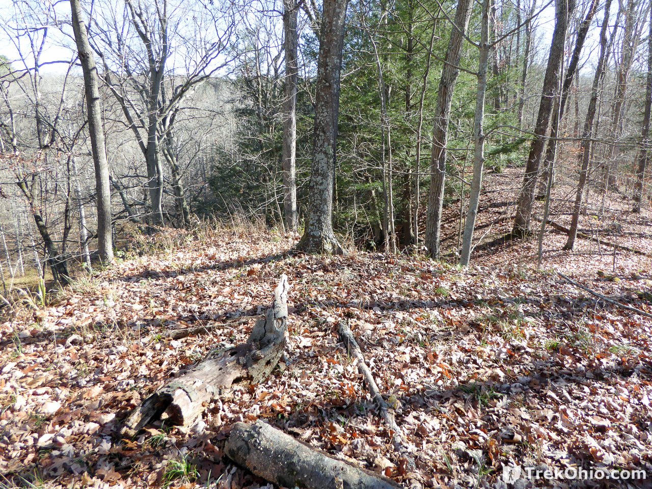
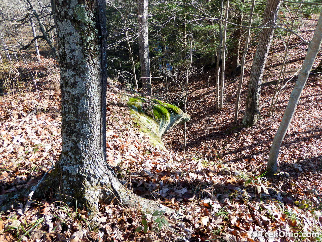
In the photo below, we are almost at the arch. We have been following a ridgeline. Beyond and to the left you can see a hollow with a creek flowing in it. That is the Elk Fork. Note the broken log on the ground. And ahead just right of center, note the tree that has dark bark with light-colored lichens growing on it. Approach that tree.
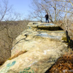
As you draw near this tree, you can see a rocky outcropping jutting out to the side. That’s part of the arch. As was the case when we were hiking to Trimmer Arch, we are once again approaching the arch from above. So at this point we need to descend the ridgeline to the right.
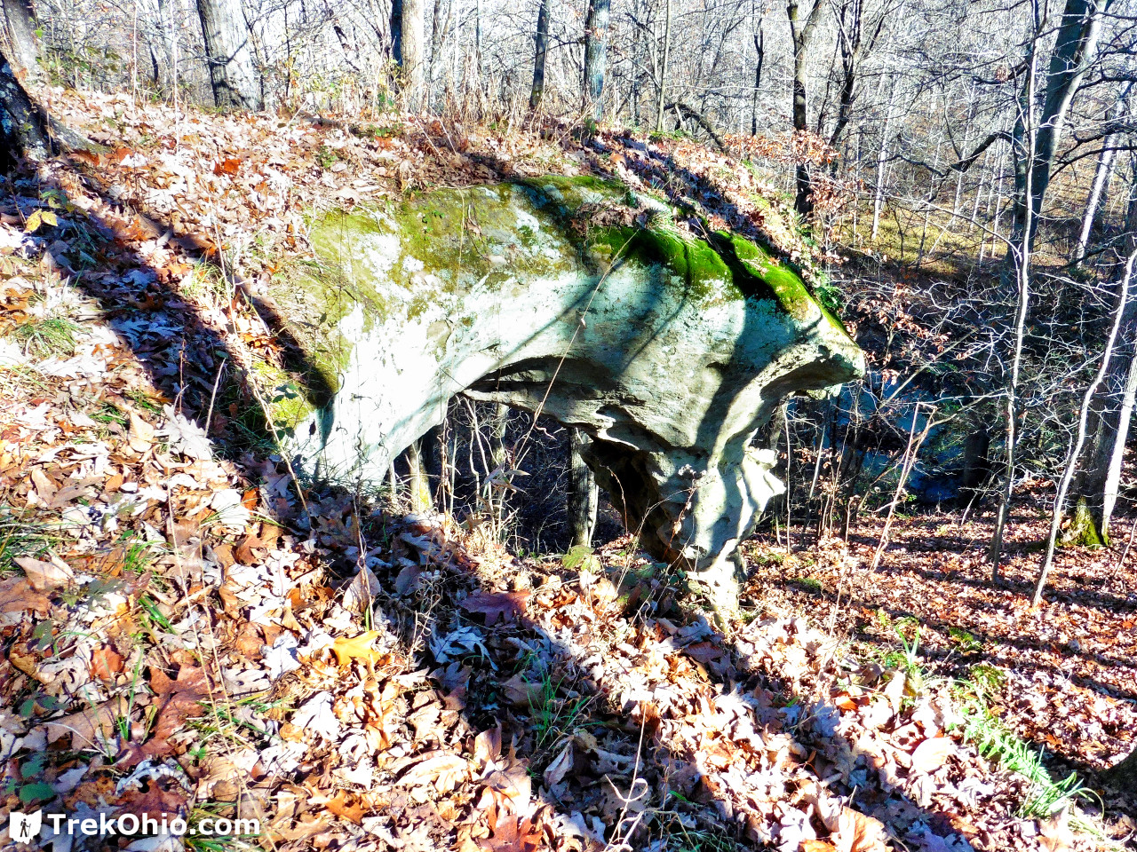
Arch Rock
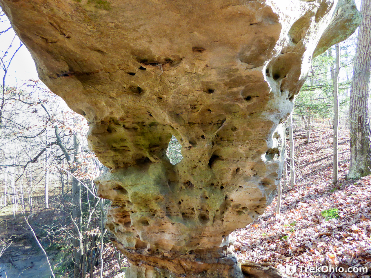
So we are here at last. While taking the photo below we are on a slope above the arch. The area immediately under the arch is flat, exposed bedrock. Just beyond the arch there is a very steep incline into the hollow where Elk Fork is. I did go under the arch, but I didn’t think it was safe to try going beyond it.
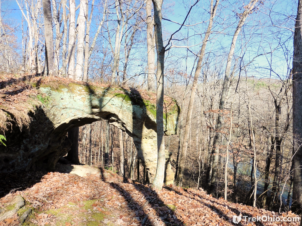
Below is a photo of the rock pillar that’s holding the arch up. As you can see there is a little window in it — a mini-arch. 🙂
And below is a panoramic photo showing the region around the rocky pillar. As you can see to the left of the pillar there is a steep drop off. You can click on the photo to enlarge it. Alternatively, if you are using a desktop computer and would like to see it as large as possible, try right clicking on the panoramic and opening the link in a new tab.

Overall we really enjoyed the hike. Seeing the arch was fun, and the weather was just perfect. For us using the GPS way point was a win, but I don’t think it was absolutely necessary.
There are still many arches that I haven’t seen in Ohio, but of those that I have visited my favorite so far is Keyhole Arch in the Fort Hill Preserve in Highland County. What I really liked about it is that the arch penetrates 90° through a hilly ridge, so it’s like passing into a hidden world. However you have to cross a creek twice to use the trail that passes through the arch, and the water is too high to just wade across while wearing hiking boots.
A more accessible arch that is spectacular in its size is Rock House in the Hocking Hills. And if you are in the Hocking Hills, there is another, nearby natural arch at the Rockbridge State Nature Preserve.
Additional information
- TrekOhio: Vinton Furnace State Experimental Forest — This is our review of Vinton Forest; we discuss the overall layout and what’s so experimental about this forest. We also describe some hikes and the ruins of an old iron furnace and a Belgium coke oven.
- TrekOhio: GPS Mapping Apps: MyTrails – a Replacement for Google MyTracks — This is the Android app that Bob used on his phone to assist us in locating Rock Arch.
- TrekOhio: Trimmer Arch — This is an account of us hiking to Trimmer Arch in the Paint Creek Wildlife Area which was more challenging to find because there are no trails at all. Unlike MyTrails, the Android app that we were using to locate Trimmer Arch was a real battery-hog.
- TrekOhio: Archive of TrekOhio Articles on Natural Arches — Posts about other parks and preserves that we have visited that have natural arches.
- TrekOhio: Vinton County Parks & Nature Preserves — This is the county where Vinton Furnace Experimental Forest is located; check out this page for links to the official website and for information on nearby parks and preserves.
- ODNR: Ohio’s Natural Arches — Introduces the reader to natural arches and lists a handful of Ohio’s publicly accessible natural arches
- ODNR: Ohio’s Natural Arches (PDF) — This has a much more extensive discussion of natural arches than the above link provides. It includes a map of publicly accessible natural arches with an associated table that provides more information on each location (including GPS coordinates).
- Waymarking.com: Arch Rock
Location
In a previous article, we describe how to get to Vinton Furnace State Experimental Forest. The GPS coordinates for Arch Rock are 39.190667, -82.371583, or the equivalent 39°11’26.4″N 82°22’17.7″W. If you like, you can view it on Google Maps.
More on Vinton County
 Zaleski State Forest: Lookout Rock
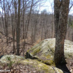 Vinton Furnace State Experimental Forest: Watch Rock
 State Park Cabins Reopen – A Stay at Lake Hope State Park
 The Annual Fall Hike at Lake Hope
I recently moved back to Ohio after being gone for several years. I am an avid hiker and voraciously explore everything within a weekend drive. I am so excited to find your blog and find so many new places to explore. I almost went to this arch the SAME weekend as you two, as I’d recently discovered maps for the Vinton Furnace and its nearby family in the area where I was spending the holiday. Having become a new reader, I would have found it very amusing to run into you two on the trail, considering we both likely explore and hike in places where we are the only ones on the trail!
Jill, it was so nice to hear from you! I’m glad that our website has been helpful. Like you, we often hike entire trails without seeing anyone else. When we do encounter other hikers, once in a blue moon someone recognizes us from our website, so we’ll stop and chat for a while. 🙂