At 26,827 acres, Zaleski State Forest is the second only to Shawnee State Forest in size. Located in Ohio within Vinton and Athens counties, this region was in the vanguard of the industrial revolution in the 19th century. Besides mining coal and iron ore, local residents cut down huge swaths of forest to produce charcoal for the region’s many furnaces where iron workers cast pig iron.

Today, the area is sparsely populated. Once a thriving industrial area, Zaleski forest is now quiet and many of the little towns that surrounded the furnaces have disappeared. Left behind are woodland cemeteries, iron furnaces now in ruin, and abandoned rail lines and tunnels like the Moonville Tunnel that we discussed earlier.
Zaleski State Forest is located south of Hocking County in an area of Ohio untouched by the last ice age. Interspersed among its hills are hollows that were carved out by melt water from the glaciers farther north. This state forest is best known for the Zaleski Backpack Trail, a 23.5 mile loop with several camp sites for overnight campers. It also has 50 miles of bridle trails with 16 camping sites for riders, as well as a hunter’s camp and shooting range.
We’ve hiked at Zaleski several times — mostly day hikes on the backpack trail. In late September, we stopped there around 3 PM following a trip to view a restored iron furnace, the Buckeye Furnace. Given the lateness of the day, we opted for a short hike on the 1.5 mile Olds Hollow Trail which is a side excursion from the Zaleski backpack trail.
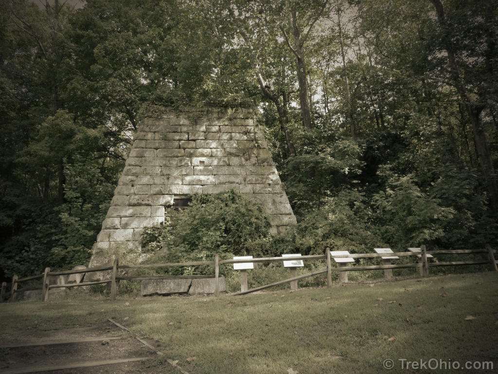
Parking for the backpacking trail is located off OH-278 across from Lake Hope State Park. The remnants of the 19th century Hope Furnace is across the road from the parking lot for the backpacking trailhead. The furnace is now part of Lake Hope State Park. A parking lot for the furnace is located on the opposite side of the road (and is sometimes used for overflow parking for backpackers). The furnace is worth a stop and includes interpretive signs about the history of the area. There is also a picnic area and outhouses.
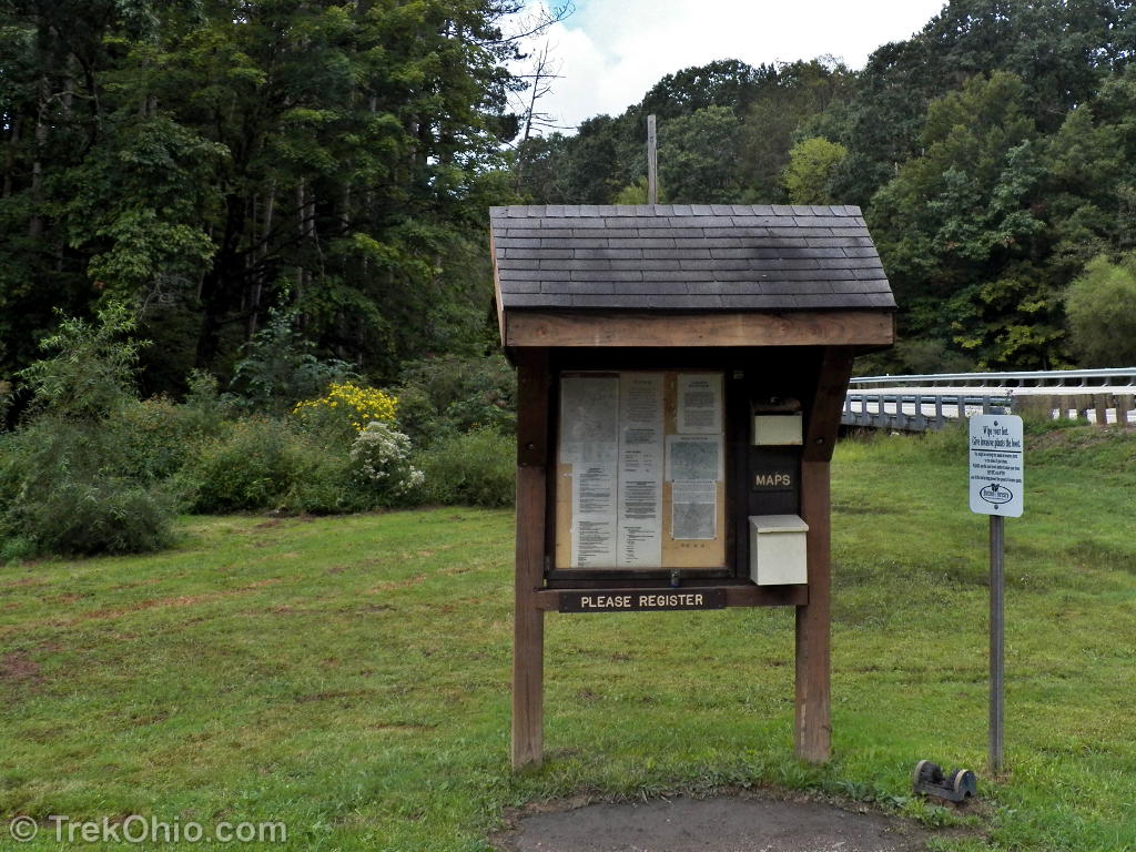
A kiosk at one end of parking lot has information on the state forest, backpack trail maps, and self-registration forms for those backpackers who will be camping overnight. There is no fee for camping. To reach the trailhead, walk south along OH-278 (on the side of the road where the kiosk is located) for about a hundred feet and you’ll see the sign for the trailhead.


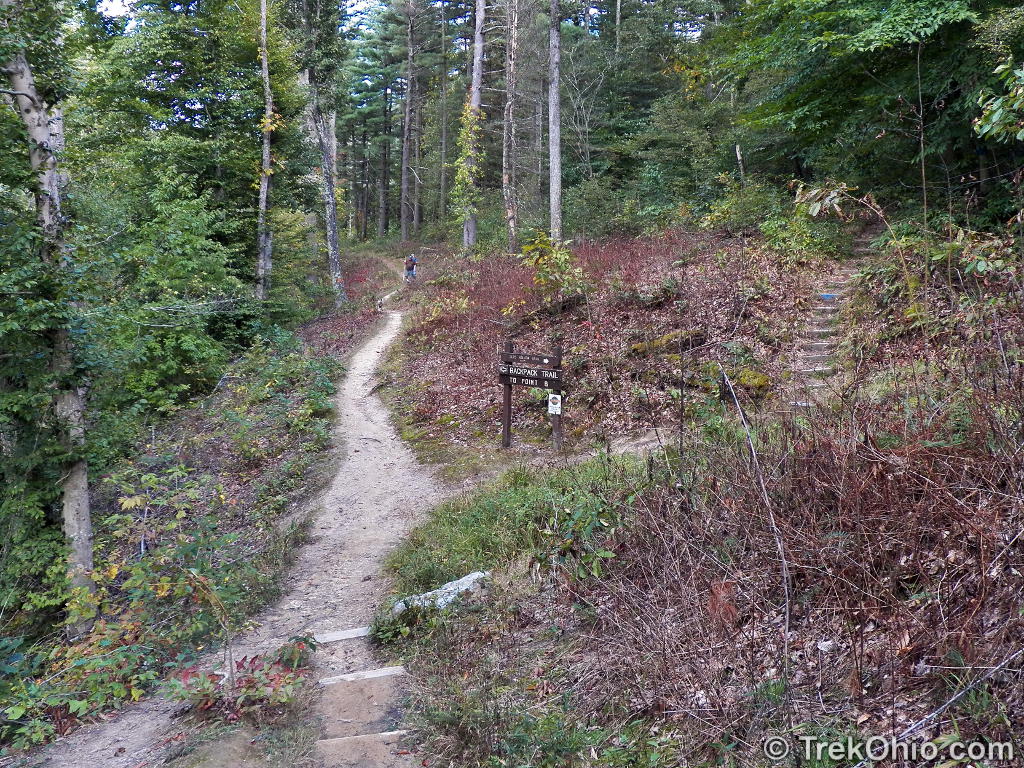
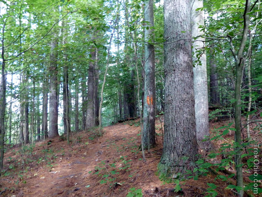
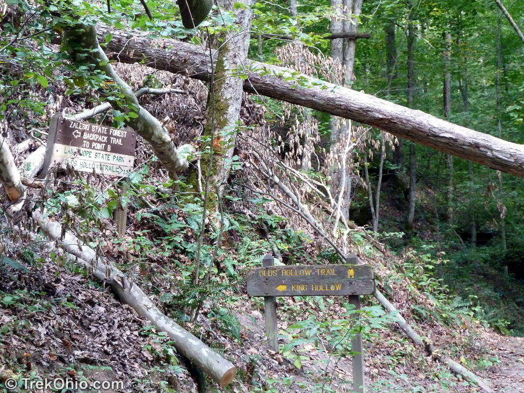
At the entrance there’s a bridge across a little stream, and then the trail immediately turns to the left. The backpacking trail is marked with orange blazes, and waypoints are indicated on the map and on trail signs with letters. The Olds Hollow trail is a side trail the intersects the backpack trail at two points. We passed the first sign for the Olds Hollow Trail and continued up and down hills on the orange blaze backpack trail. We came to a second sign for the Olds Hollow Trail. At this point those following the Olds Hollow Trail go right down a hollow while those following the backpacking trail go left and up a hill. The Olds Hollow Trail is marked with blue blazes (though it is not part of the Buckeye trail).

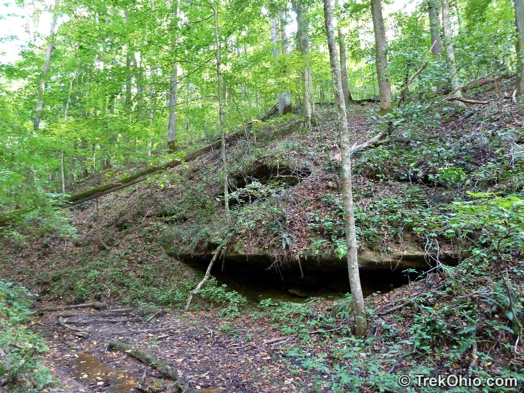
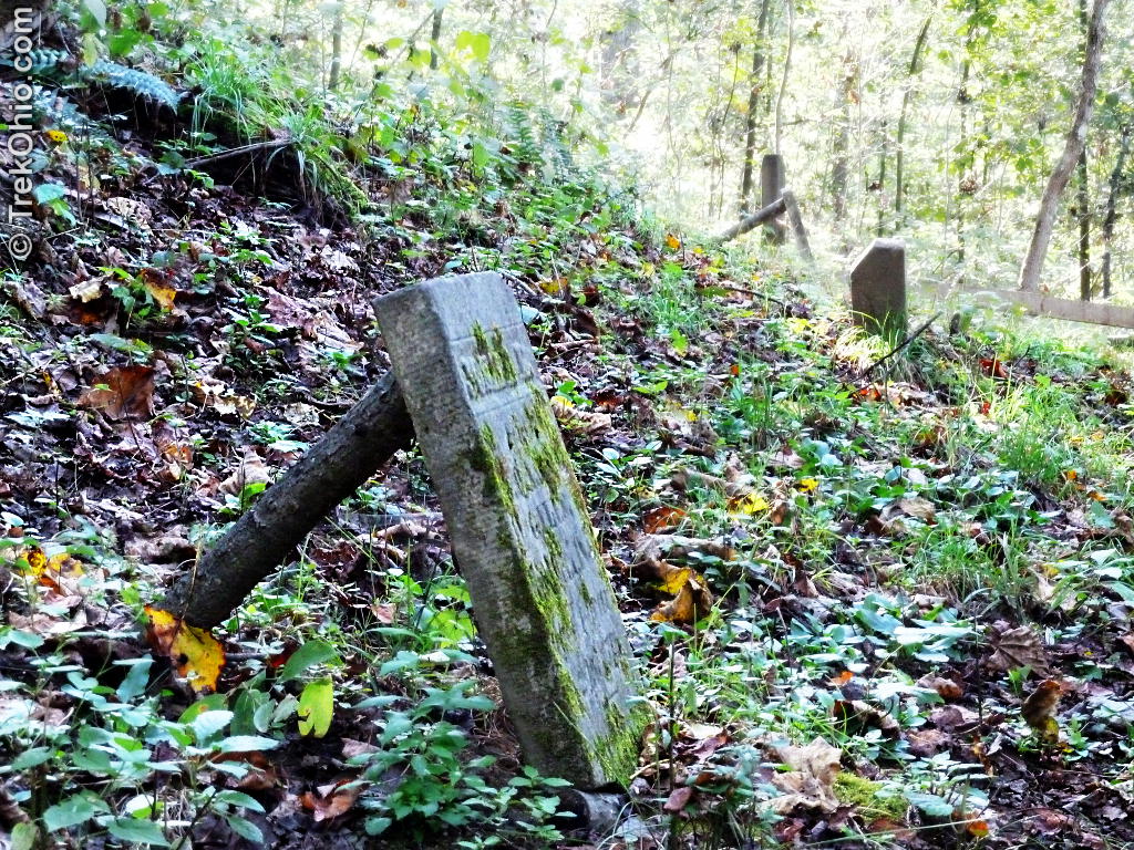
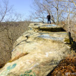
The trail follows a stream bed through a hollow that gets narrower as you go. There is a rock outcropping on one side that terminates at a small recess cave. Across from the cave, stairs led out of the hollow and up the opposite hill. As you reach the ridgeline there’s a bench where you can take a breather and look off into the valley below. Behind the bench is a rail fence which separates a small, woodland cemetery from the trail. The cemetery was established in 1853 for the departed residents of Hope, an iron-producing town that has since disappeared. Down the trail at the other end of the fence is a kiosk that provides some historical information about the cemetery. The trail continues through the forested hills and valleys and finally ends at the initial intersection with the backpacking trail.


The trails of Zaleski don’t get as much traffic as the nearby Hocking Hills parks, so it’s usually a nice place to enjoy solitude. When we were there the conditions were ideal for backpacking and camping, and the parking lot was overflowing with cars. This is often the case on warm, autumn weekends. However we still only saw one other couple on the trails, probably since we were making such a late start of it. The camp sites are primitive (see the brochure link below for details). Dogs on a leash are permitted on the trails and in the camp sites.
Additional information
- TrekOhio: Vinton County Parks and Preserves — This is the county where Zaleski State Forest is located; check this page out for links to official sites (including maps) and for information on nearby parks and preserves.
- TrekOhio: Zaleski Backpack Trail from Hope Schoolhouse
- TrekOhio: Zaleski State Forest: Moonville Tunnel — A popular destination to an allegedly haunted site in Zaleski State Forest.
- TrekOhio: Zaleski State Forest: Lookout Rock — Just up the road from Moonville Tunnel
- TrekOhio: Zaleski State Forest: King’s Hollow Tunnel — Another abandoned rail tunnel that’s on the same, former rail line as Moonville Tunnel.
- YouTube: Winter Backpacking – Zaleski State Forest South Loop — This is a half-hour video that’s very well done on a winter backpacking trip to Zaleski.
Location
- Parking for backpacking / hiking trails
-
- Address: OH-278, New Plymouth, Ohio 45654 (estimated using Google Maps)
- Directions: From US 33 at Nelsonville, take OH-278 South. The parking lot for the Zaleski Backpack Trail is on the right side of the road across from Hope Furnace in Lake Hope State Park.
- GPS Coordinates: 39.331500, -82.339861
- Google Maps: View on map or get directions
More on Vinton County
 Zaleski State Forest: Lookout Rock
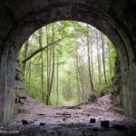 Zaleski State Forest: Moonville Tunnel
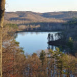 Lake Hope State Park
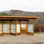 Zaleski State Forest: The Backpack Trail from Hope Schoolhouse
Are the blaze colors different for the south and middle trail loops?
Thank You guiding us. All the photos are so great. My favorite one is the photo “The ruins of Hope Furnace”.
Stunning… I’d love to visit this area. And I love the remnants of the village — a bit spooky!
Such an interesting post! We keep saying that we have to get to the Lake Hope area–we haven’t been there in years. This may be our inspiration! That NE Aster photo is wonderful!
Thank you for sharing your photos of and info about the park. It was like I had a virtual tour around Zaleski State Forest which looks different from the forests we have here in my side of the world.
Oh, I love that photo of the New England Aster. I have to look if we have it here in my country.