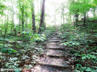
 Towards the end of last spring we visited the Wilderness Trail at the Edge of Appalachia Preserve in Adams County. Starting at the parking area, the trail is a 2.4 mile loop. The trail features hills, rock outcroppings, streams, forest with lush vegetation, and a small segment of prairie.
Getting Oriented
We hiked the trail in a counter-clockwise direction, passing through the prairie opening towards the end.
The Hike
The parking lot is at the end of Shivener Rd, a gravel Read more ➜
 Edge of Appalachia: Charles A. Eulett Wilderness Preserve Trail
 Towards the end of last spring we visited the Wilderness Trail at the Edge of Appalachia Preserve in Adams County. Starting at the parking area, the trail is a 2.4 mile loop. The trail features hills, rock outcroppings, streams, forest with lush vegetation, and a small segment of prairie.
Getting Oriented
We hiked the trail in a counter-clockwise direction, passing through the prairie opening towards the end.
The Hike
The parking lot is at the end of Shivener Rd, a gravel Read more ➜
 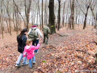 Dillon State Park is a 2,285-acre park located in Muskingum County. The parks has 9.6 miles of multi–use trails, 1.25 miles of trails used exclusively for hiking, 15 miles of bridle trails, and 12 miles mountain bike trails. For those in the Columbus area, the park is about an hour to an hour-and-a-half drive east of the capitol. We had never been to Dillon State Park before, so when we heard the park was hosting its first annual winter hike on January 9th, we decided to participate.
We
 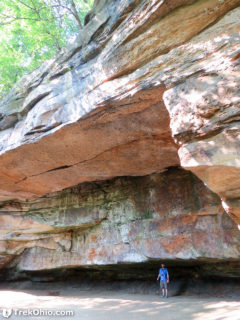 Many of the places we hike are in forests, or rural parts of Ohio. Gorge Metro Park is right in the city of Akron and it's spectacular. The park is 155 acres and is located on either side of the Cuyahoga River. There is a dam on the river near the park's center. The dam was built at the former site of a cascade waterfall in 1911 to provide electric power. The power plant is gone, but there is a path to a series of observation decks to view the water cascading over the dam. Upstream of the dam is
 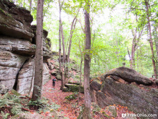 Thompson Ledges is a small park managed by the Thompson Township Park Commission; the township is located in Geauga County in northeast Ohio. To get to the geological formation that makes up the ledges, we entered the driveway of the Thompson Township Park Commission. The driveway ends in a parking area; there are restroom facilities and a trailhead nearby. We weren't sure where the ledges were, so we just headed down the nearest woodland trail which soon lead us to the ledges. Our entire hike was
 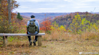 The Shawnee Day Hike Trail has changed since our 7.2 mile hike a year and a half ago. The suggested blue-blazed day hike trail is now a 4.2 mile hike. However by combining the white-blazed connector trail and a new segment of the blue-blazed day hike trail, we were able to do an 8.4 mile-loop hike. As an unexpected treat, the new segment of the blue-blazed day hike trail took us by a lovely overlook with a bench where we could take in what remained of fall color. Since we were hiking there this past
 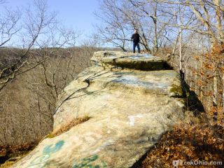 While staying at a cabin in Lake Hope State Park, we visited Lookout Rock and hiked on the nearby Moonville Rail Trail. It was the Wednesday before Thanksgiving, and the weather was sunny and cool.
Lookout Rock is located on Hope-Moonville road, a narrow, gravel road that winds through Zaleski State Forest. At one point, the road goes along a saddleback ridge with steep drop-offs to either side. On one side of the road, we saw a tall sandstone cliff. This was our destination.
 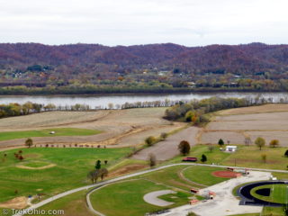 This past Friday we visited Raven Rock State Nature Preserve. It was our first visit to a permit-only preserve. We'd planned a visit to Shawnee Lodge and had applied for a permit more than two weeks before our trip.
It was a cool, overcast afternoon when we parked near the trailhead for Raven Rock. There were two parking spots, one of which was already occupied. The trail is 1.25 miles (one way) and ends at a cliff 550 ft above the start with a stunning view of the Ohio River and the hills of
 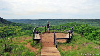 Buzzardroost Rock Trail offers a truly stunning vista perched 500 feet above the Ohio Brush Creek valley. The trail is part of the 16,000-acre Edge of Appalachia Preserve in Adams County. Located just south of Ohio SR-125, the trail stretches 2.2 miles one-way along ridgelines from the parking lot to the observation area, making for a 4.4 mile hike.
A sign at a gravel turn-off on the south side of SR-125 identifies the parking area and trail-head for Buzzardroost Trail. About a quarter
 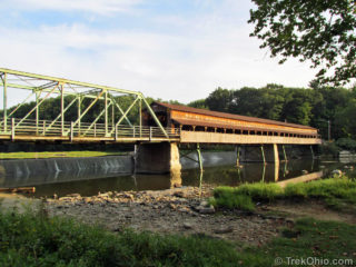 We recently visited Harpersfield Covered Bridge Metropark in Ashtabula County. The star attraction of the park is the aforementioned covered bridge. The 228 foot (69.5 m) covered bridge spans the Grand River and is the third longest covered bridge in Ohio. The bridge was built in 1868 replacing a prior bridge that was destroyed by a flood. In 1913, another flood washed away the ground on the northern side of the bridge. A 140-foot (42.7m) steel truss bridge was added on this end.
The
 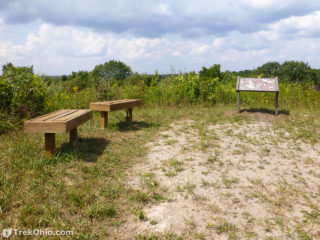 Last weekend after hiking at Wildcat Hollow, we drove over to have a look at Monroe Outlook. Monroe Outlook is a scenic overlook providing a large hill-top panoramic view of the area. The site was developed by Wayne National Forest, Ohio Dept. of Natural Resources, Little Cities of the Forest Collaboration, and Miller High School.
The parking area is a small gravel parking lot with an informational kiosk off of Irish Ridge Road. Its about a 5 minute drive from the Wildcat Hollow trail-head.